
|
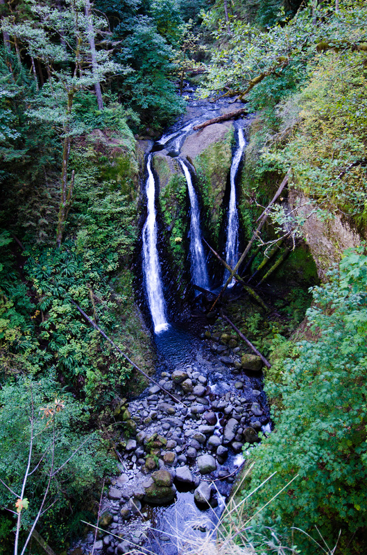
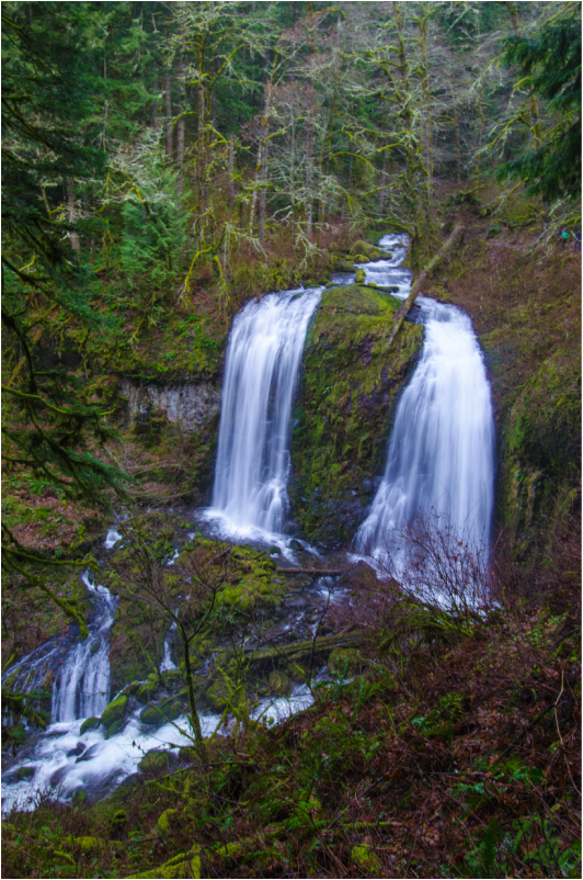
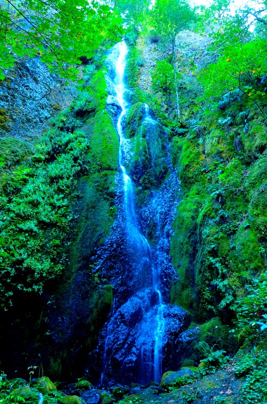
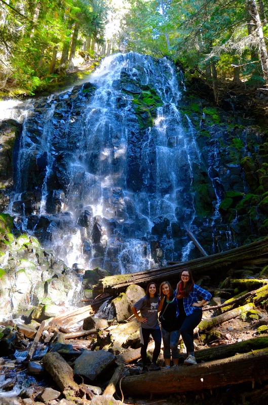
Triple Falls, OR
Description coming soon... |

|
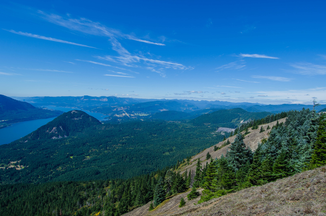
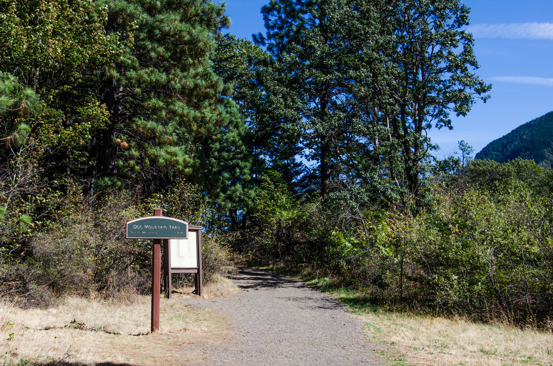
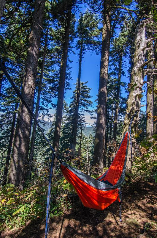
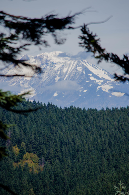
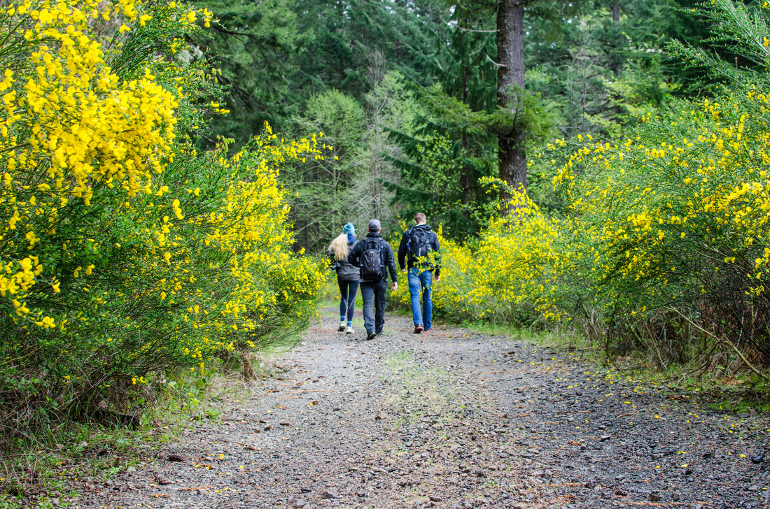
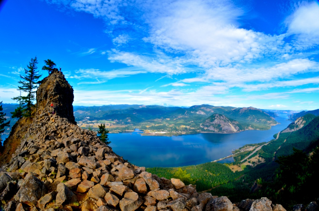
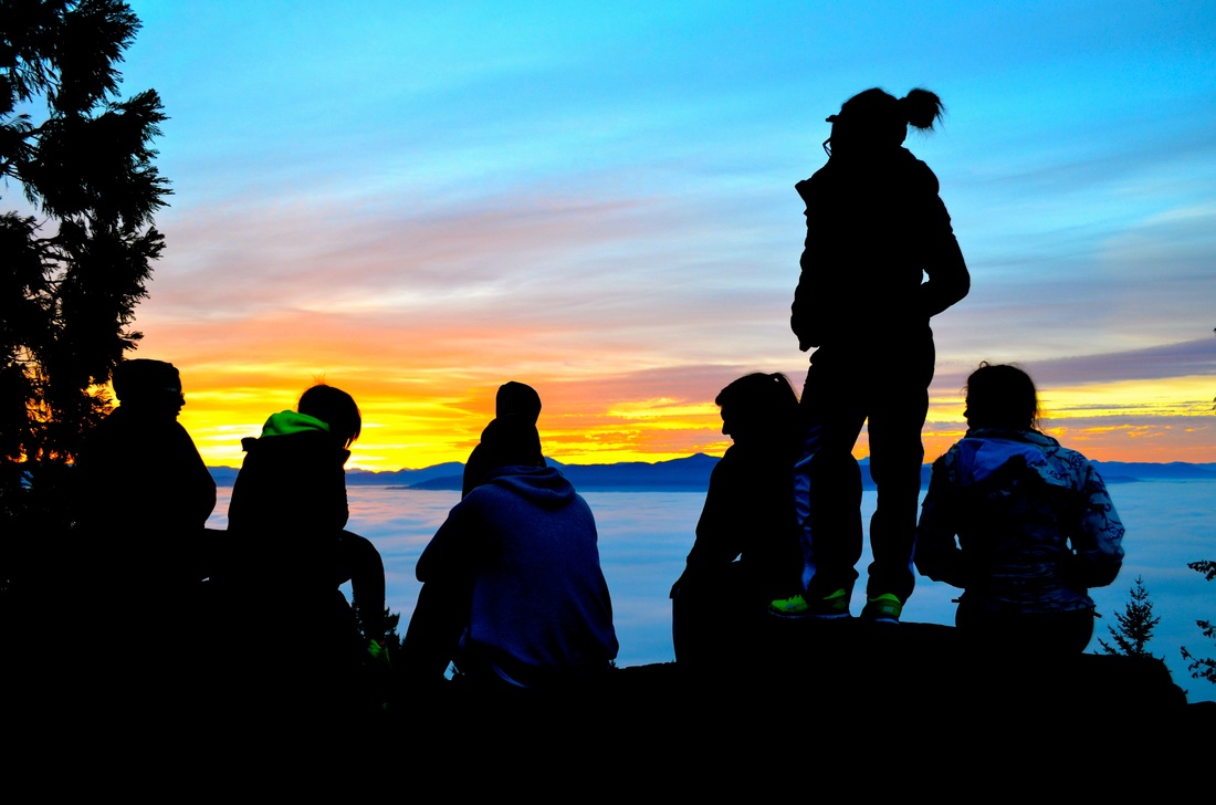
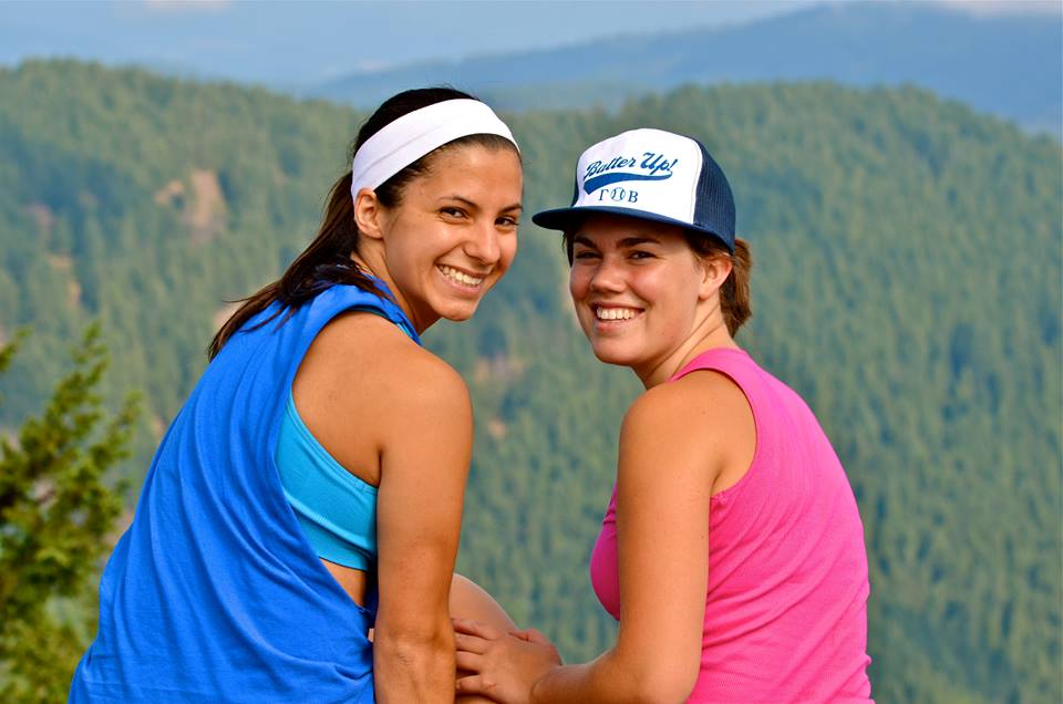
Dog Mountain, WA
Description coming soon... |


|
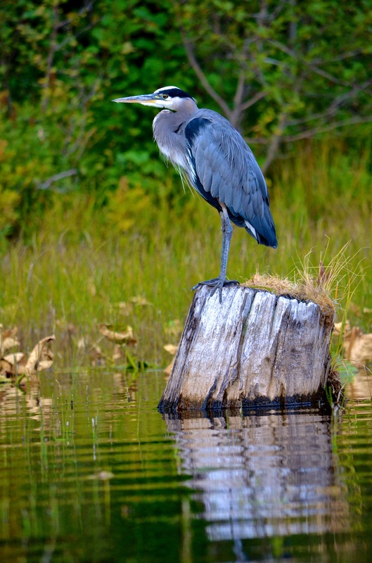
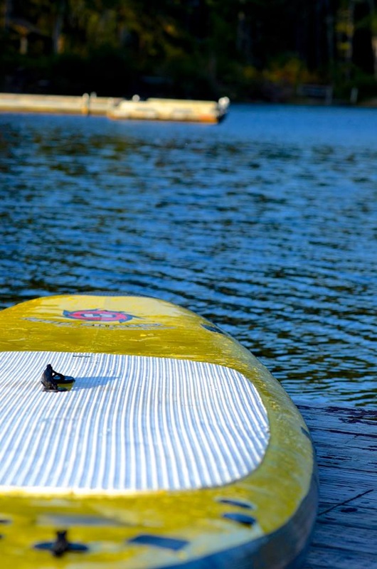
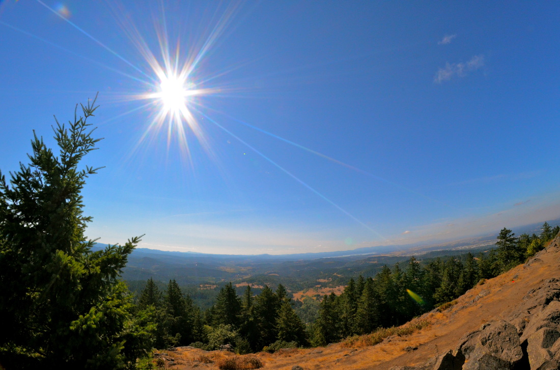
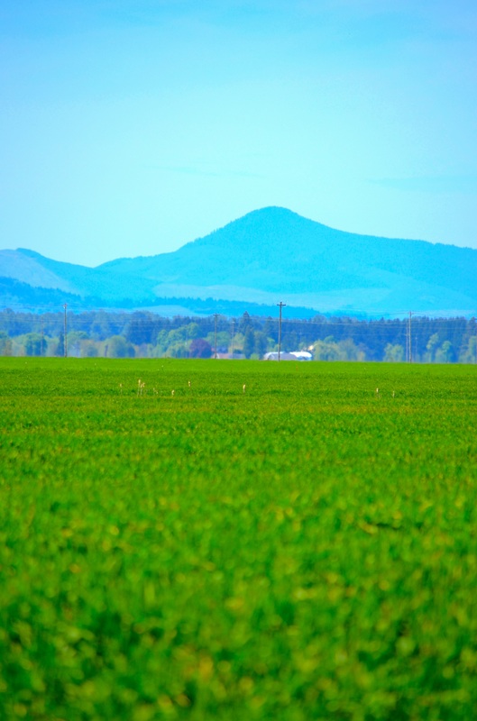
Henry Hagg Lake, OR
Description coming soon... |

|
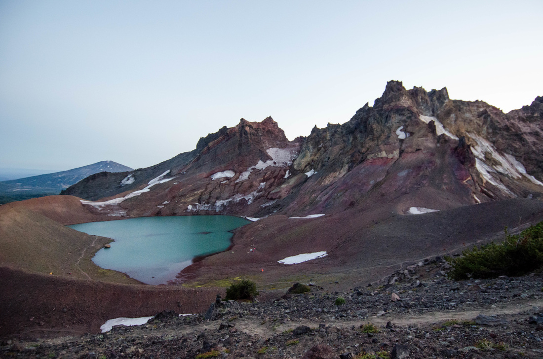
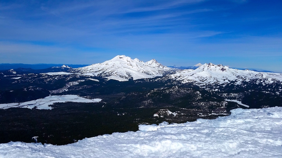
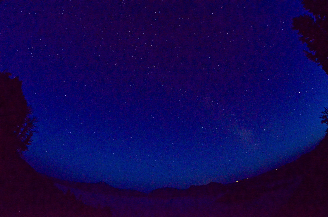
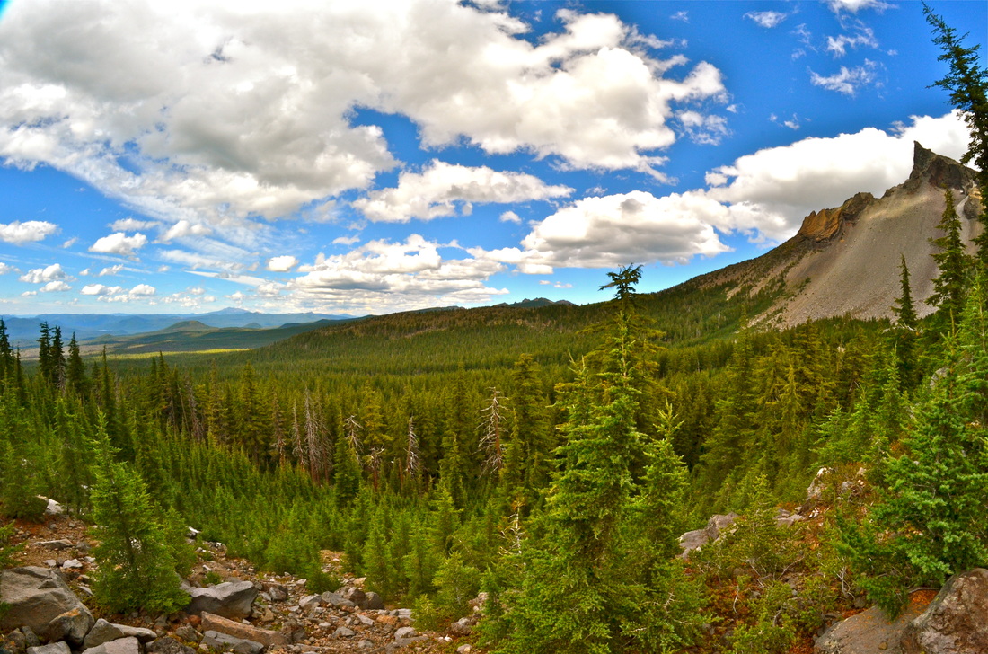
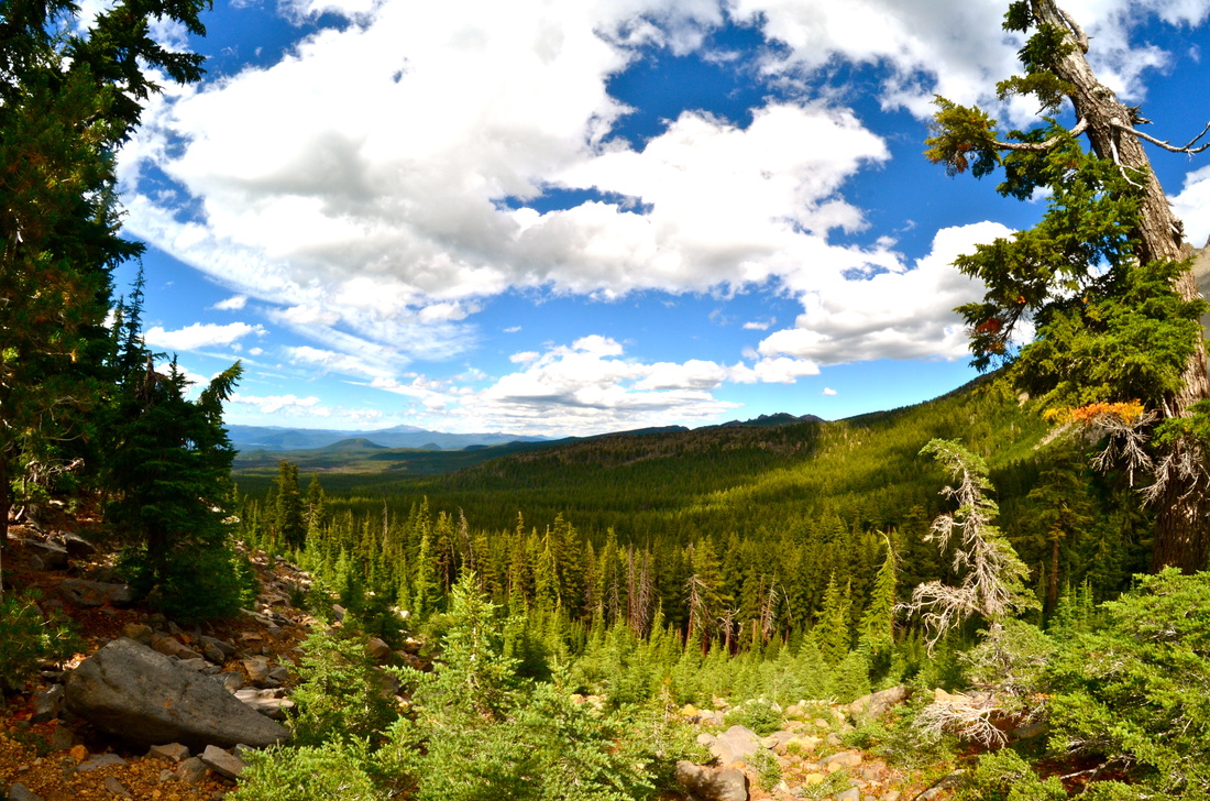
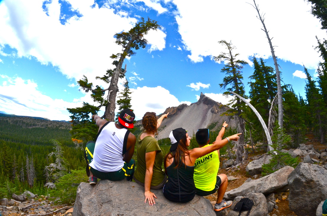
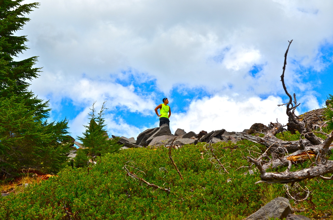
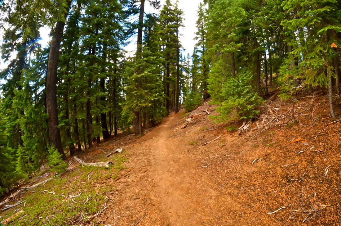
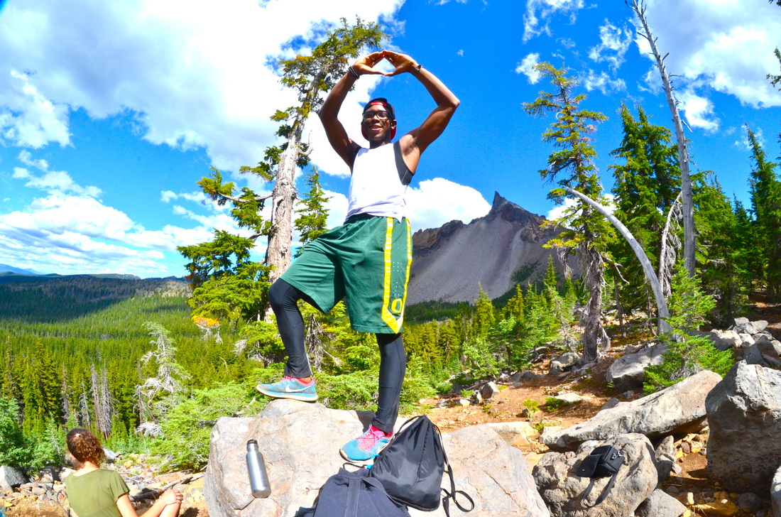
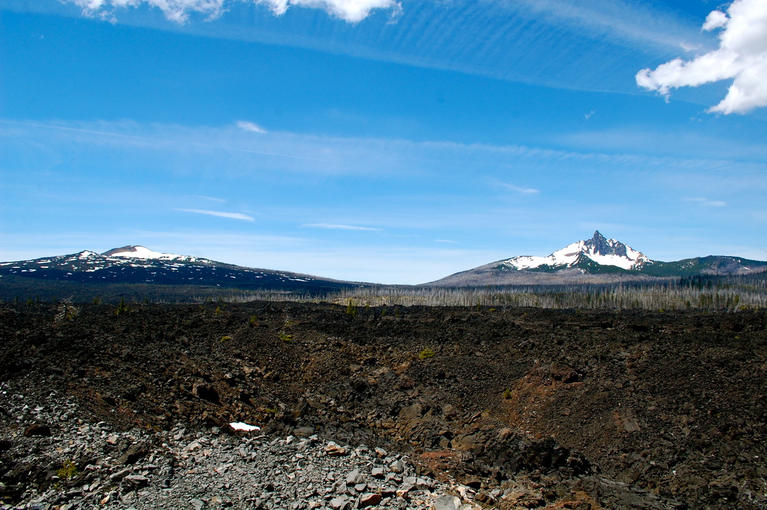
Broken Top, OR
Description coming soon... |

|
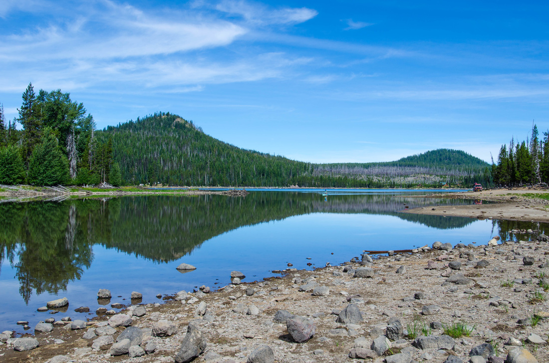
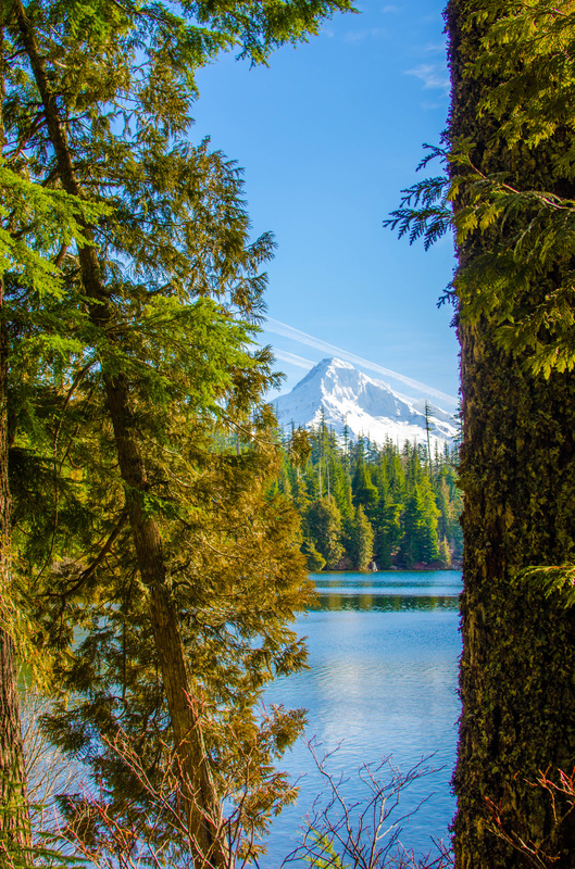
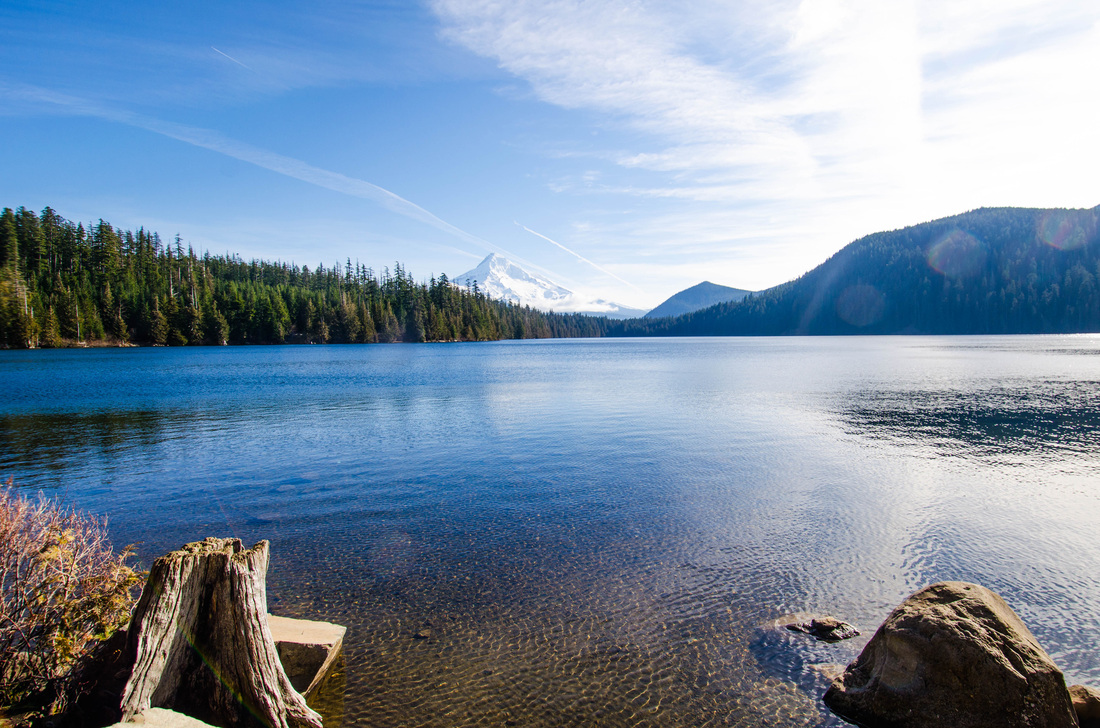
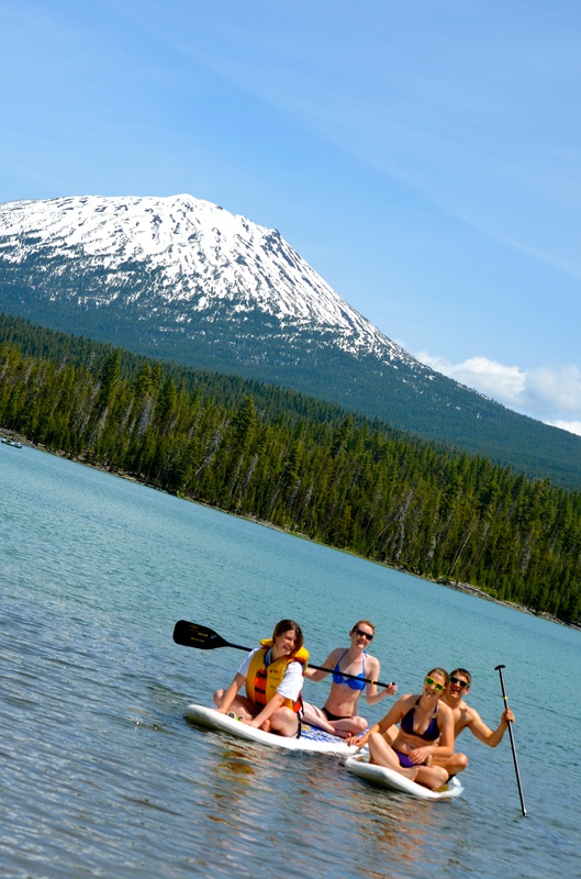
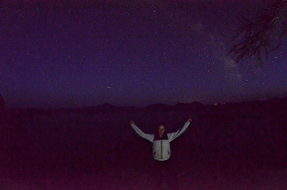
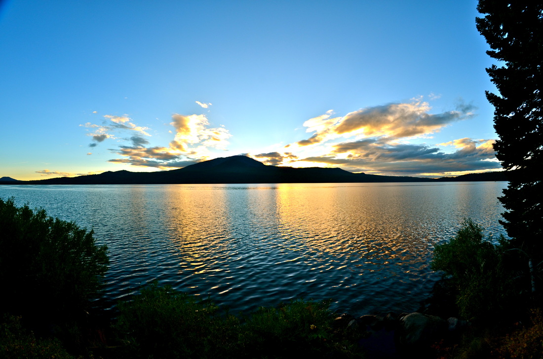
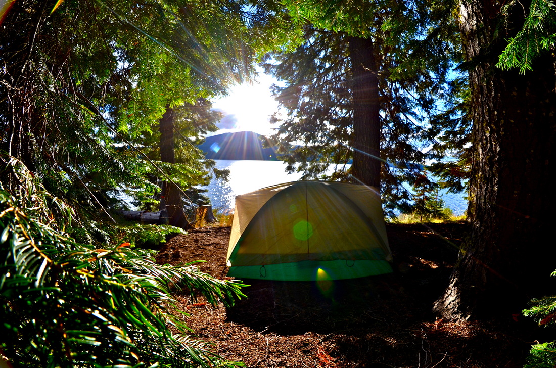
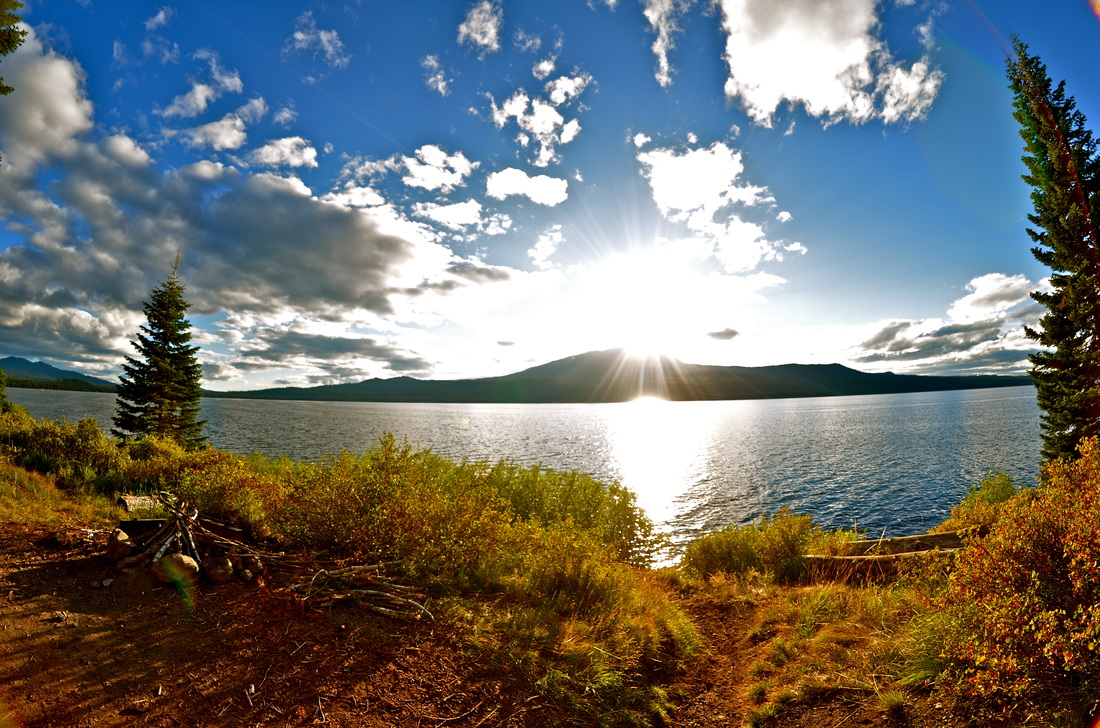
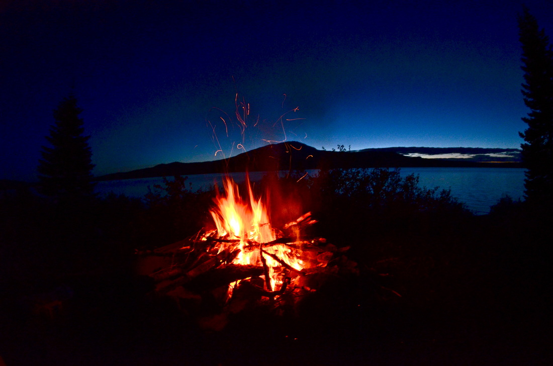
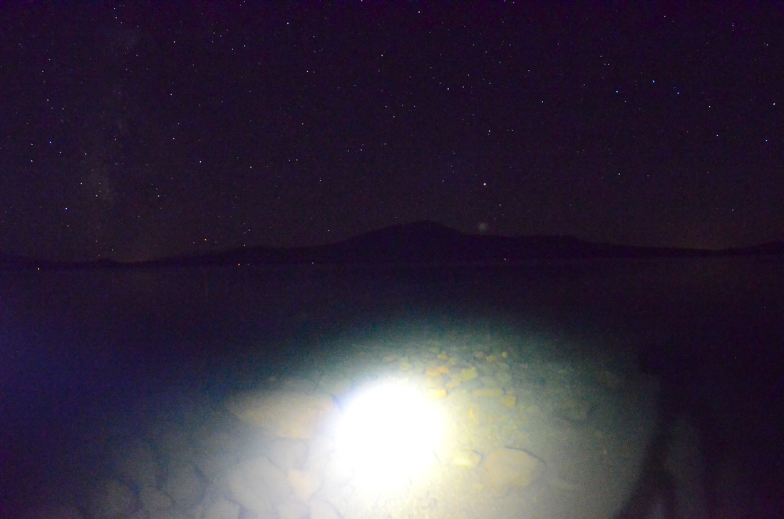
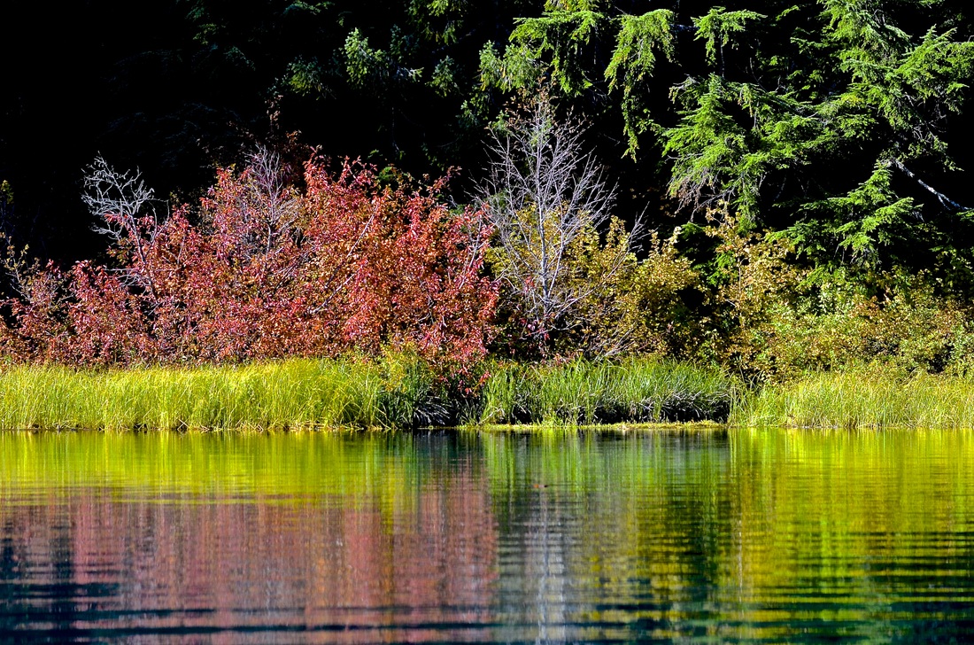
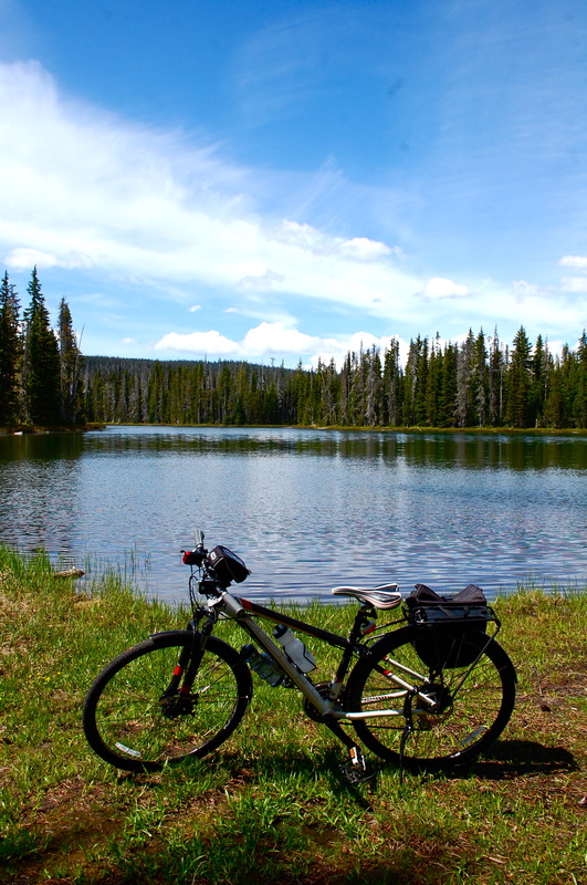
Elk Lake, OR
Description coming soon... |
|
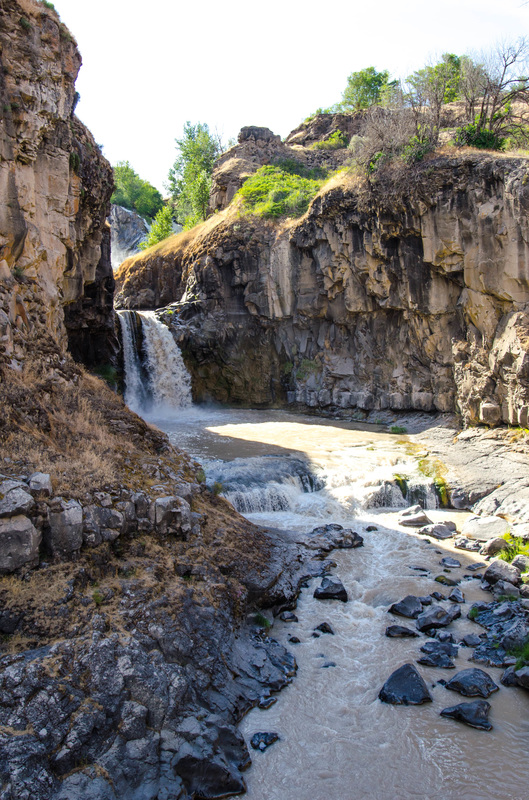
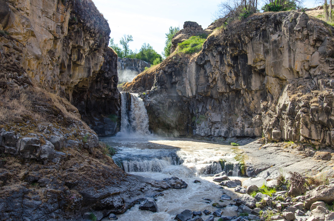
White River Falls, OR
Description coming soon... |

|
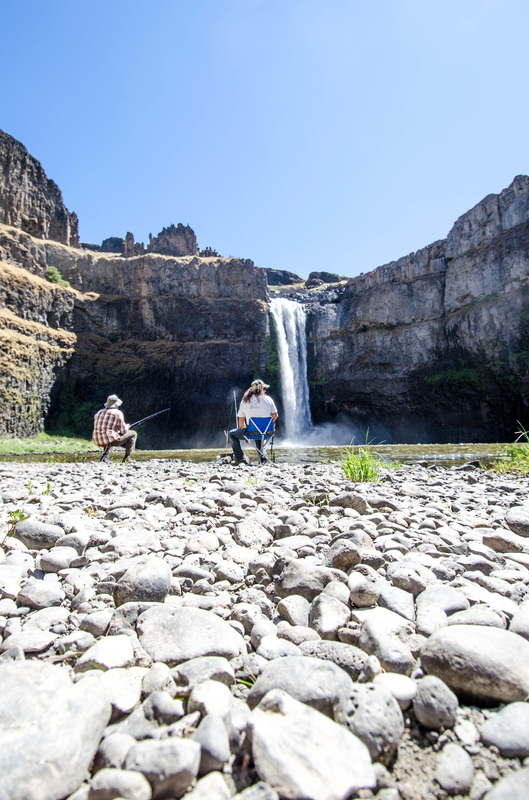
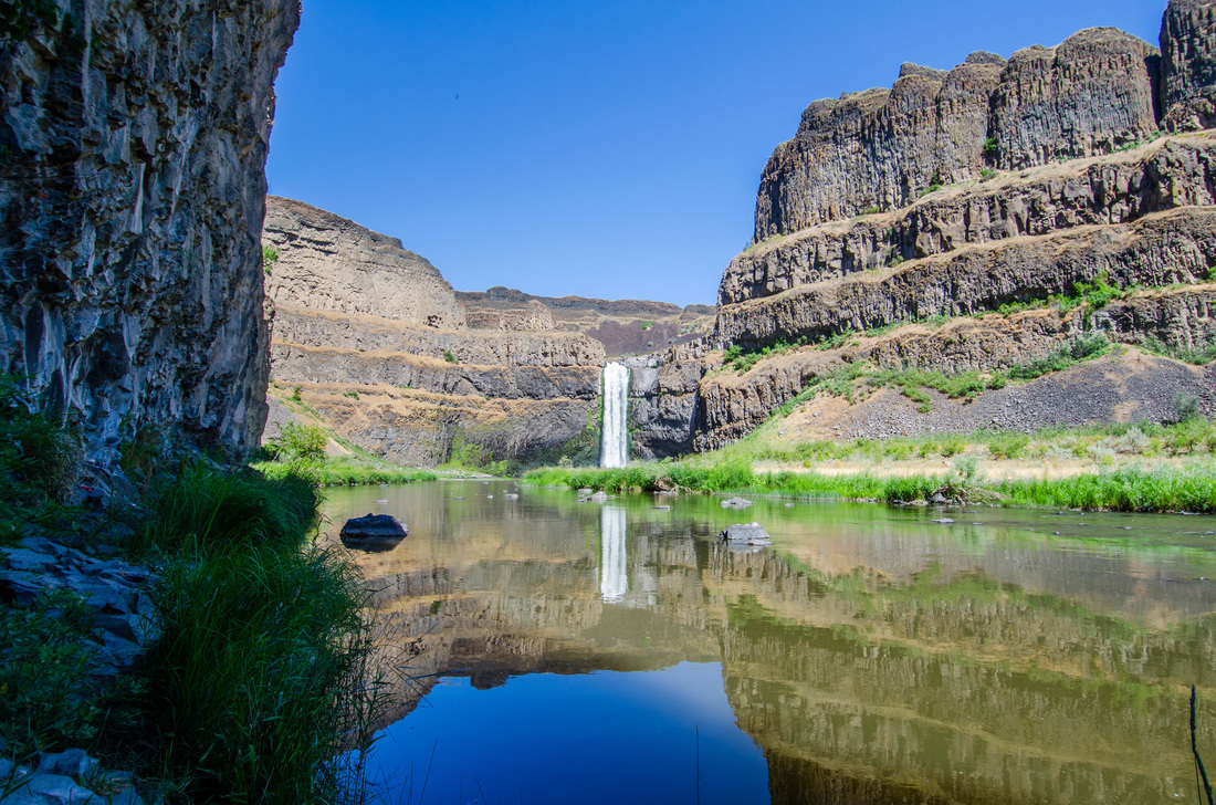
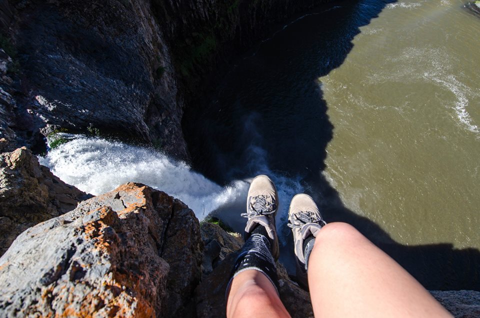
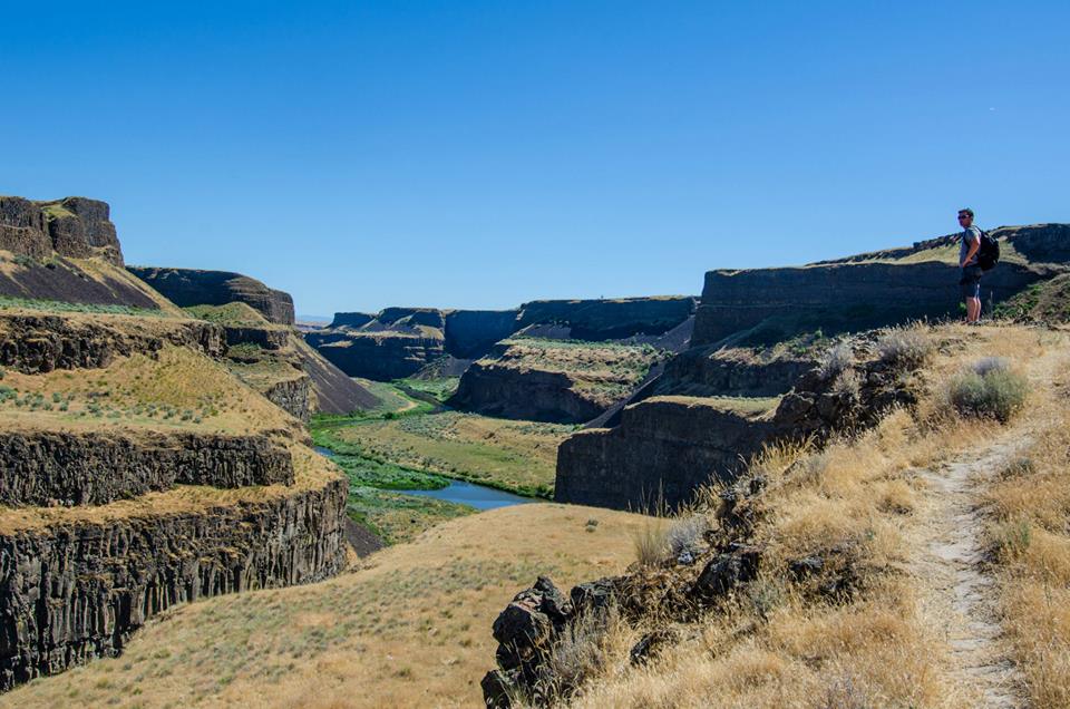
Palouse Falls, WA
Description coming soon... |

|
Shellburg Falls, OR
Description coming soon... |

|
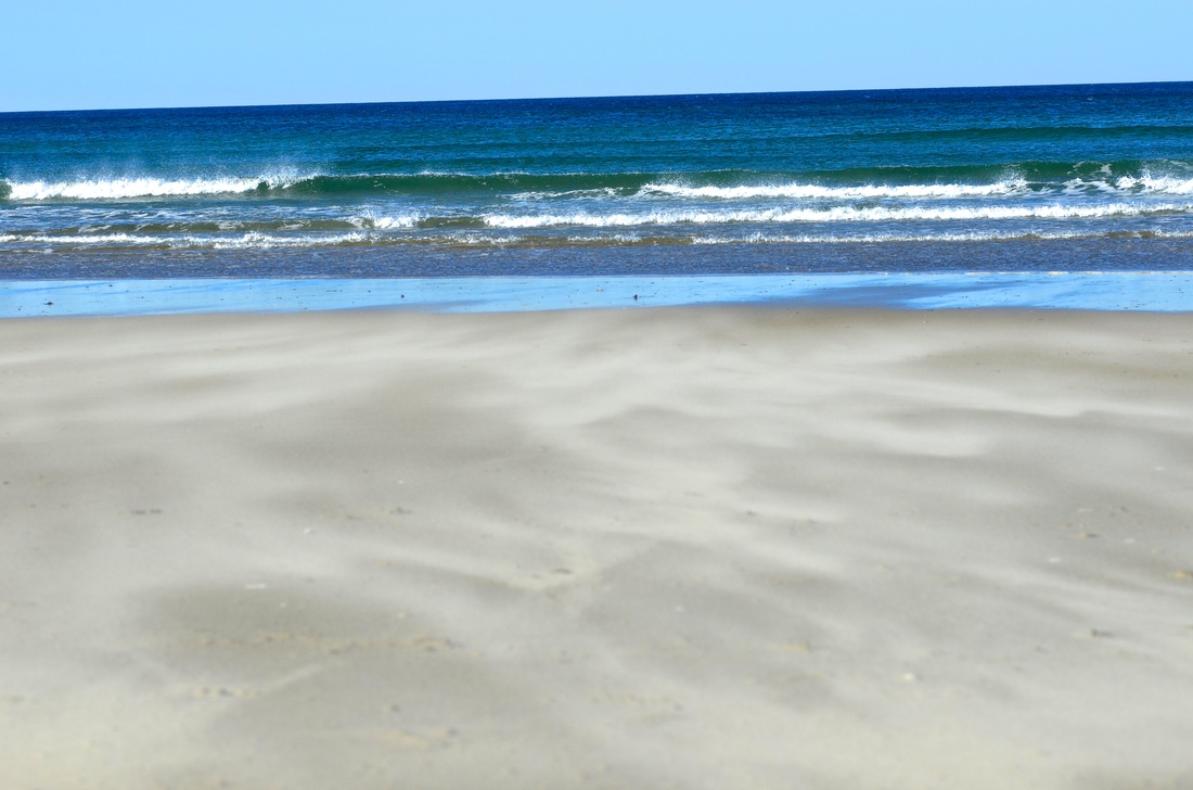
Manzanita Beach, OR
Description coming soon... |

|
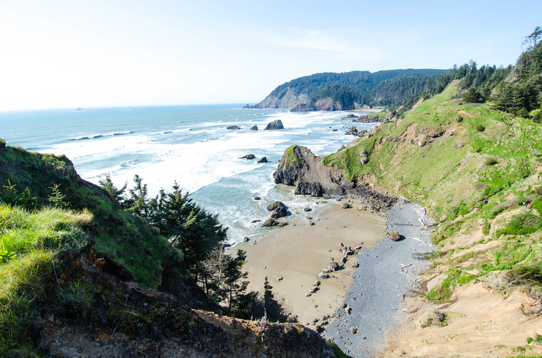
Ecola State Park, OR
Description coming soon... |

|
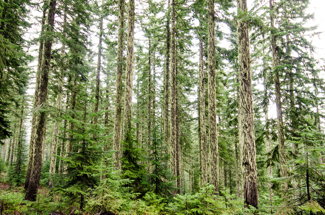
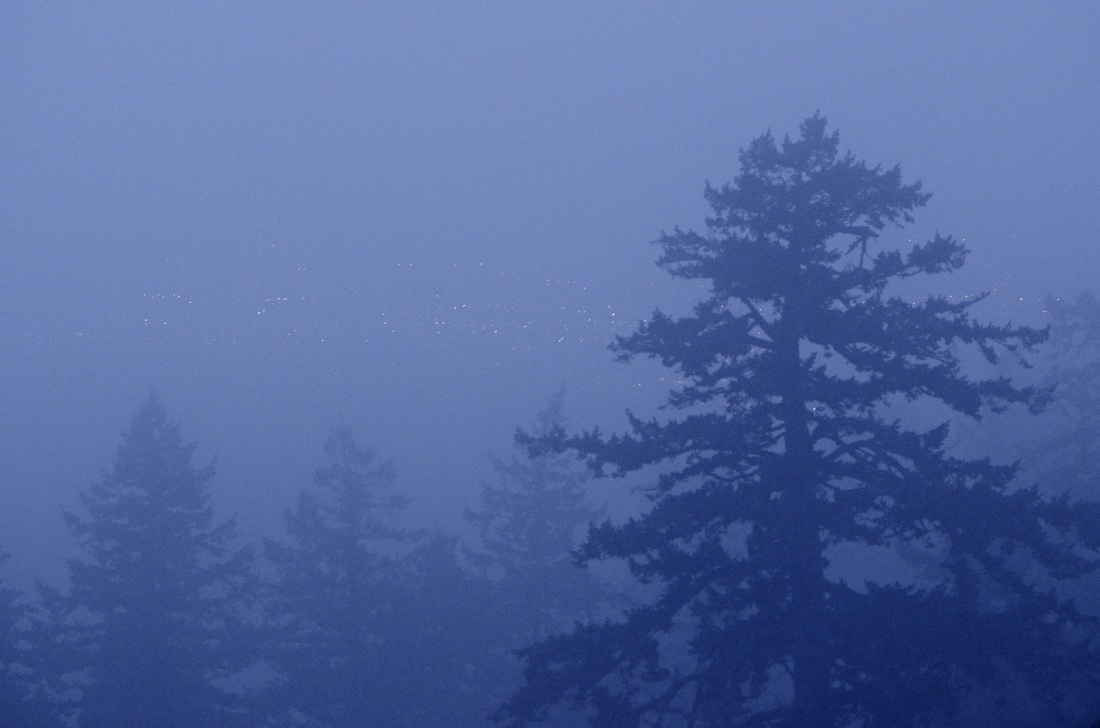
Indian Heaven Wilderness, WA
Description coming soon... |
|
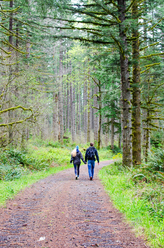
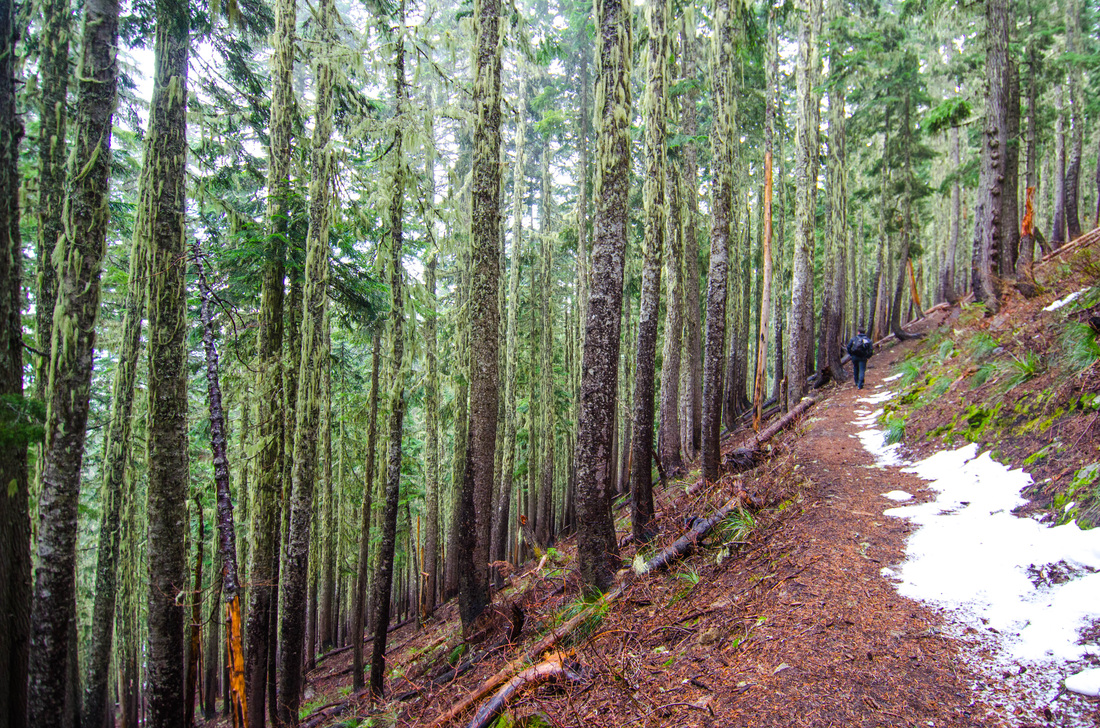
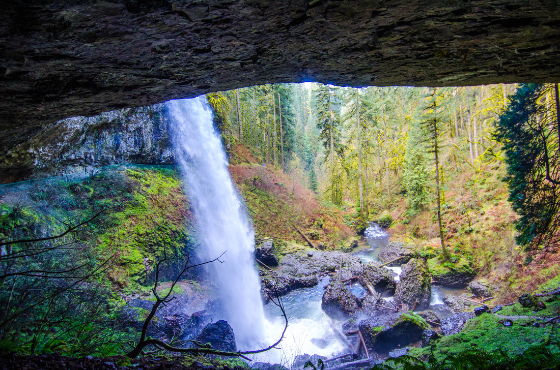
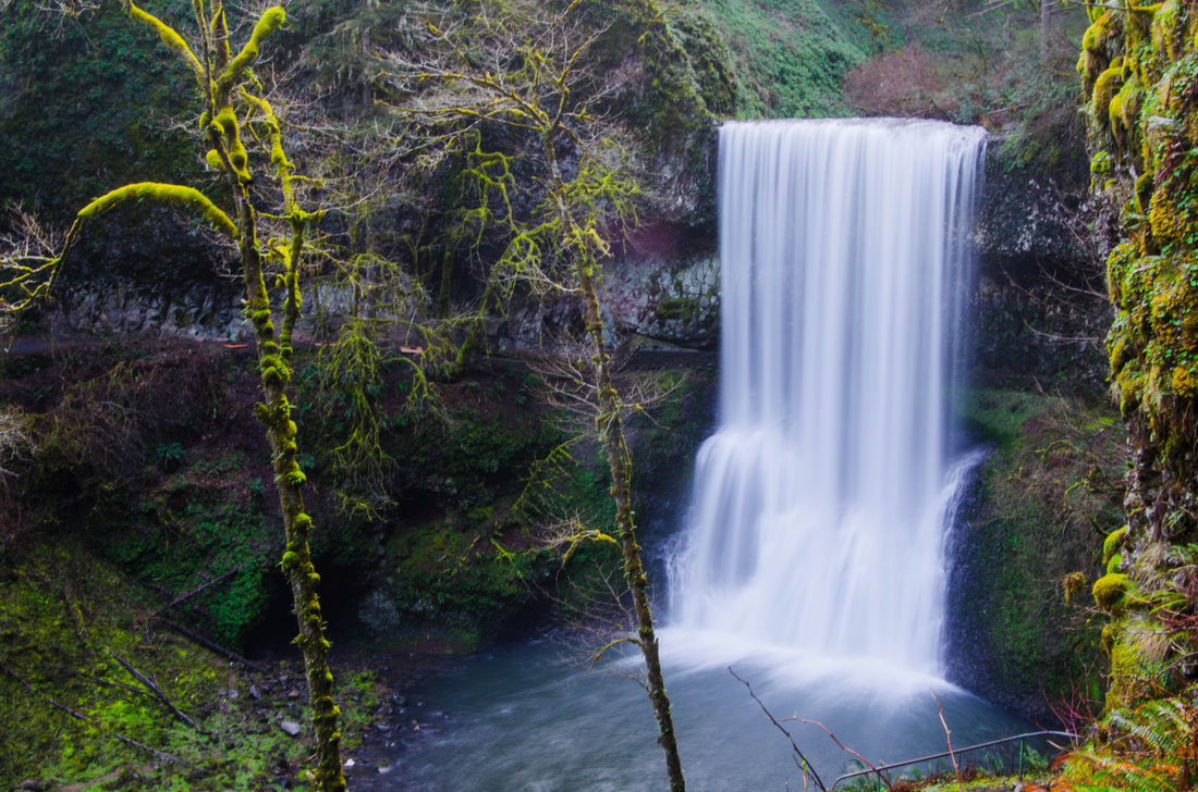
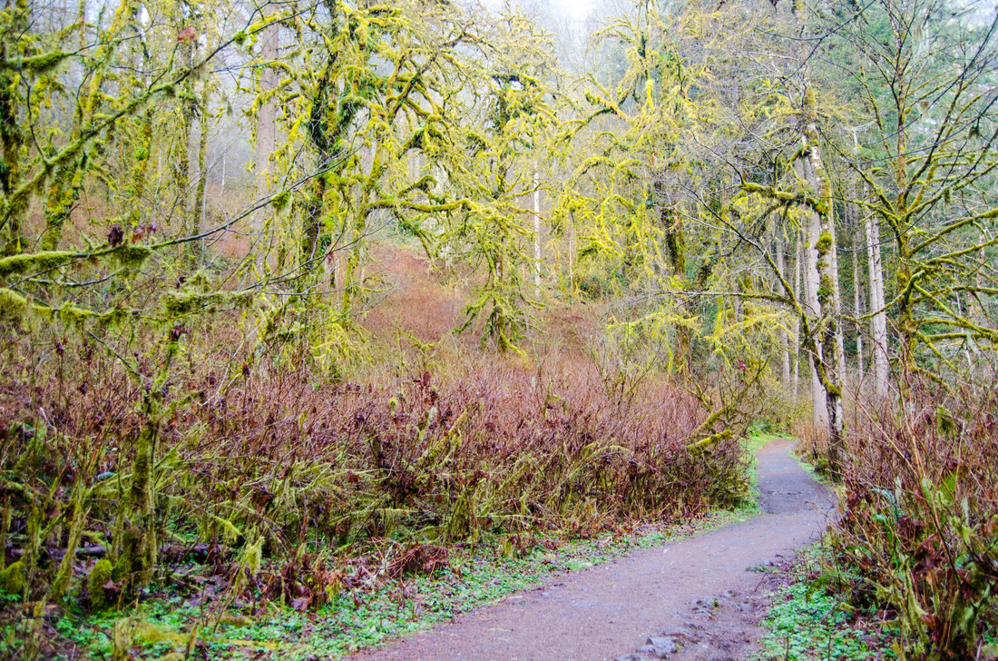
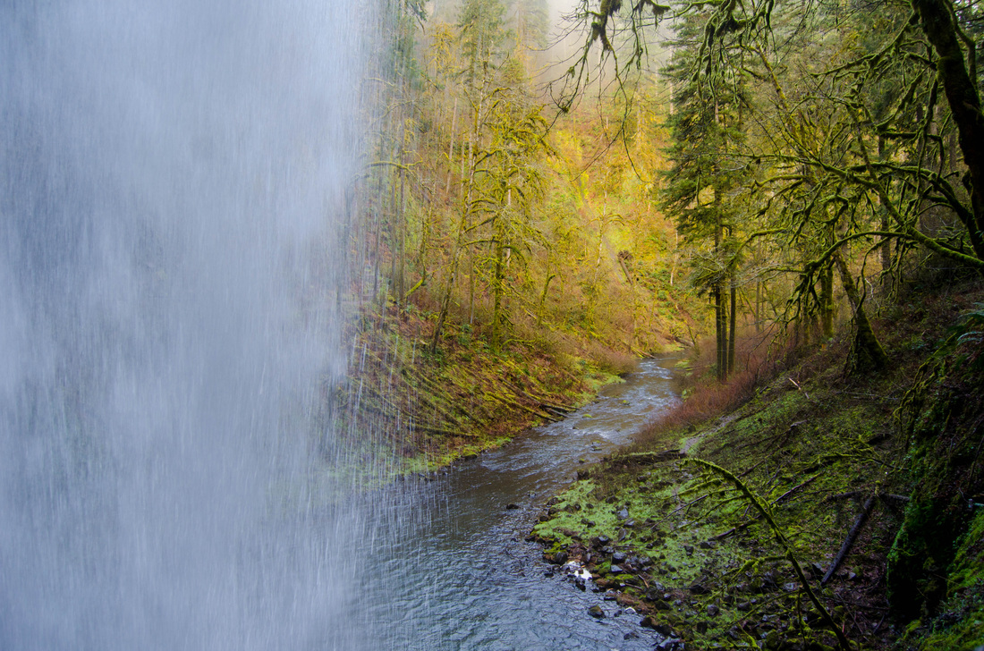
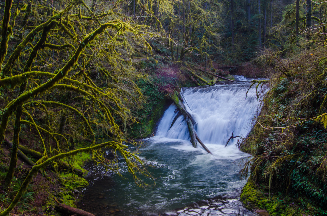
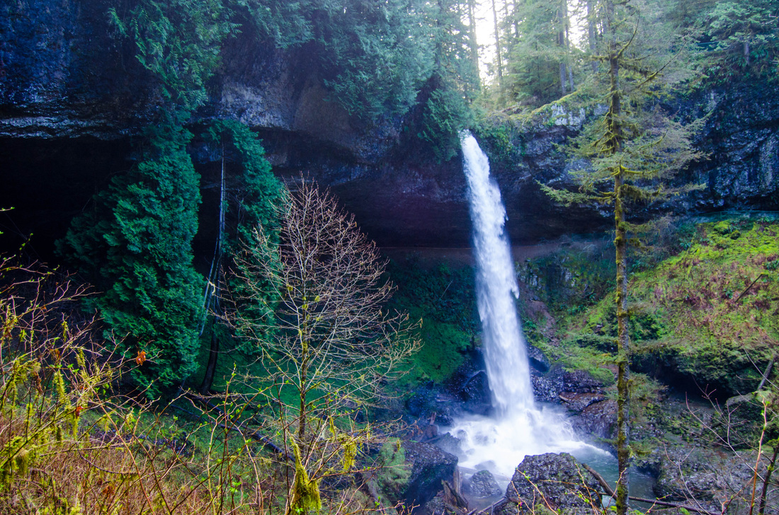
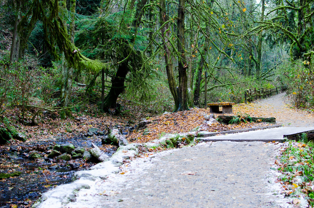
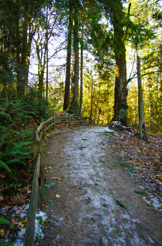
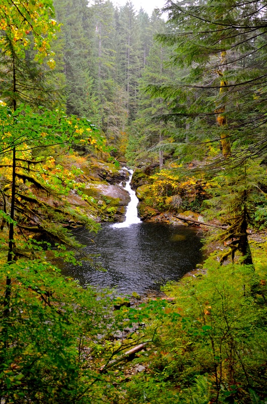
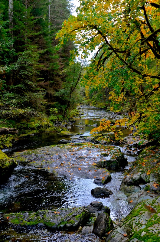
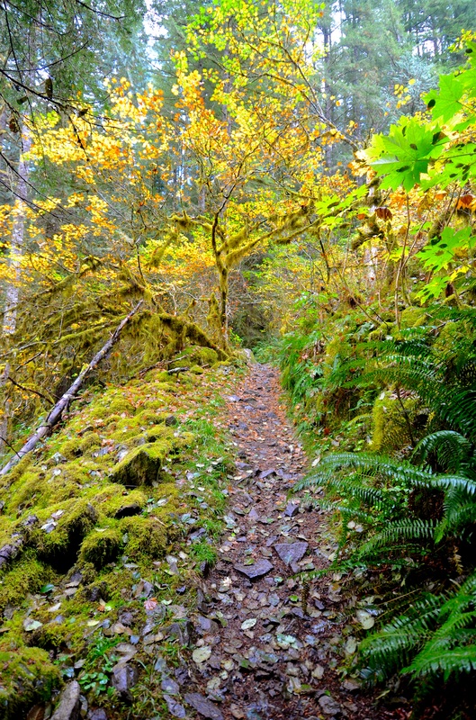
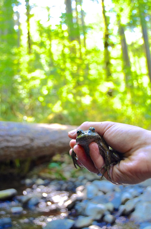
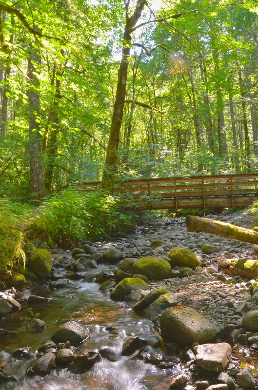
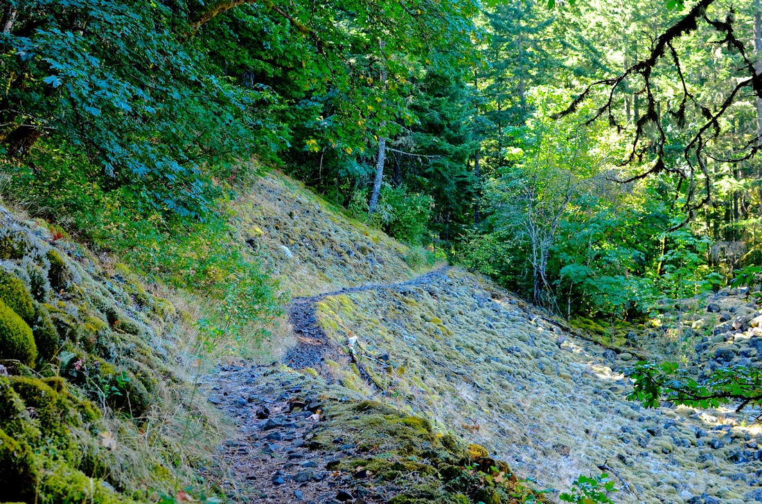
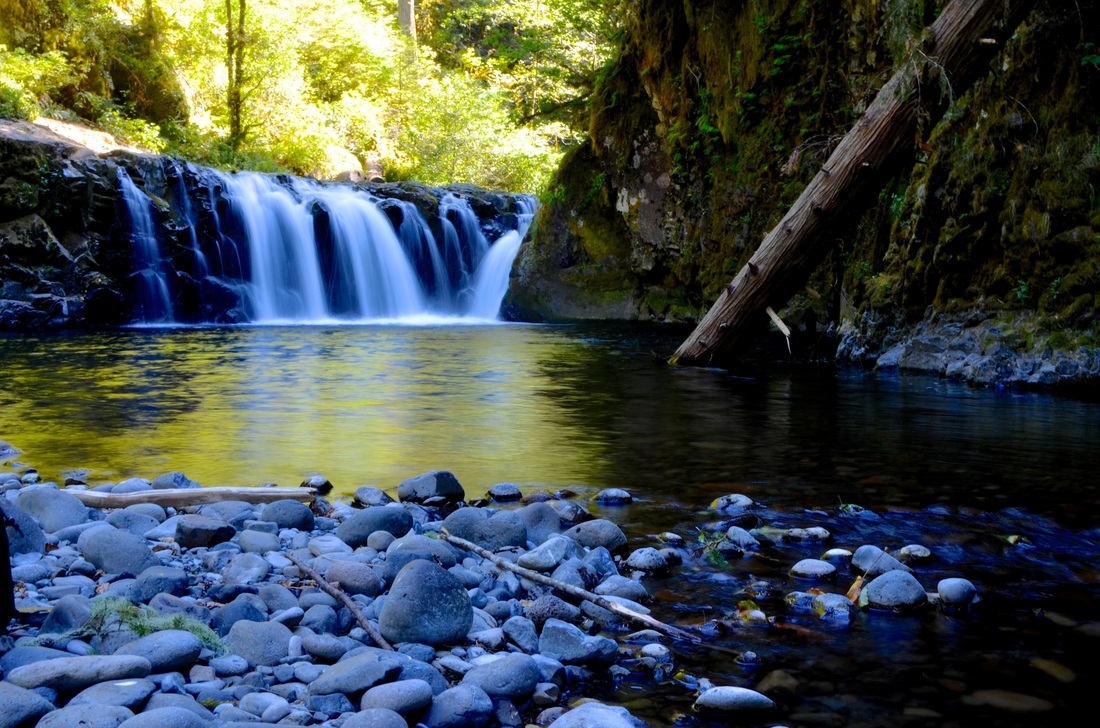
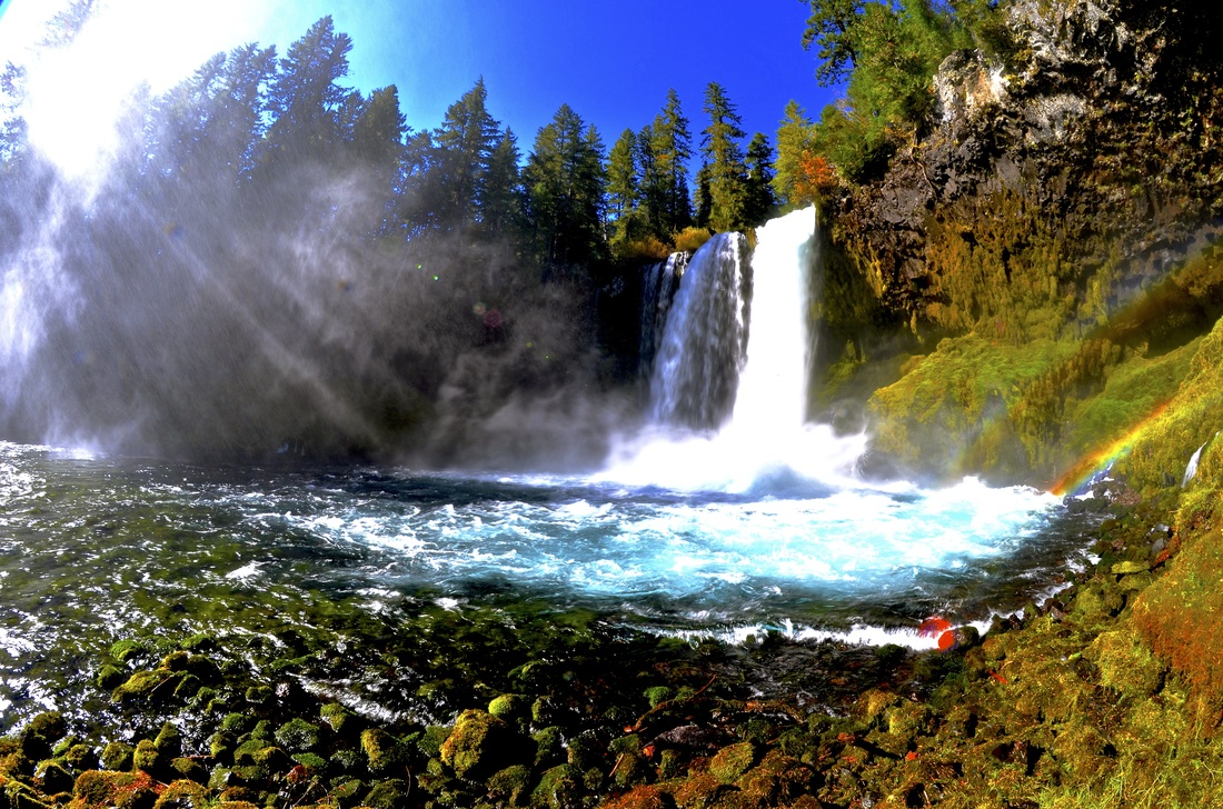
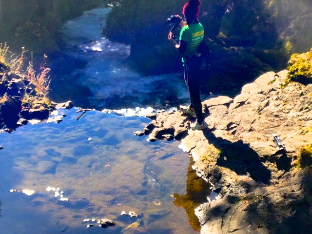
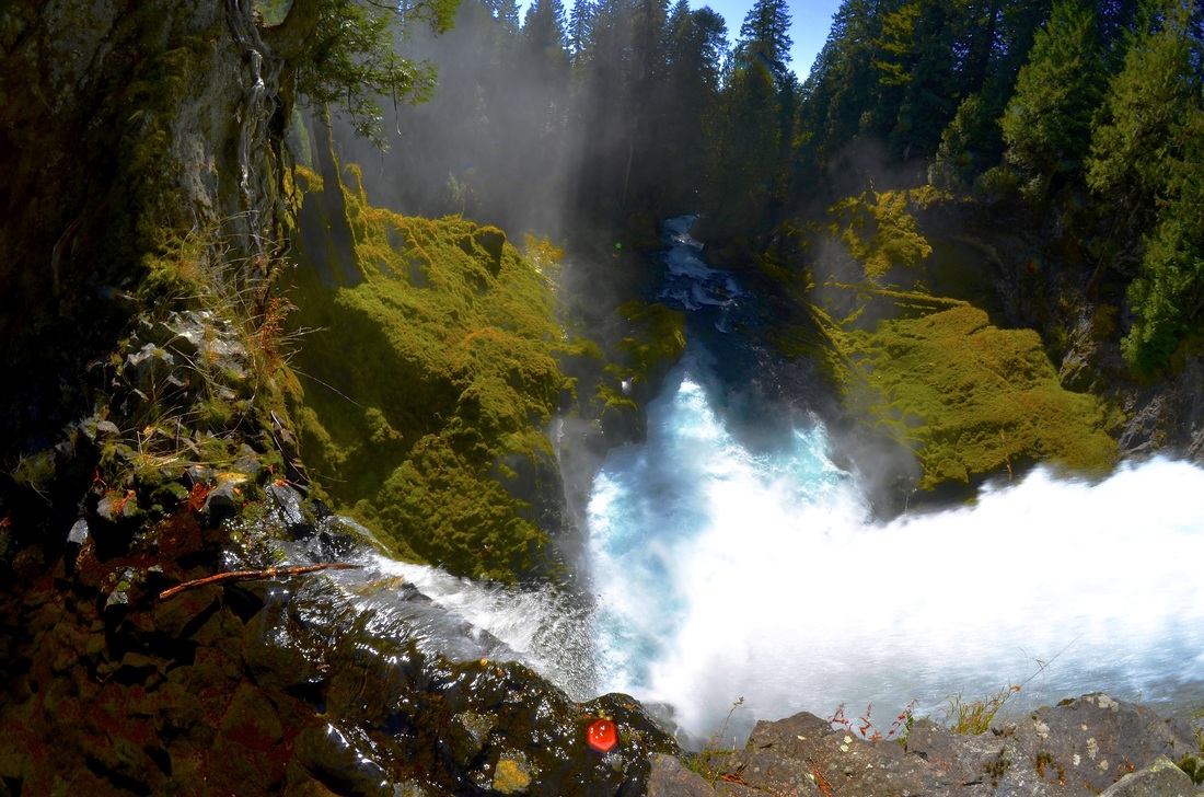
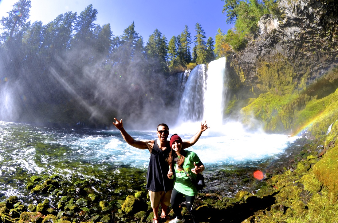
Silver Falls State Park, OR, 2015
This hike involves ten different waterfalls across an 8.7 mile loop. Just outside of Salem, this is an incredible tour of Oregon waterfalls. Note: • Get there earlier than later! The light during the day & people traffic is preferable. • There is minimal elevation gain so it is an easy loop. • Wearing hiking boots is a great idea as it is quite muddy and slick between all the waterfalls and Oregon's typical weather. My experience: Being the only two people on the trail, my hiking buddy and I had an incredible experience. While it was nearly a 9 mile hike, we sped through it quite efficiently and enjoyed every bit of it. Great place to pack a lunch and enjoy a day out an incredible Oregon park. Links: • http://www.oregonhikers.org/field_guide/Trail_of_Ten_Falls_Loop_Hike • http://www.oregonstateparks.org/index.cfm?do=main.loadFile&load=_siteFiles/publications/silverfalls_trailmap.pdf |

|
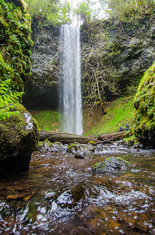
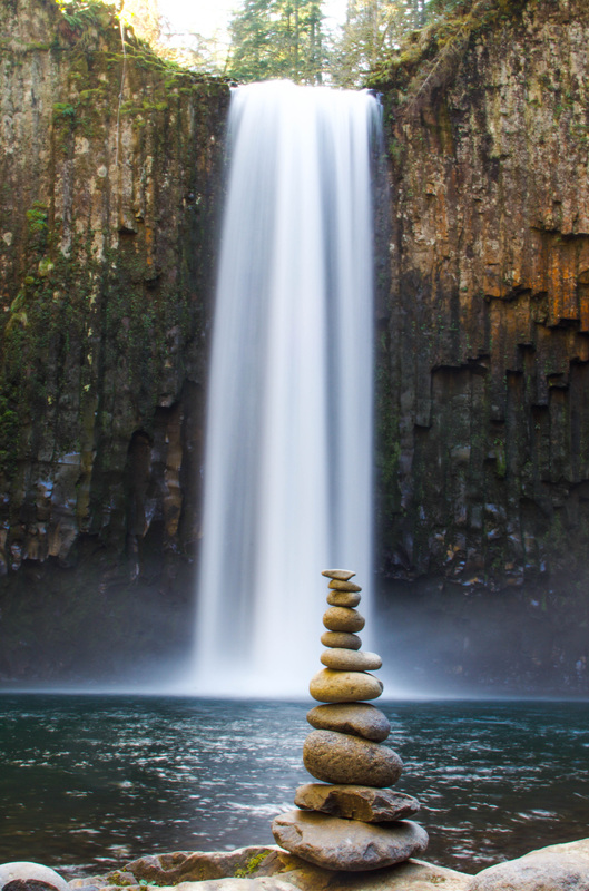
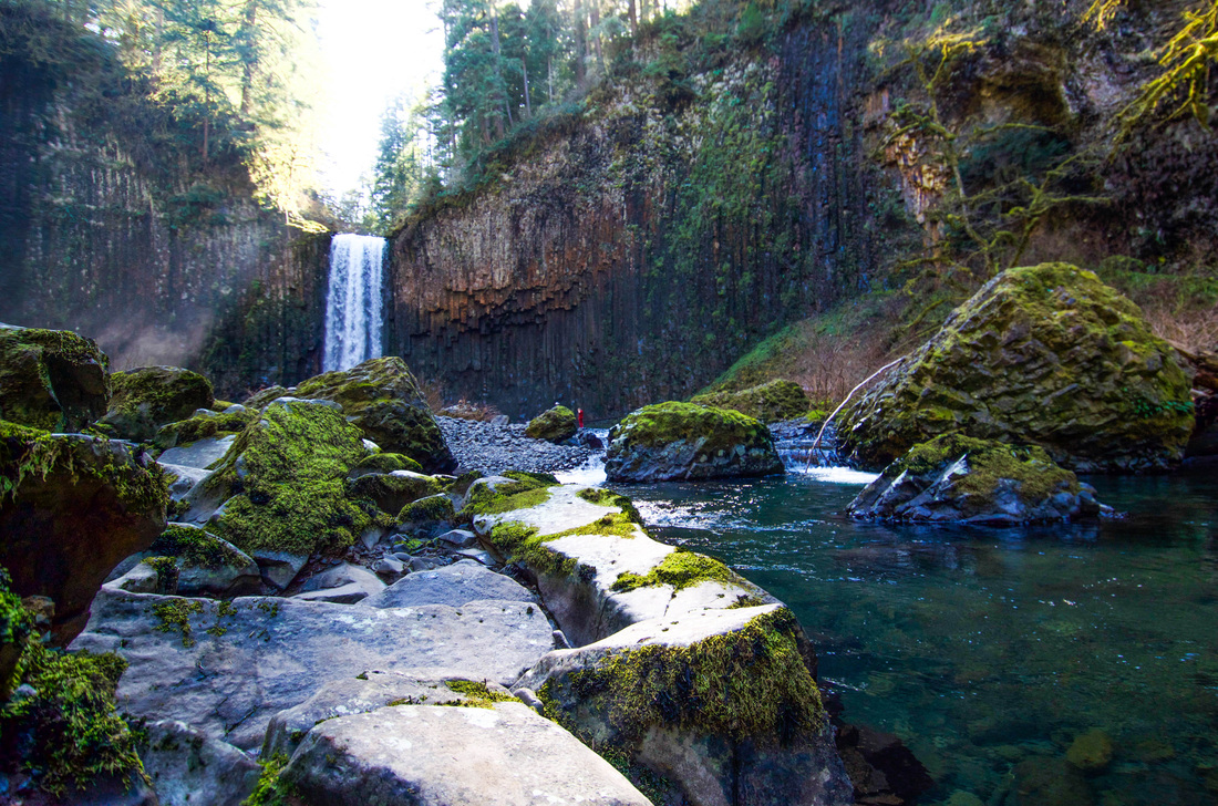
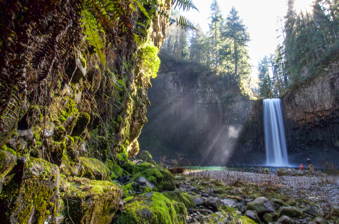
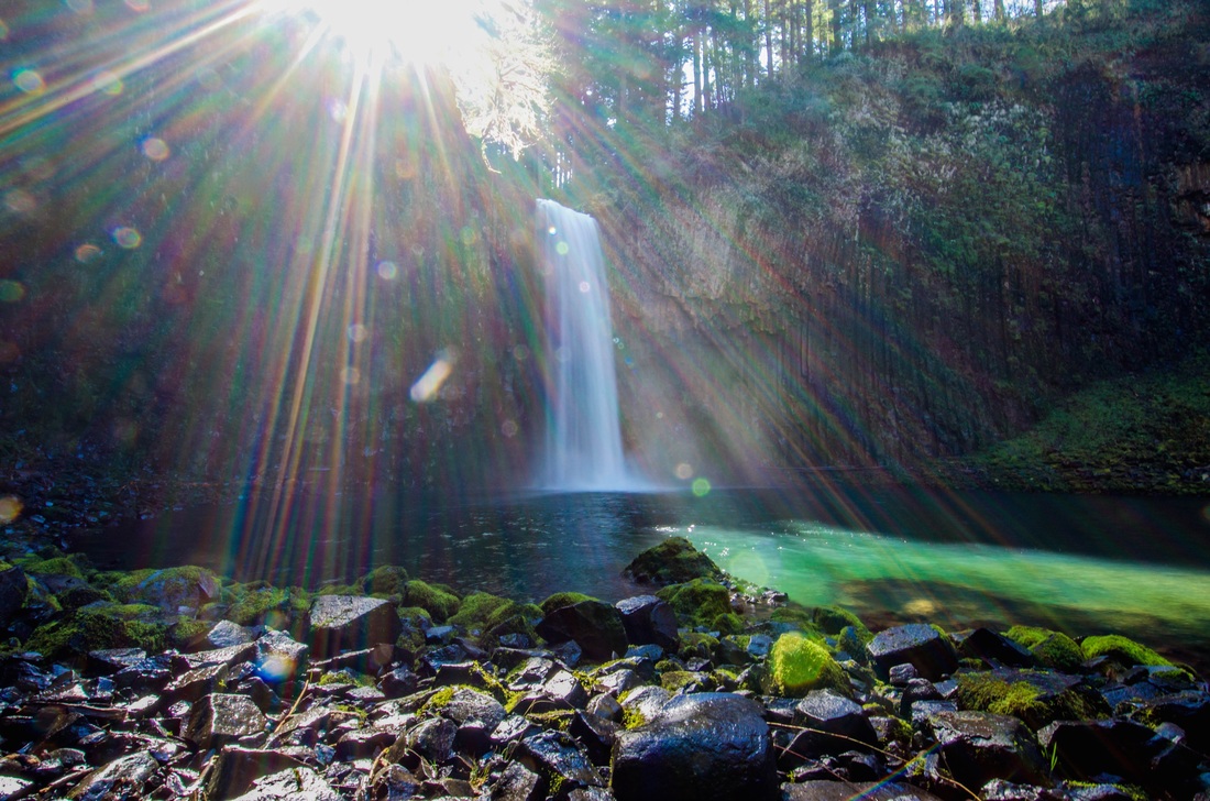
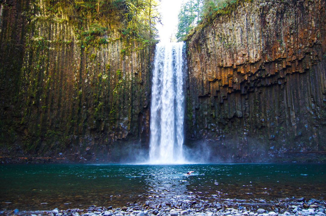
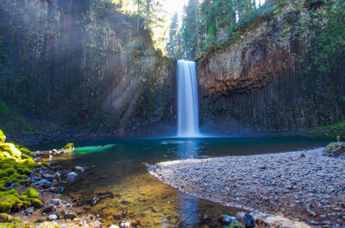
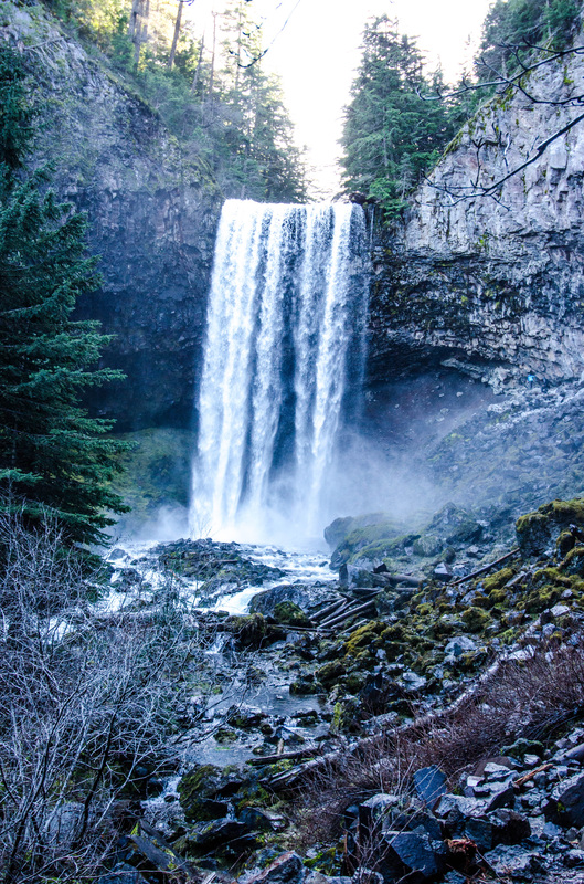
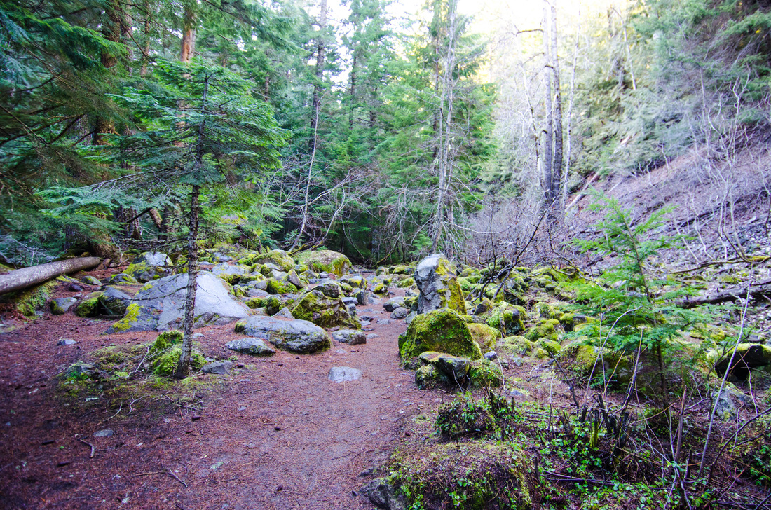
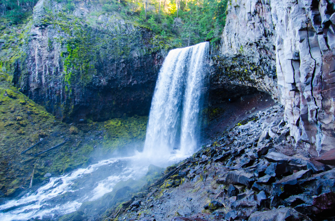
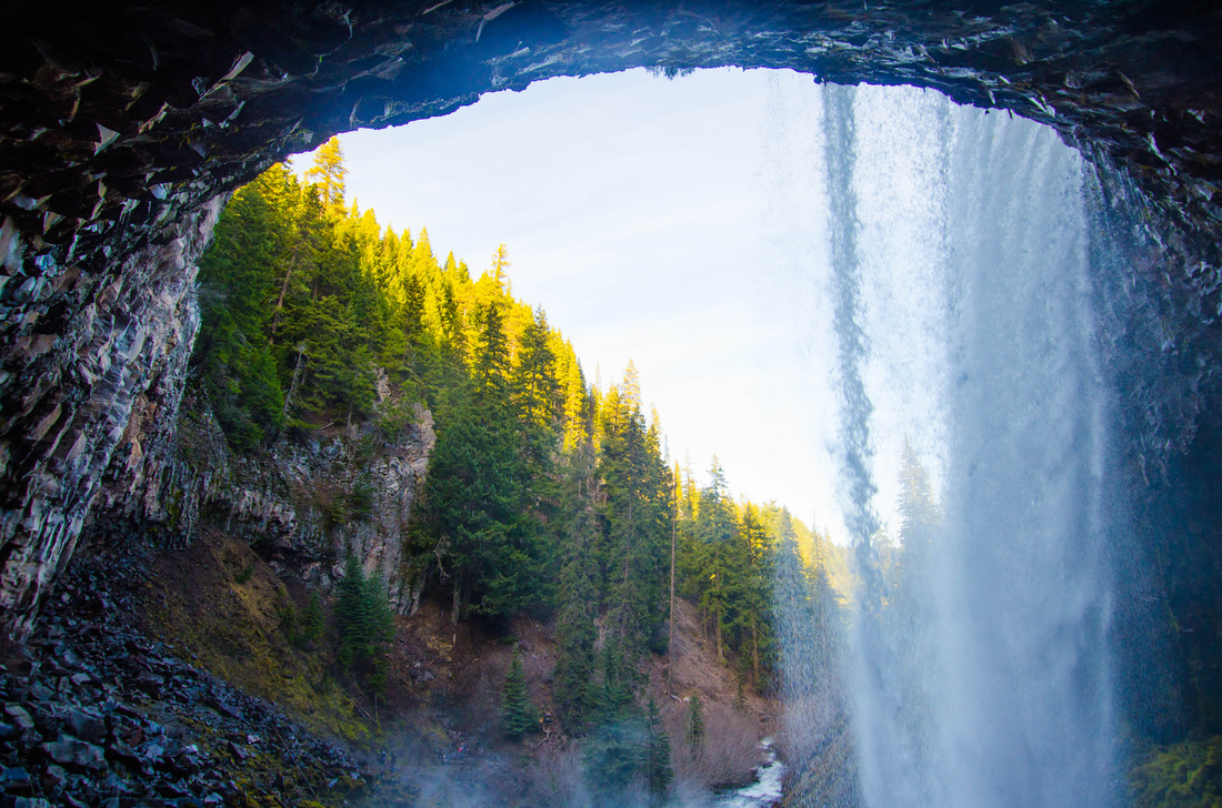
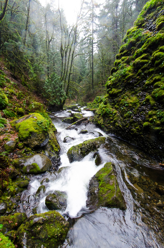
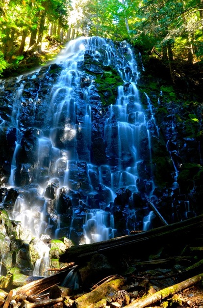
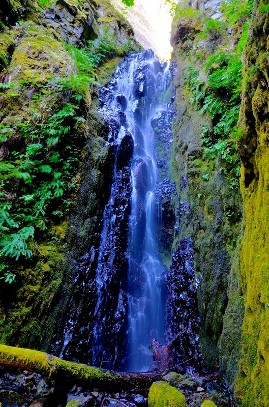
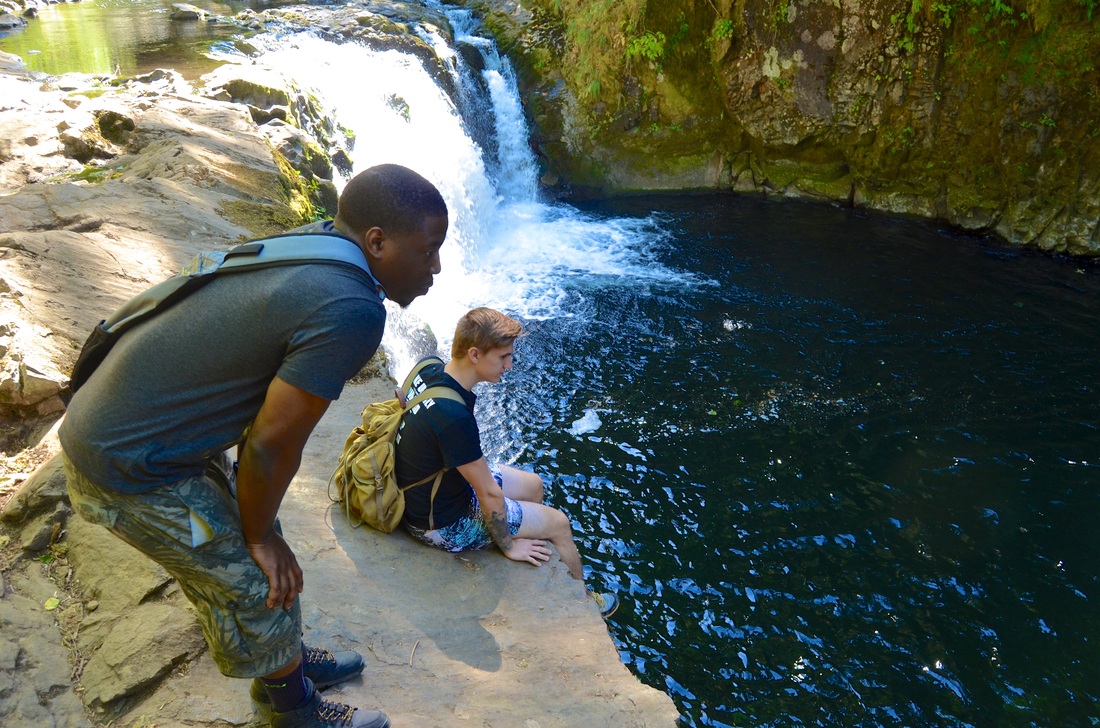
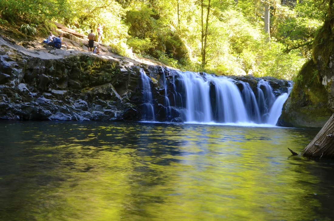
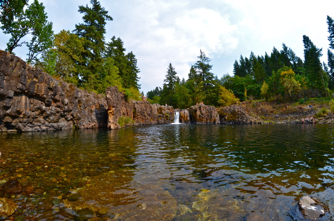
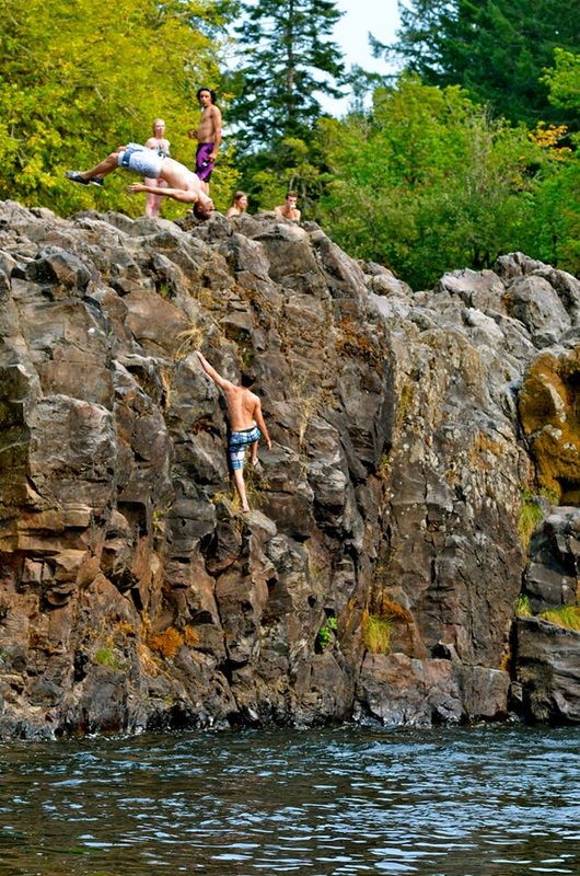
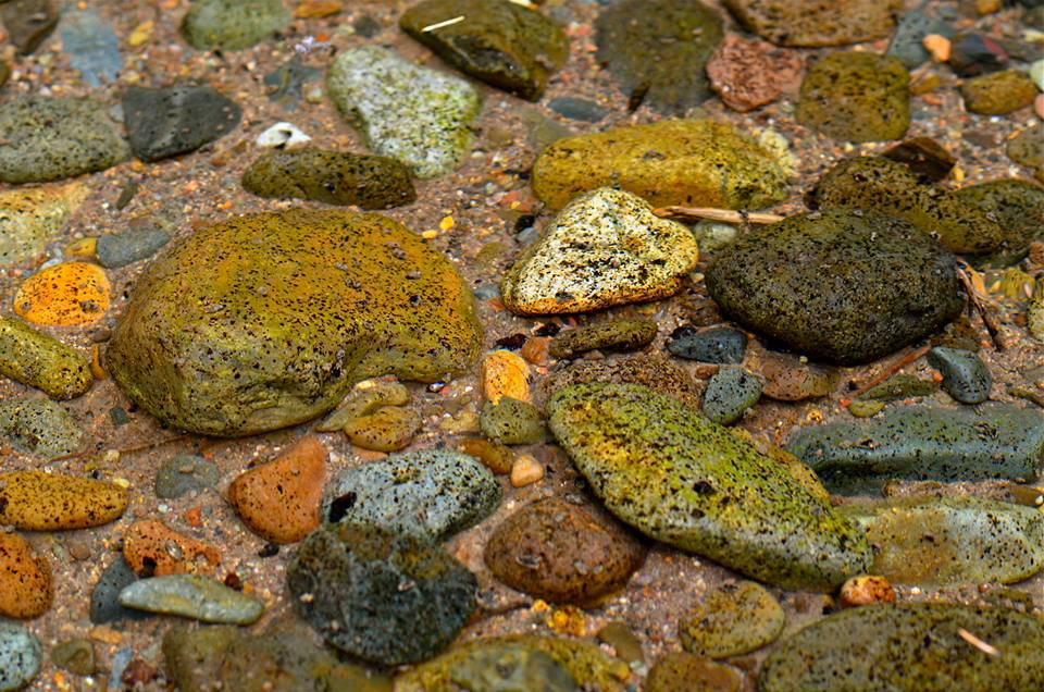
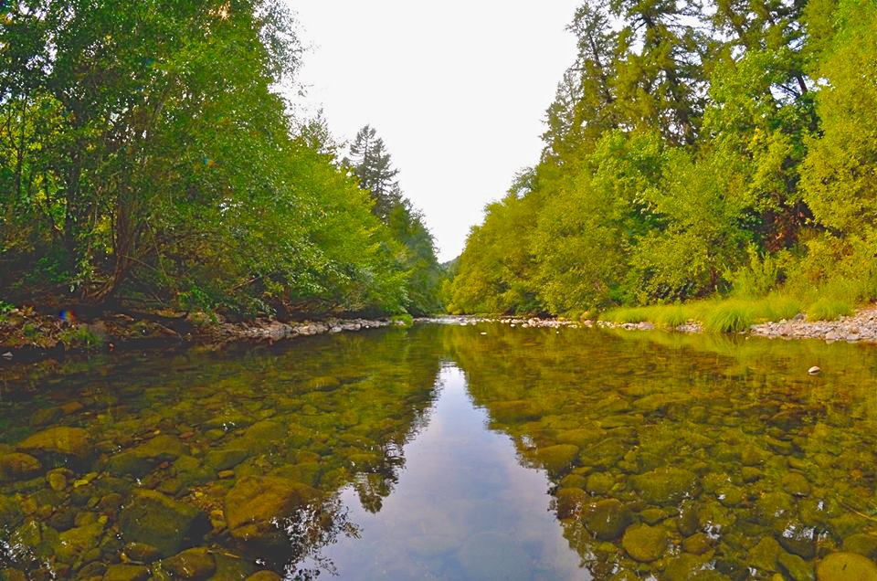
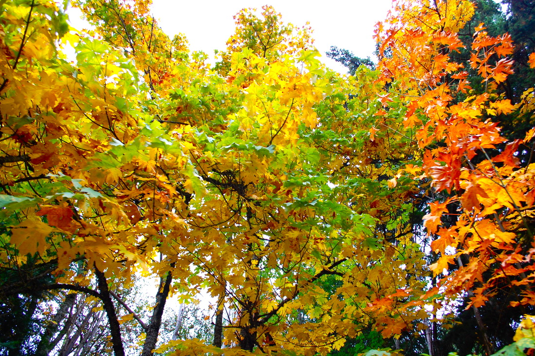
Abiqua Falls, OR
|

|
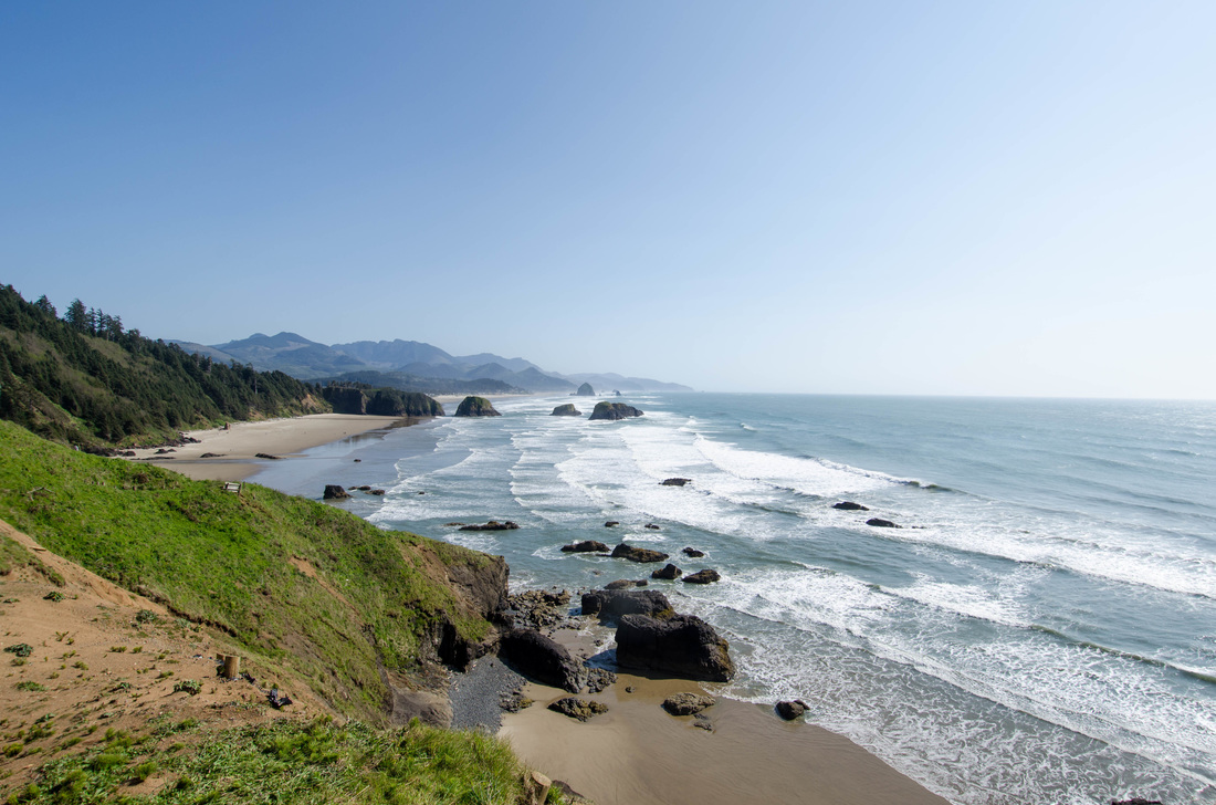
Canon Beach, OR
Description coming soon... |
|
Lost Lake, OR
Description coming soon... |

|
Tamawanas Falls, OR
Description coming soon... |


|
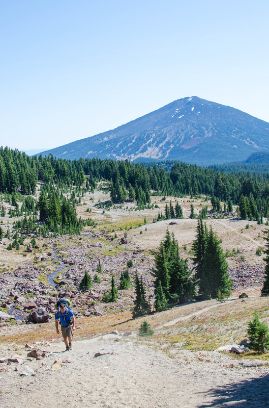
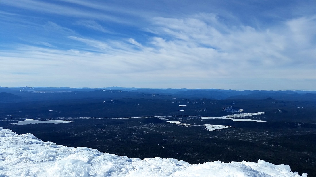
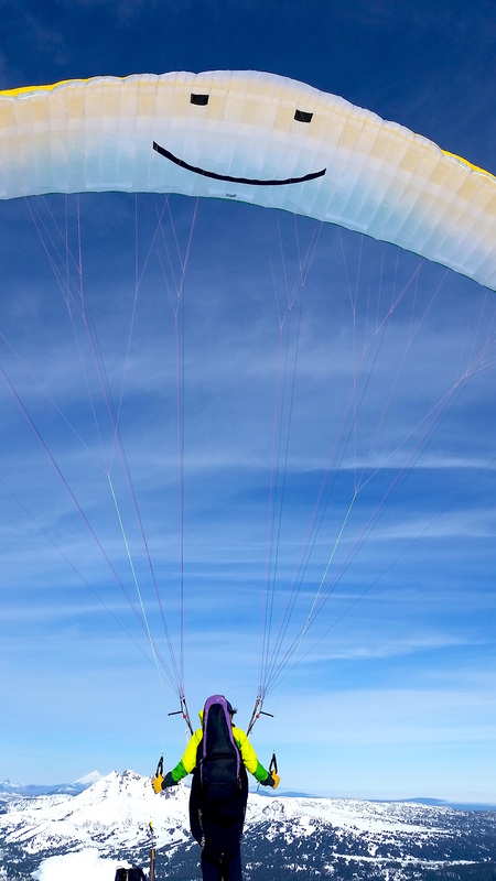
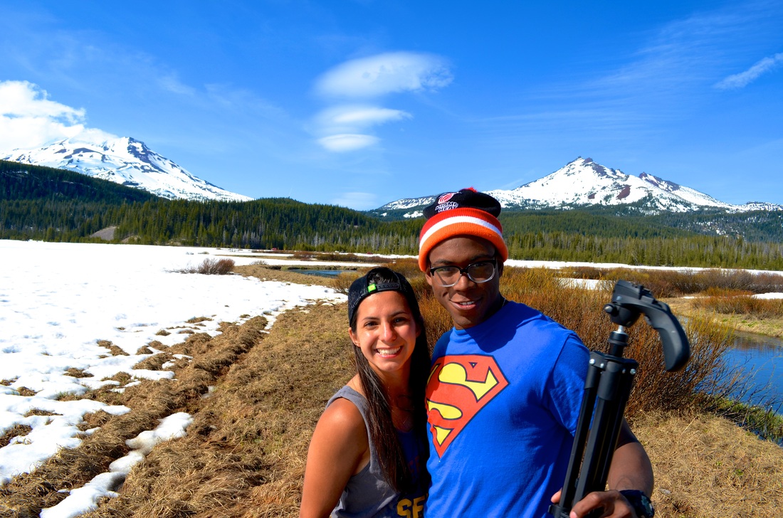
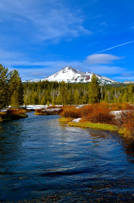
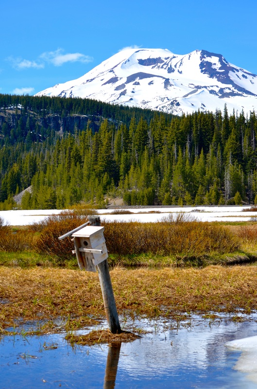
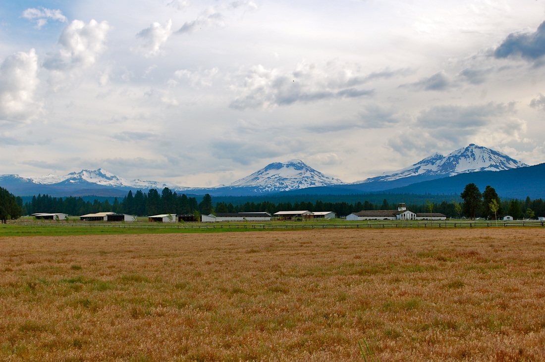
Mt. Bachelor, OR
Description coming soon... |

|
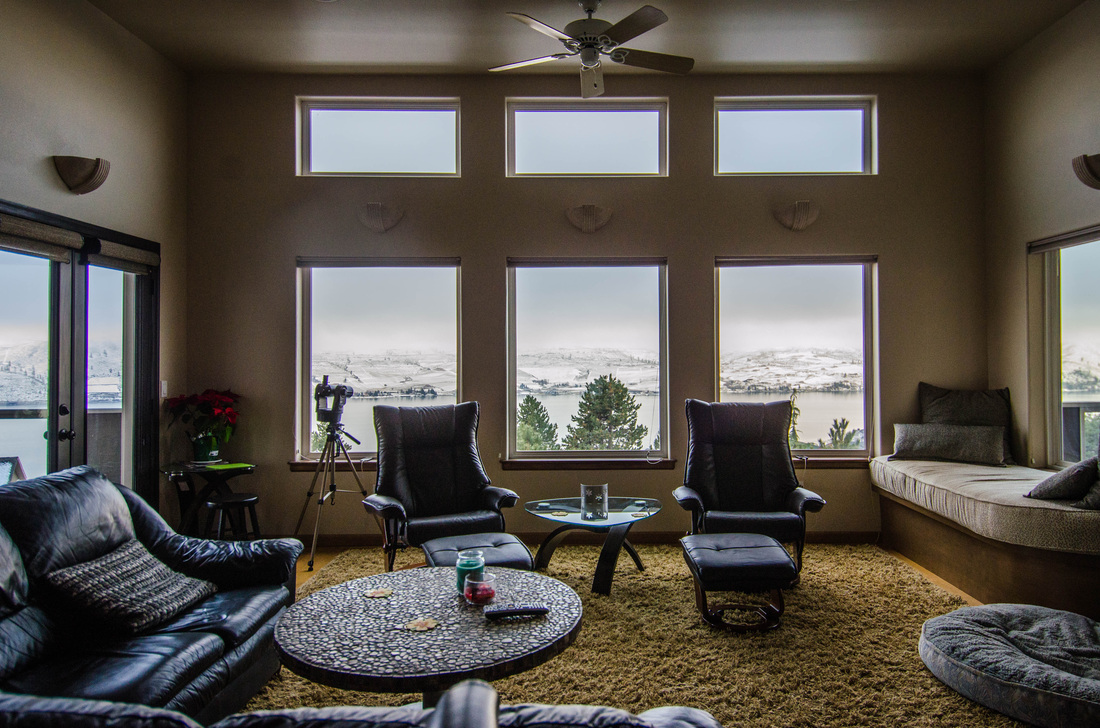
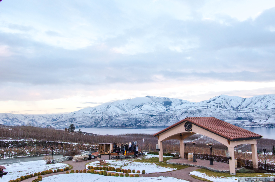
Lake Chelan,WA
• Drove up to Lake Chelan from Portland. A decent drive but well worth the time! Lake Chelan is incredibly stunning during the winter for the snow, and during the summer for the water sports and general summer fun. Note: • The wineries are a fun part of the area to explore. • There is snowshoeing, cross-country skiing, boating, fishing, wineries, cycling, camping, and more! My Experience: We had the great fortune of staying with some friends who had a beautiful home. We had the chance to go snowshoeing, but with the lack of snow it was easier just with hiking boots, and incredibly close town we were able to drive to Leavenworth which may be one of the cutest towns I have ever experienced. Links: • http://www.lakechelan.com/what-to-do/activities/ • http://www.lakechelan.com/ |

|
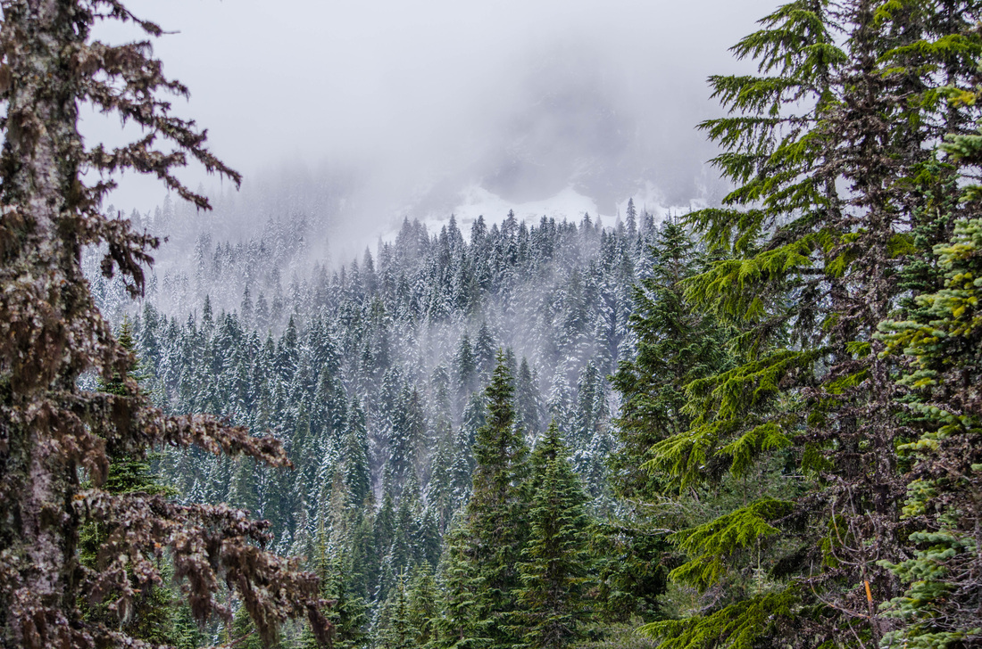
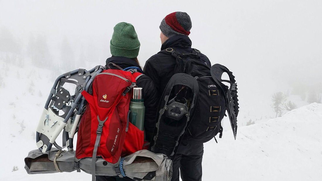
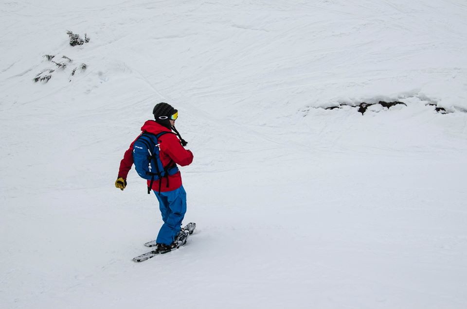
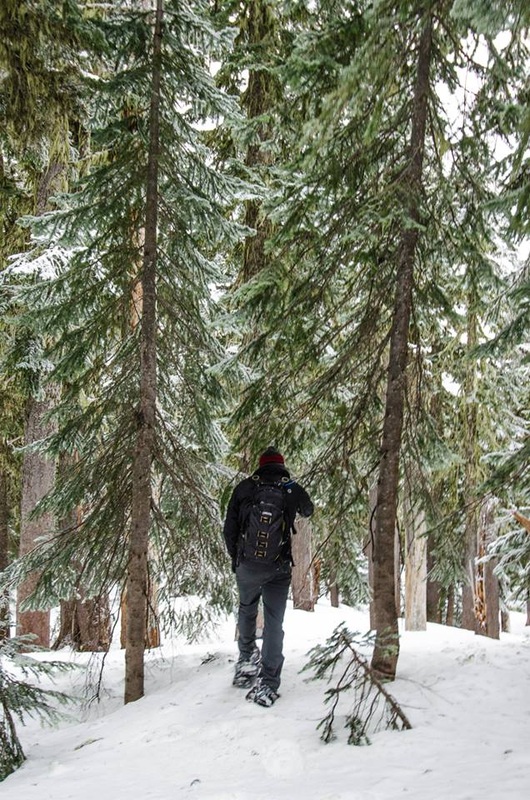
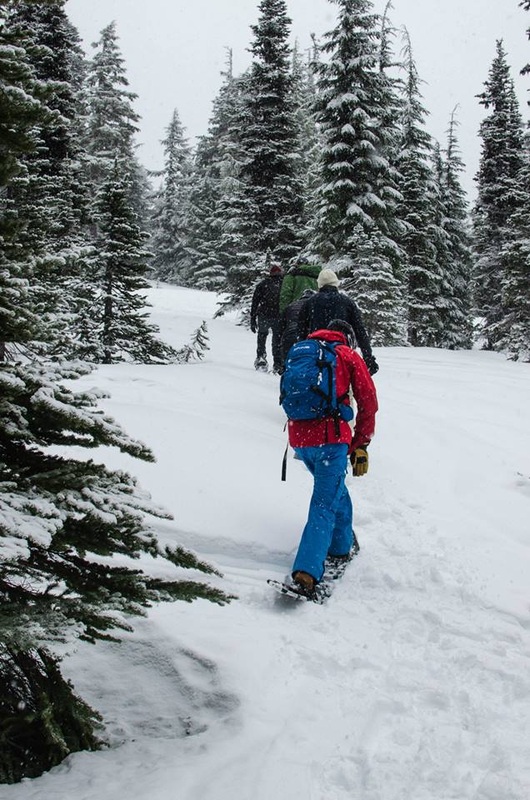
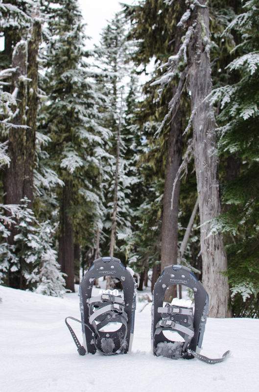
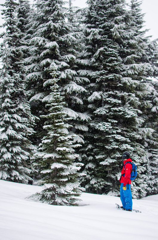
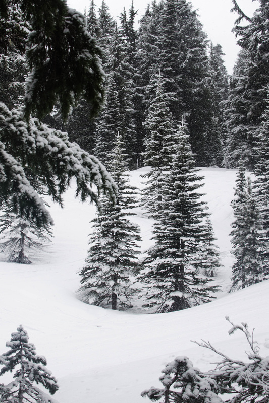
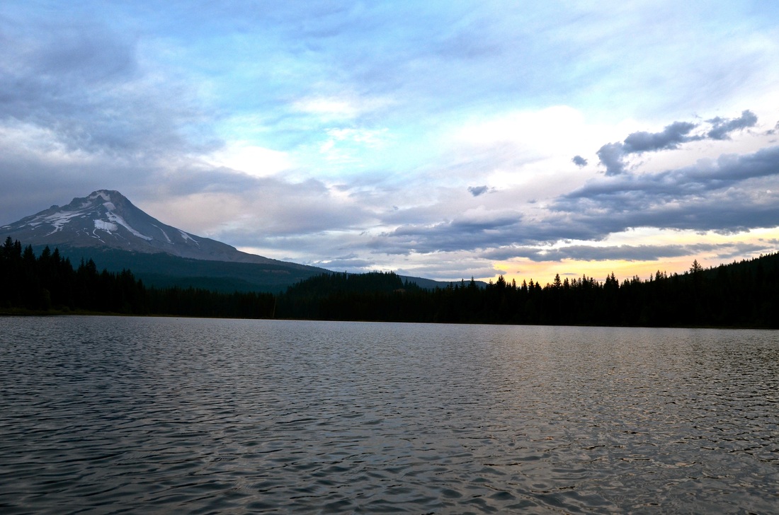
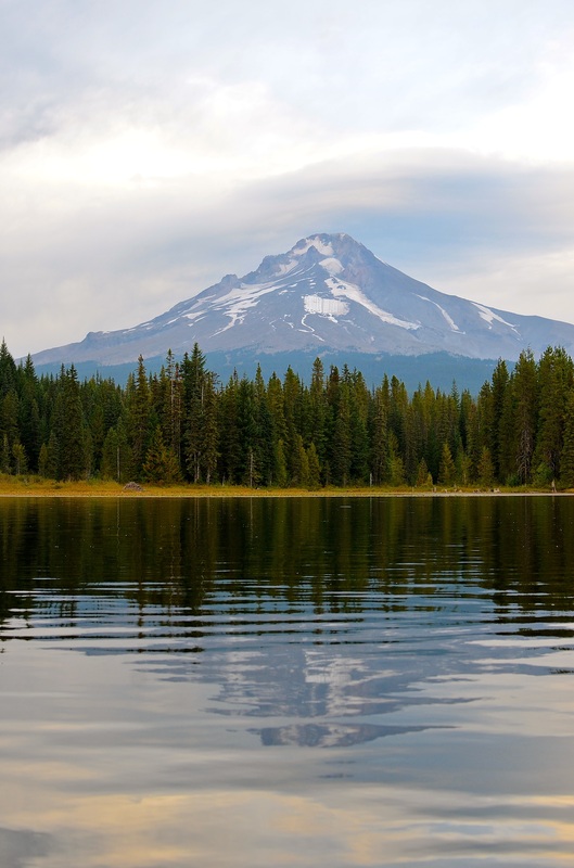
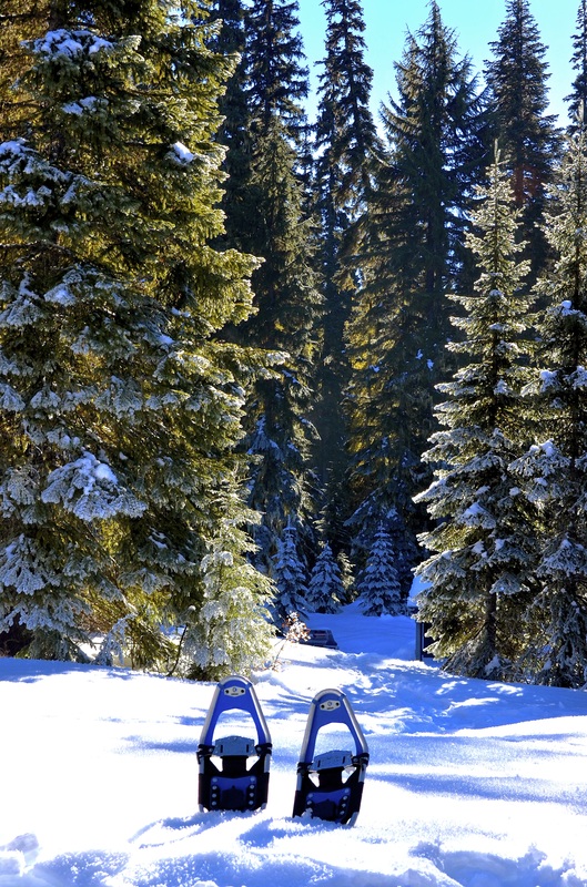
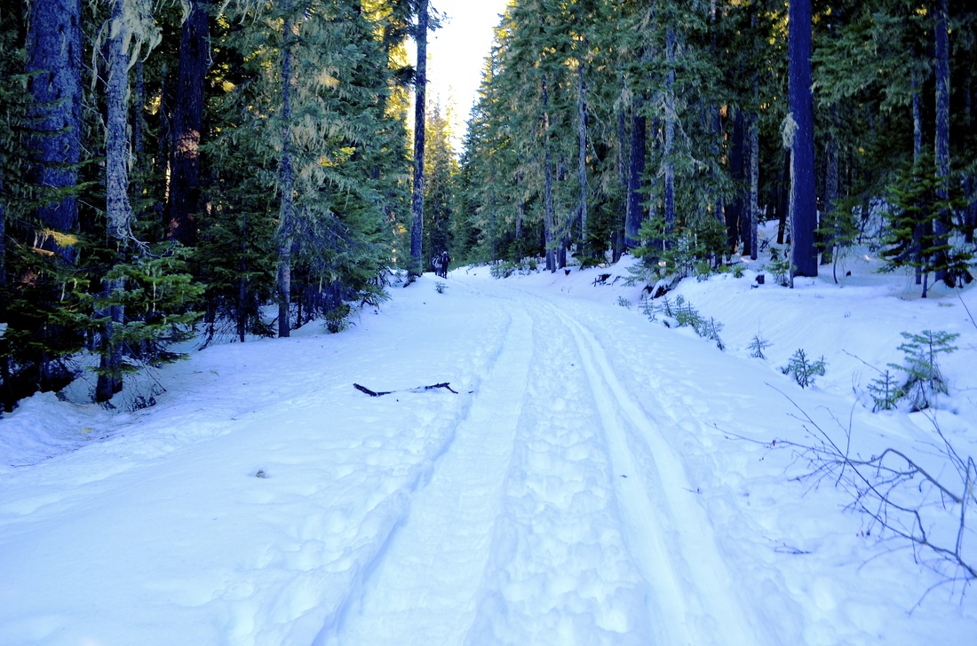
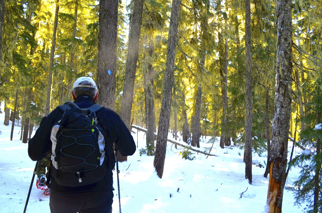
Mt. Hood Snowpark, OR
•Six of us drove up Mt. Hood to go snowshoeing through the snow park. Note: • Finding a trail before hand is a good idea. There are many options with a lot of elevation gain or little elevation gain, distance, or a short loop, etc. • Renting snowshoes from Next Adventure is incredibly easy and cheap. My Experience: • We had a fantastic time trekking up and around hood. We did a four mile loop, leisurely through some of the slopes and into the boundary lines. • We brought a tarp and food and had a wonderful picnic. • We even enjoyed a spout of snow which was perfect considering the snowless season in Portland. Links: • http://www.timberlinelodge.com/ski-area/freestyle-terrain/ • http://www.timberlinelodge.com/plan-your-visit/travel-and-transportation/ |
|
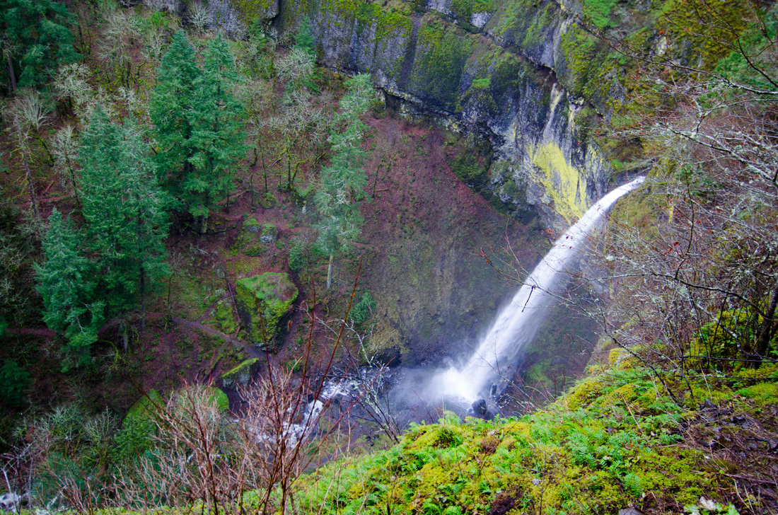
Elowah Falls, OR
|

|
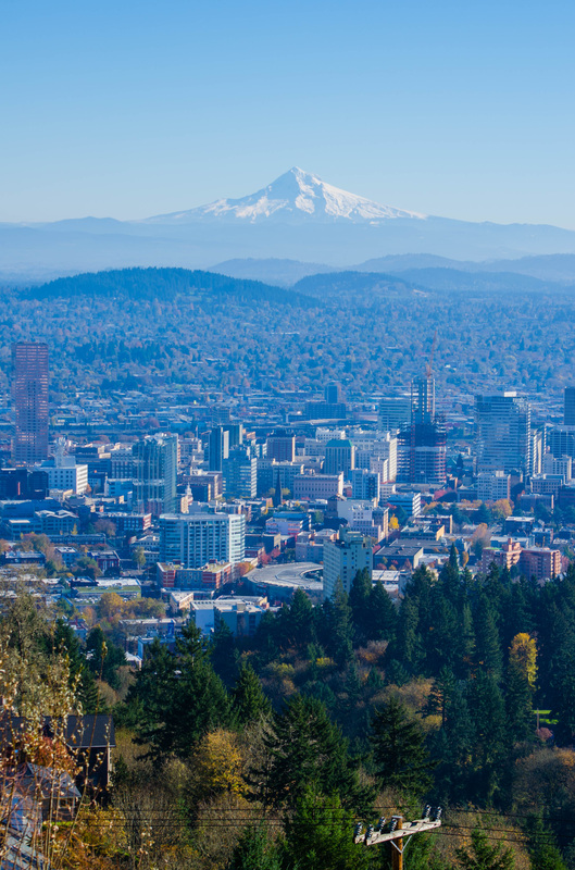
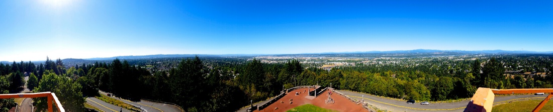
Pittock Mansion. Forest Park, OR
|
|
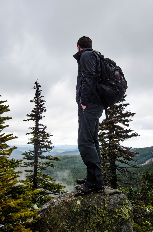
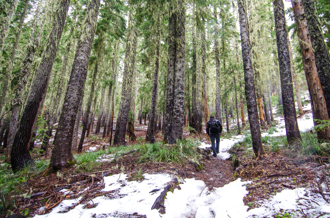
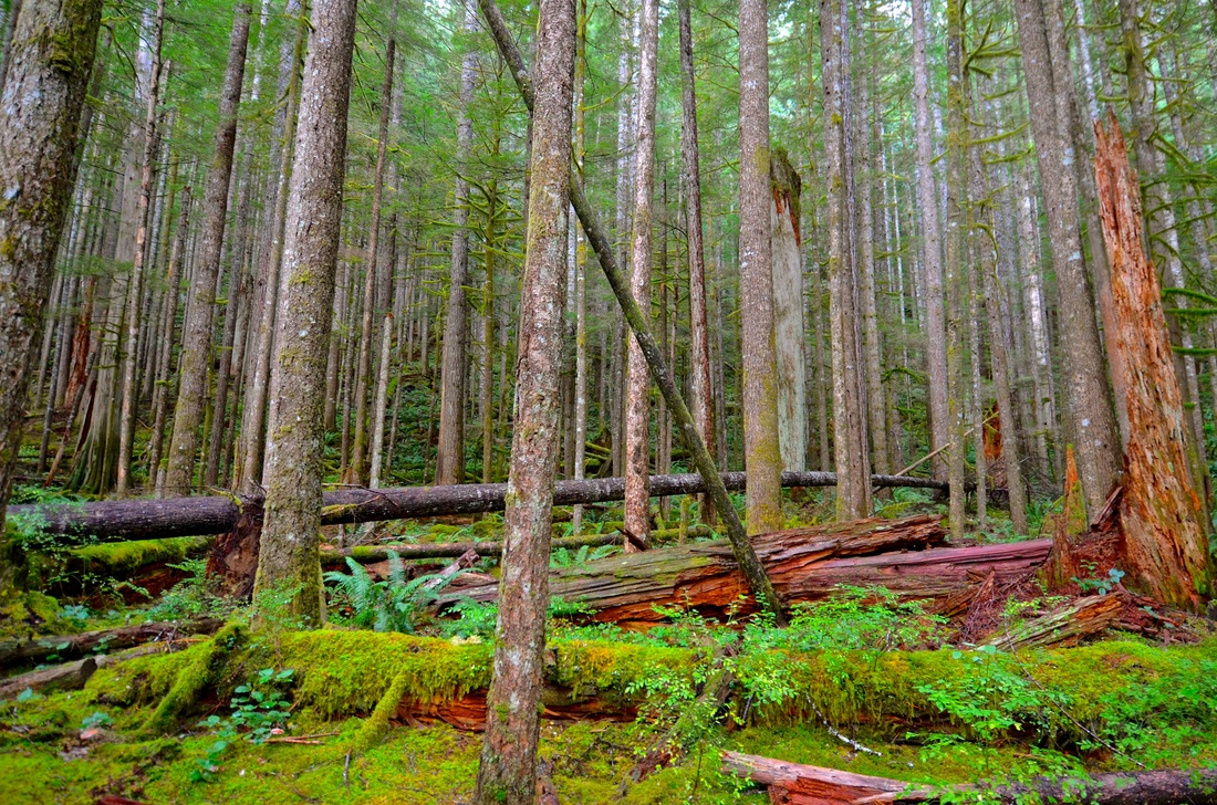
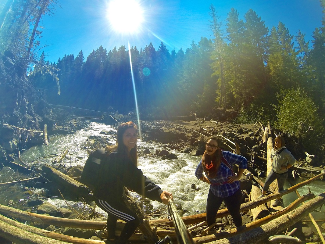
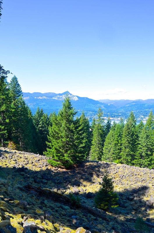
Siouxon Peak, WA, 2014
Hiked out in October on a relatively drizzly day to the Siouxon Peak trailhead. We didn't finish the whole hike because we were so distracted by the side trails that led to the endless waterfalls and gorgeous creek viewings. Note: • Driving a bigger car is advantageous as there are quite a few potholes along the road in. Some parts the road has even given way so they are very large drops in the road. • This hike is very backpacking friendly. • Wearing rain gear as the weather heads into the winter season is advisable. • Be careful about slick rocks and wood if you take any of the side trails down to the water. My experience: We went out to check out a beautiful Washington hike that had trails ranging from 8 miles up to 13. It is a gorgeous area with a wide variety of beautiful water falls that you have complete access to. There were great places to go out and camp at as well. Admittedly we got a little lost on our way out to the trailhead because our phones lost GPS connection so if I had an encouragement it would be to screen shot the directions. Either way this is a great fall hike for the entire family! Links: • http://www.summitpost.org/siouxon-peak/354102 • http://www.portlandhikersfieldguide.org/wiki/Huffman_Peak_Loop_Hike |

|
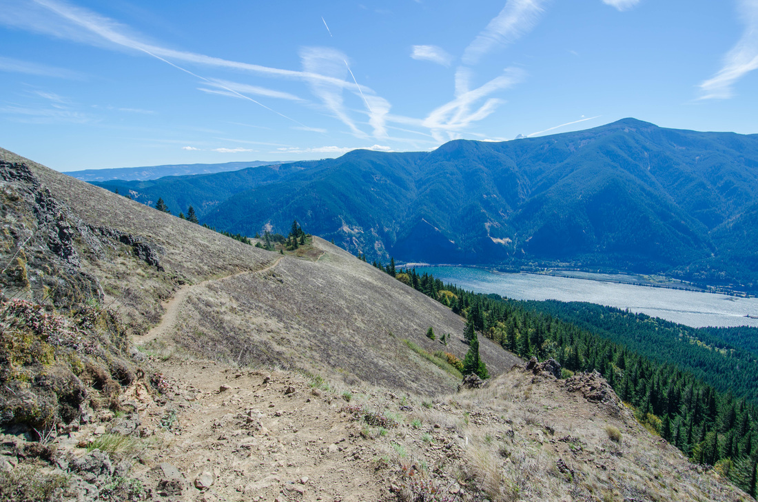
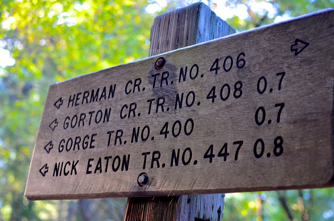
Indian Point, 2014
Hiked out to Indian Point this October to see an incredible overlook of the Columbia River Gorge. Take exit 44. Note: • If taking a smart phone or heading out without - make sure you print off at least three different maps & website descriptions of this hike and where to turn to ensure you don't get lost. • Have a NW Forest Pass or expect to pay the customary $5. • Brings lots of waters. This is a difficult hike. • If hiking out to the ridge be mindful of how incredibly dangerous the ridge is and furthermore, if you are interested in climbing to the top where you can barely see me, make sure you have some rock climbing experience and rope for safety. My experience: Charlotte and I got madly lost. If you see the waterfall featured below you have gone too far. The sign I have posted is where the trail ends. Up further is where it begins. I would encourage people to bring water, a camera, and hiking poles as the hike up can be very steep. Overall this is a great day hike and an incredible view! Links: • http://www.portlandhikersfieldguide.org/wiki/Indian_Point_Loop_Hike • http://nwhiker.com/CGNSAHike41.html |


|
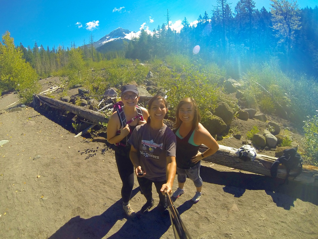
Ramona Falls, 2014
• Hiked out to Ramona Falls this September. This hike is in the Mount Hood Wilderness. • Note: • The trailhead is at the end of a long winding road with an incredible amount of potholes. A bigger car is preferable to drive along this road. • You do need a Mt. Hood wilderness pass which you can pick up at just about any convenience store in Sandy (which you'll go through if you're driving from Portland.) • This route is very dog friendly. • The bridge has been washed out from flash floods - however, when you reach the trail point where you are supposed to cross there is easy access across the bridge from fallen logs in multiple areas. If you have a dog that is too big to carry you can even walk them across the river. (So bring water shoes and shorts!) Experience: This was a fantastic hike. The land was a diverse terrain, the forest was beautiful, and the falls - as you can see - was gorgeous. We decided to picnic and met some friends to go hiking with in the future. An overall fantastic experience! Links: • http://www.portlandhikersfieldguide.org/wiki/Ramona_Falls_Hike • http://www.fs.usda.gov/recarea/mthood/recarea/?recid=53460 |


|
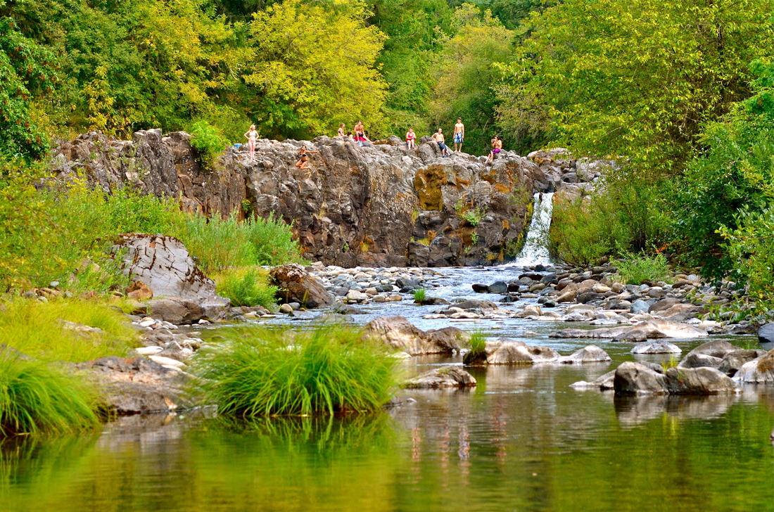
Dry Falls Creek, 2014
• Hiked out to Dry Falls Creek this September. The trail starts near The Bridge of the Gods in the Columbia River Gorge off exit 44. • Note: • You connect with the trail by heading up the path, then going towards the Pacific Crest Trail by going under the overpass. • Tips: • Mark which trails you enter and leave from. Due to the PCT intersecting with this hike the trails converge at multiple points. • Once you reach the footbridge you are almost there. • The waterfall is unmarked and is covered by loose rocks. • Go up to the waterfall by hiking towards it. Do NOT climb up to see the second portion of the falls. It is very dangerous. • Have an emergency number on you. Cascade Locks Police Department number is: 541-374-8510 My experience: • Upon hiking out by myself I not only struggle to find the trail head, I also managed to walk into over 200 spider webs, failed to tag my trails and on the way back got lost down a logging road, and ended up stuck up on a rock-slide prone shelf when I went to check out the second portion of the waterfall which, by the way, was not noteworthy. Alas, it's important always to stay on the marked path except to see the lower portion of the waterfall. Links: • http://trails.gorgefriends.org/trail/dry-creek-falls-and-herman-creek-pinnacles/ • http://www.portlandhikersfieldguide.org/wiki/Dry_Creek_Falls_Hike |

|
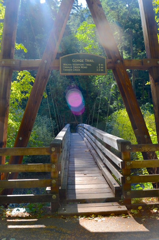
Punchbowl Falls, 2014
• Hiked out to Punchbowl Falls this June. The trail starts at the Eagle Creek Trailhead up by the Wauna Viewpoint. Note: • You may park at the Viewpoint then hike up a paved path, then pass a campground, then walk down a road and at the end of it will be the trailhead which is well marked. • In order to get to the bottom of the falls and go for a dip there is an unmarked trail down that is rather steep and should only be used if you feel very confident in your ability to go slow, and use your hands if need be. The log at the bottom also is full of slivers so try your best not to put your hands on the big logs on the bottom. My experience: • Finding the trailhead was a little tricky. Once we found it however, the hike was fantastic. Some pretty incredible views on the way to the falls. The trail is well marked. Punchbowl falls is a great place to go out and picnic at. It is also very dog friendly. Links: .• http://www.portlandhikersfieldguide.org/wiki/Eagle_Creek_to_Punchbowl_Falls_Hike • http://www.portlandhikersfieldguide.org/wiki/Punchbowl_Falls |

|
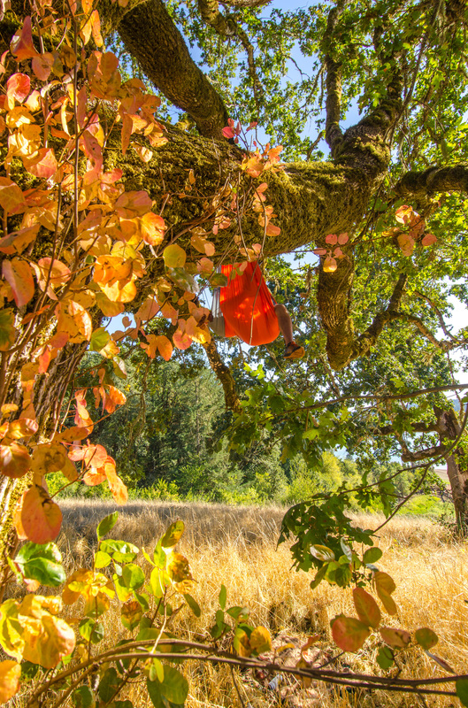
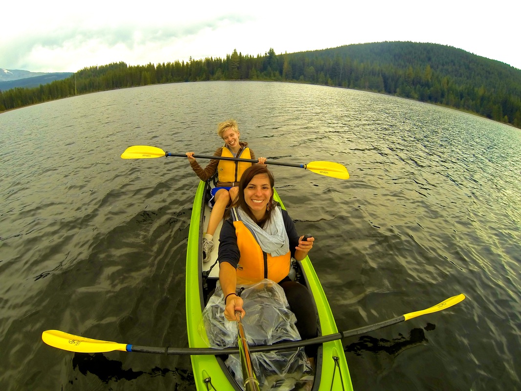
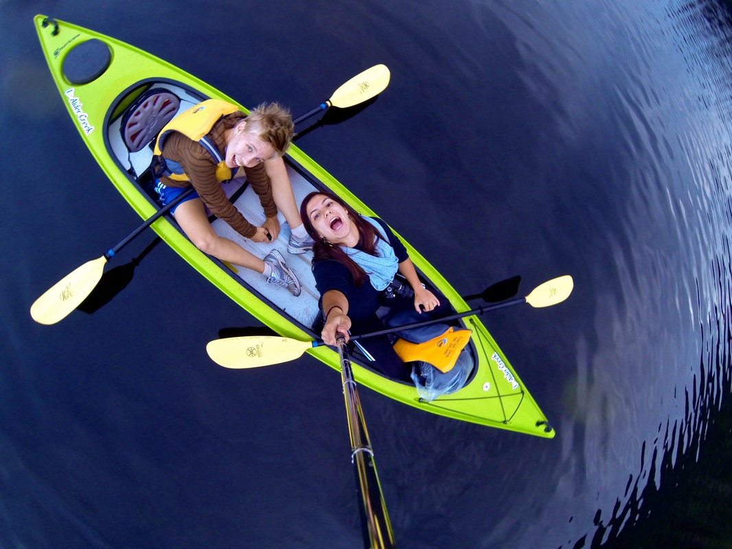
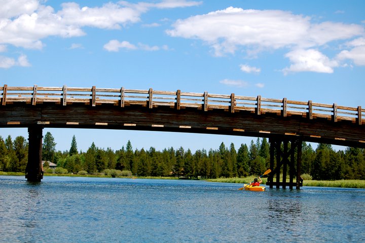
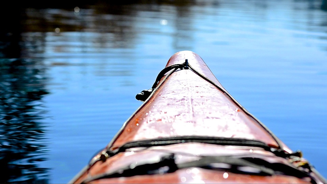
Trillium Lake, 2014
• Went kayaking out on Trillium this September. Note: • Where to park to put in your boat is not the road to the campsite, rather you continue down the road and there is a day-use parking area where you can put your kayak/canoe in. My experience: • "Black smoke curled around the the tip of Mt. Hood like a Chinese New Year dragon when Natalya Jenney and I first stumbled from her van, Red Mamba, at Trillium Lake's boating dock Monday evening. The smoke vanished before we could reach the cameras, leaving a naked mountain towering over a dark lake with air riddled in hazier smoke from recent wildfires. This was our "adventure"! Paddling around on a calm lake might not be the most stimulating kayak outing for thrill-seekers, but with blue-green algae blooming on rivers, the mountain was one of the only nearby places to go—and what a lovely time we had. We did not crest rapids or riffles, but we did observe herons, a hungry hawk, chat with a duck, enjoy each other's company, and catch traces of the sun setting. " - Emily Gritzmacher Links: • http://www.fs.usda.gov/recarea/mthood/recreation/hiking/recarea/?recid=53514&actid=91 • http://traveloregon.com/see-do/recreation/hiking/trillium-lake-loop-trail/ |

|
Rocky Butte, 2014
• We hiked up to see the view this September. Note: • Park in The Grotto parking lot. The trailhead heads north and isn't dotted with religious statues. The religious statues are a part of The Grotto and quite interesting to check out if you're in the area and have time! • As you hike up, before you connect with the road for some urban-hiking, you will follow a gorgeous rock face that ascends with you as you hike towards the campus. You will go through a tunnel before you get to the campus. • This rock face is used by rock climbers. Be cautious and do not climb on these rock faces. Three people in the last two years have fallen and been seriously injured or killed due to trying to take a closer look or climbing the rock face without proper equipment. • This path is also lived in by many transient folk, so it is important to stay on the trail and not disturb any of the individuals who have set up camp in the area. My experience: I went up with two friends and we got madly lost. We had a hard time finding where the trailhead started and once we got to the trailhead we began hiking and were a little spooked by the amount of trash on the path and how well lived in the forest was. After a couple wrong turns on the trail we found ourselves on the road and decided to hike up the road on the shoulder that was spacious enough for two people to walk safely together. This is in fact the way up to the top of the Butte. Going as a group was important as we took a wrong turn in the forest portion of the trail and found ourselves at a very large camp site. It's just good to be cautious as the trail is off the road and can be quite desolate. The top was well worth it as it a stunning overlook of the city on all sides and all of the surrounding mountains. Links: • http://www.portlandhikersfieldguide.org/wiki/Rocky_Butte_Hike • http://hikingnorthwest.wordpress.com/2013/07/13/urban-hiking-portland-rocky-butte-2/ |


|
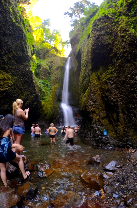
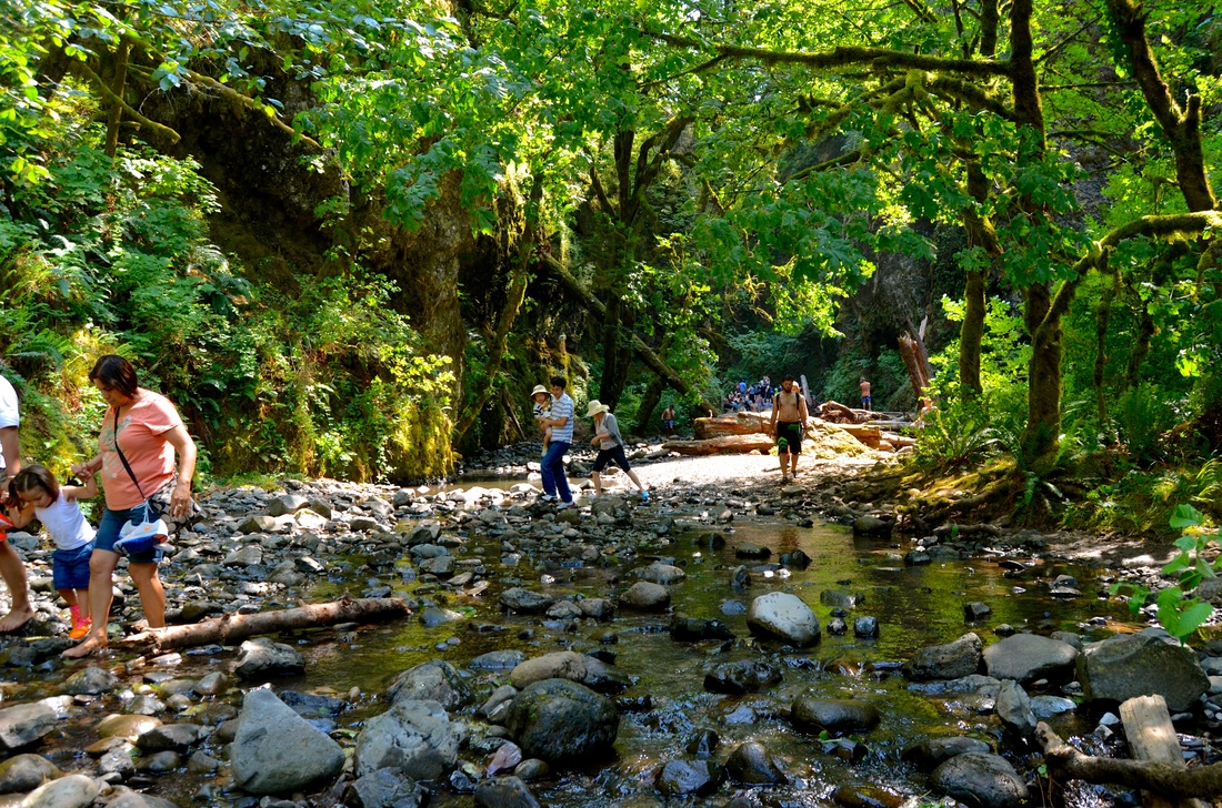
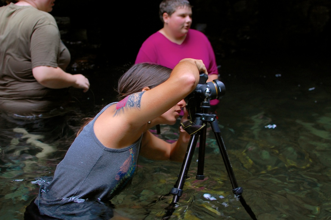
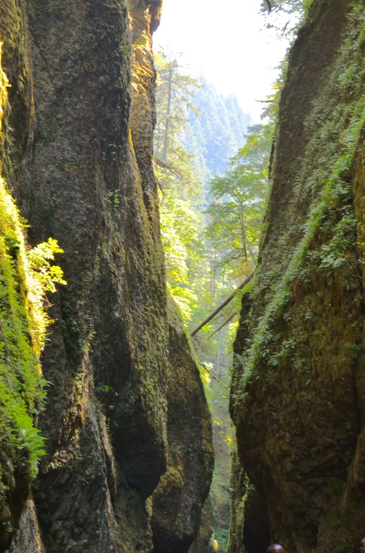
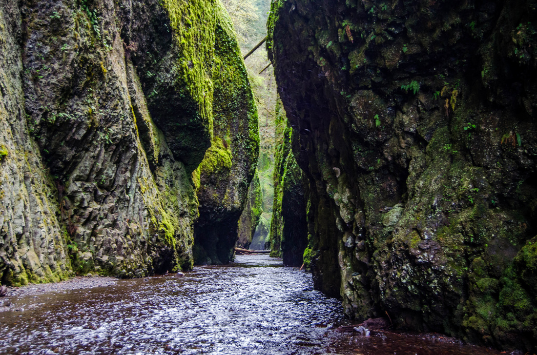
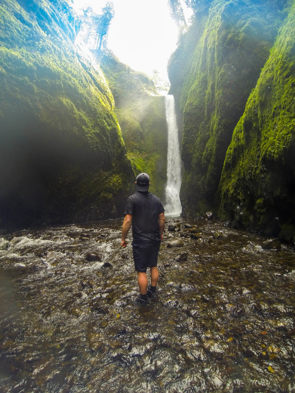
Oneonta Falls, 2014
• We hiked out to Oneonta Falls for my birthday this past August. It was incredible! This is an absolute must do* hike if you are in the Portland area, even if just for a weekend. It is a couple miles down the Historic Highway from Multnomah Falls. Notes: • You do NOT want to be the person everyone knows is a rookie by not wearing the right gear. • There is a five foot stretch of water that you do have to literally walk through. • Water shoes, swimming trunks and tops are highly suggested. • Keep your phones and electronics in a water proof container/bag. • Expect high levels of traffic if you are going during the summer. My experience: I had been looking forward to this hike for some time. I had been told it was just an incredible example of the beauty Oregon has to offer - and I wasn't disappointed. I was wearing the right gear and we went during a hot period in the year and the water was still freezing. So expect to get chilly and have a change of clothes or towel and time to warm up afterwards. It was a hilarious site seeing my trudge through the five foot pool of water standing at an impressive 5 ft 2 inches. No less I had all my camera gear and my phone on me. So I had that stretched above my head as I went through the water. A priceless scene. We also unfortunately saw a group of girls give their taller friend all of their phones in his bag only to see him slip on one of the rocks and go straight into the water. So water proof your electronics before you go because the tall ones aren't a guarantee to protecting your electronics. There is also a massive conglomeration of wood logs that you need to traverse in order to access the Oneonta gorge path. So if you're traveling with your dog or kids, make sure they are able to traverse well or can be carried by one hand to give you a free hand. Either way - this was an awesome experience! Links: • http://www.nwhiker.com/CGNSAHike53.html • http://www.portlandhikersfieldguide.org/wiki/Oneonta_Falls |
|
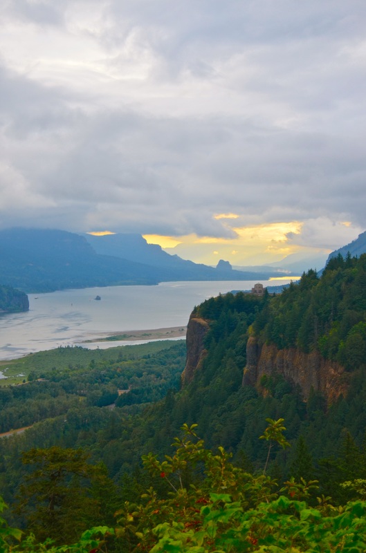
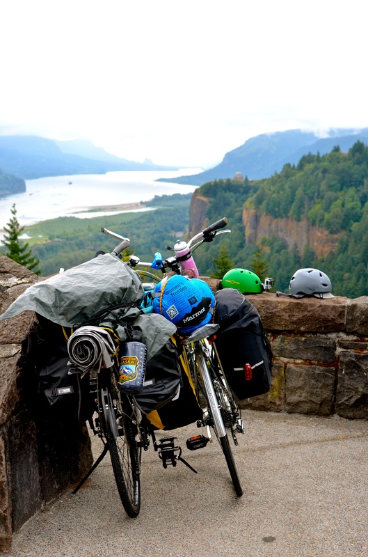
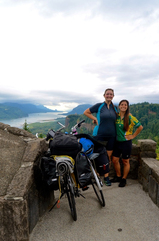
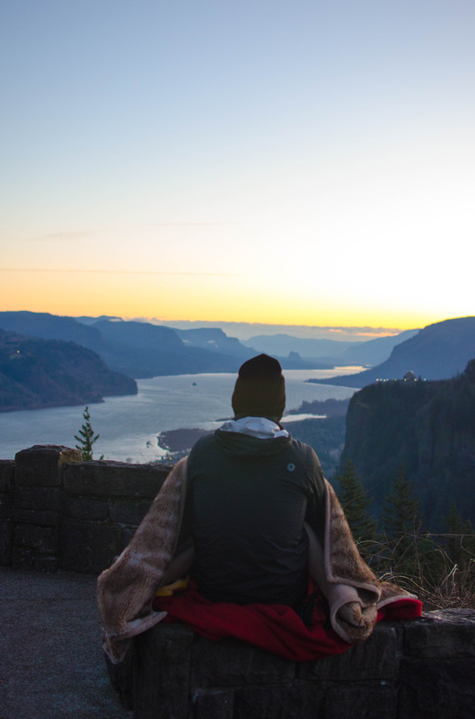
Portland Women's Forum, 2014
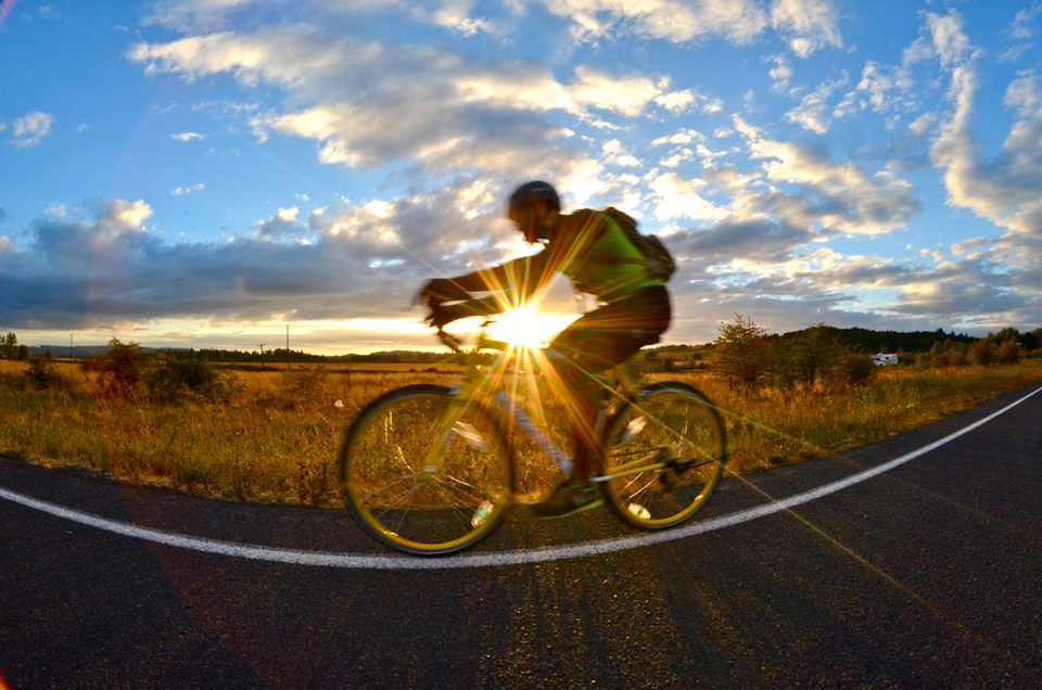
• We had camped out down the road and were able to wake up early and bike up to this spot to see sunrise. It was well worth the early morning as this is an astonishing view point! Notes: • This is very bike and car accessible. • Camping in this area can be tricky if you are walking/biking. With a car there are campsites down by Multnomah falls which is just past the Vista House pictured here. • Sunrise is a site to see from this vantage point. • I have heard that when the aurora borealis (northern lights) gets close enough to Oregon to be seen - this is an ideal location to camp out at. My experience: Charlotte and I biked from Portland to Multnomah Falls with our camping gear as we camped out right before reaching the falls. The bike ride was incredible. I encourage anyone who has bike and drive to do it to go for it. There are a lot of websites that give specific directions of where to go and how to get there. If you're really motivated you can even bike there and back. And along the trip you can get some incredible views in such as this! Links: • http://www.oregon.gov/ODOT/HWY/BIKEPED/docs/columbiagorgebikemap.pdf • http://ridewithgps.com/routes/2513030 |


|
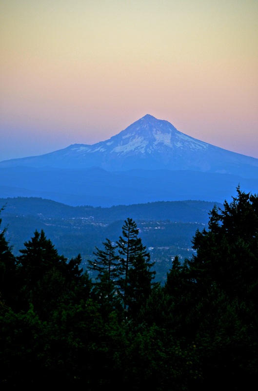
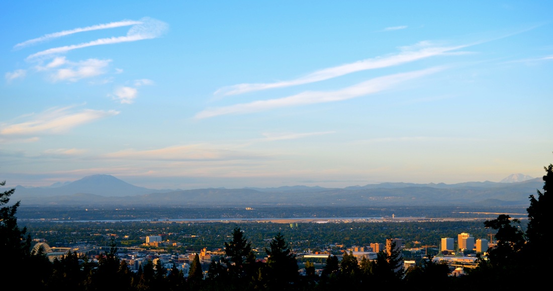
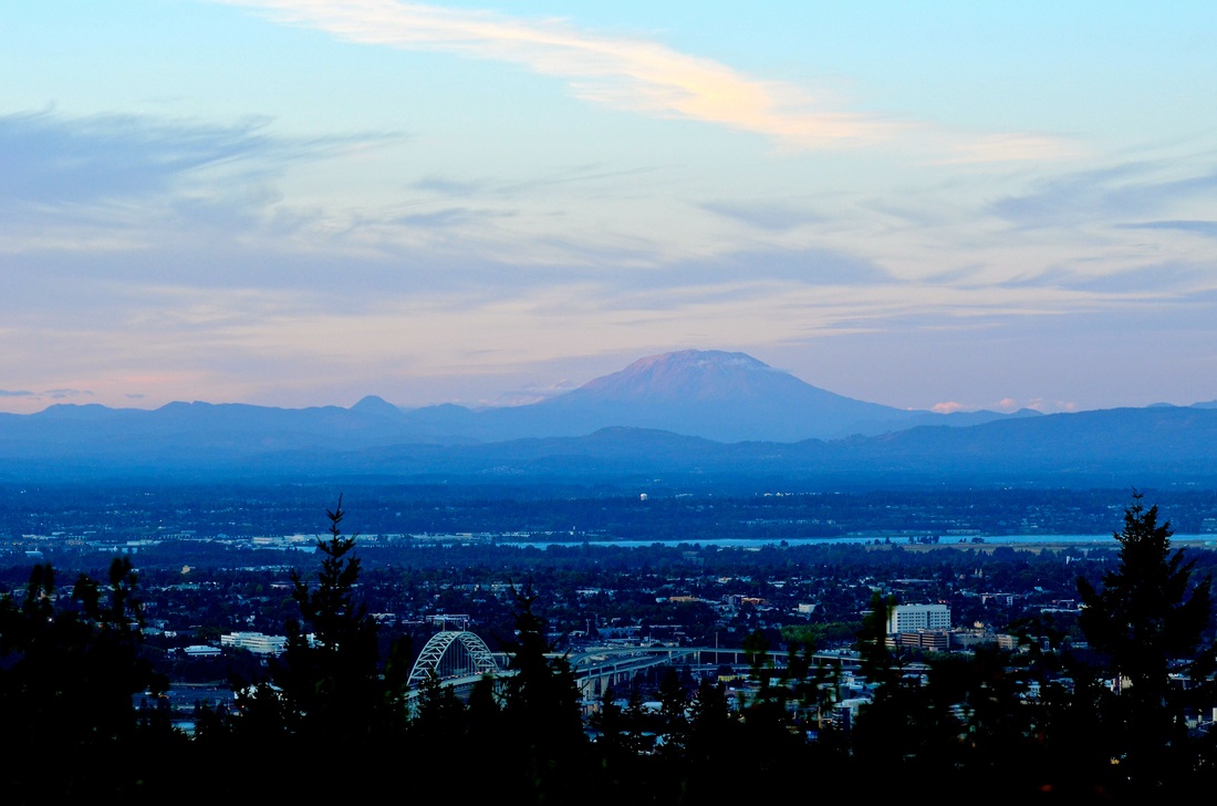
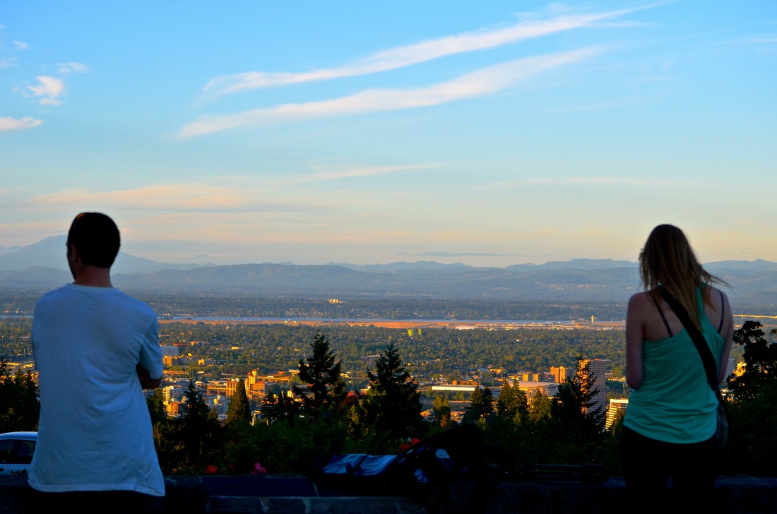
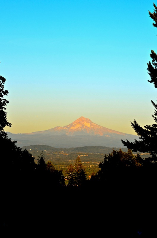
Council Crest, 2014
• We headed up to Council Crest this past September. It was an incredible view of all of the surrounding mountains around Portland. This park is located in Southwest Portland. Notes: • If you are a biker or hiker this is a great trail to do during the day or head up around sunset or sunrise. This photo was taken during sunset of Hood! • This space is ideal for picnics and walking your dog. • Multnomah Village is just down the road if you're looking for a fun bite to eat afterwards. My experience: I was excited to see what the view point in Portland had to offer and it was quite impressive. We stuck it out through sunset and the different shadows cast across the mountains was gorgeous. Other mountains that were visible included Mt Hood, Mt St Helens, Mt Adams, Mt Jefferson, and Mt Rainier. Links: • http://www.portlandhikersfieldguide.org/wiki/Council_Crest_Hike • http://www.portlandhikersfieldguide.org/wiki/Marquam_Trail_to_Council_Crest_Hike |
|
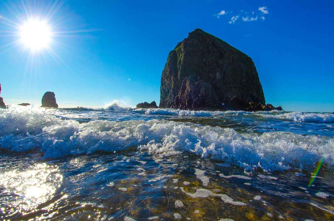
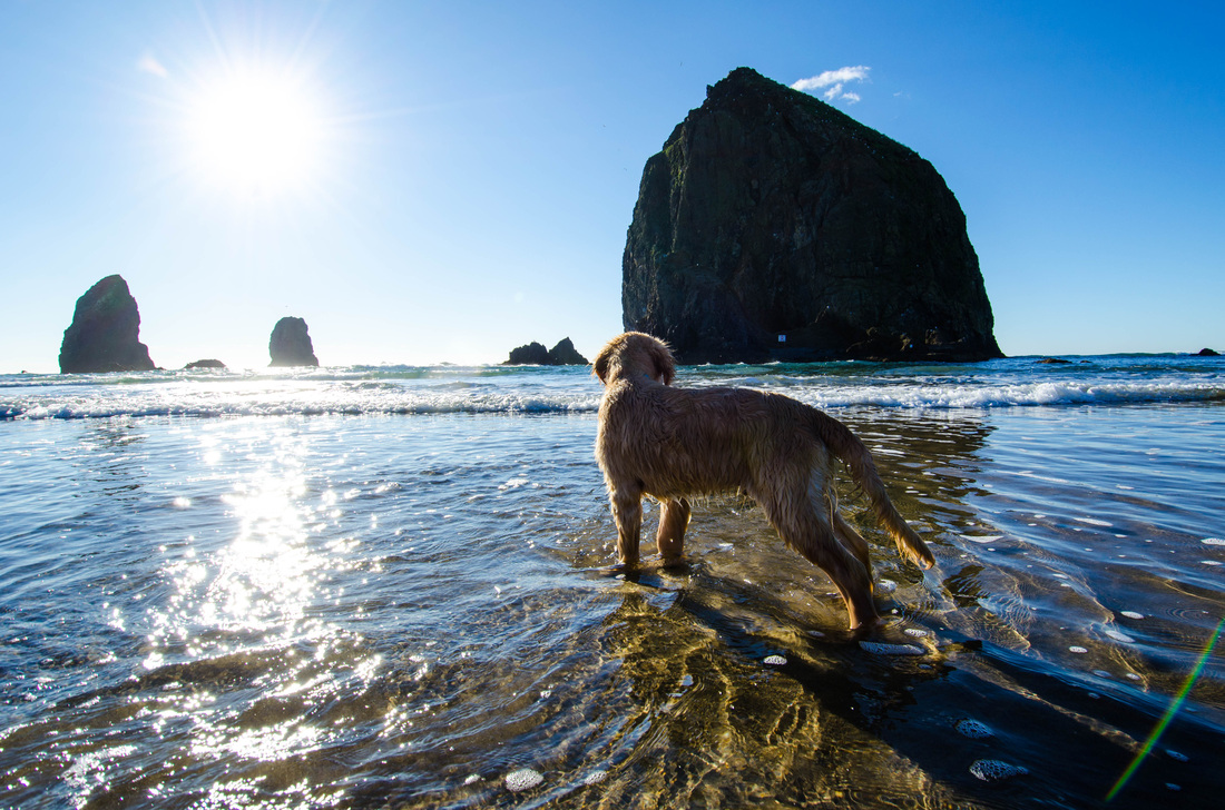
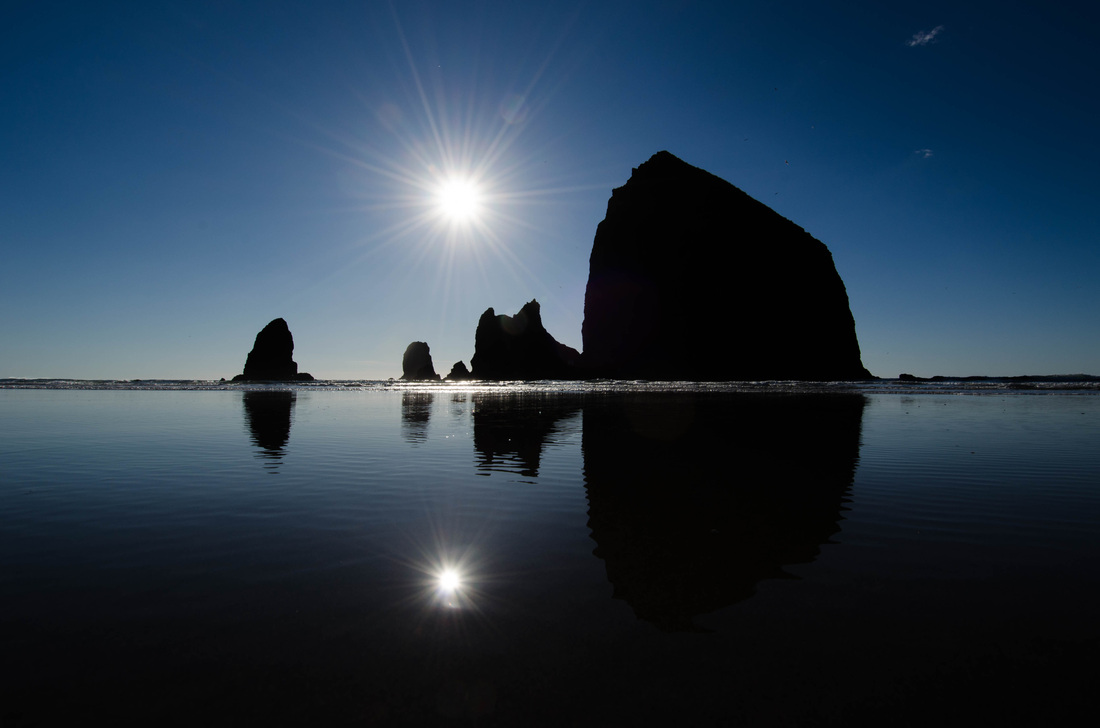
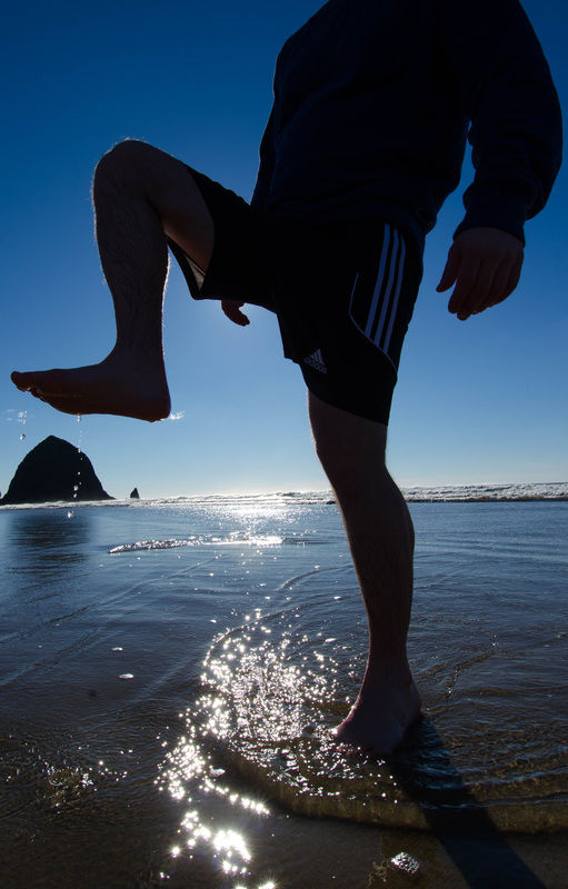
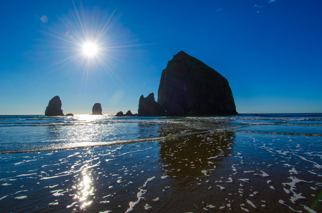
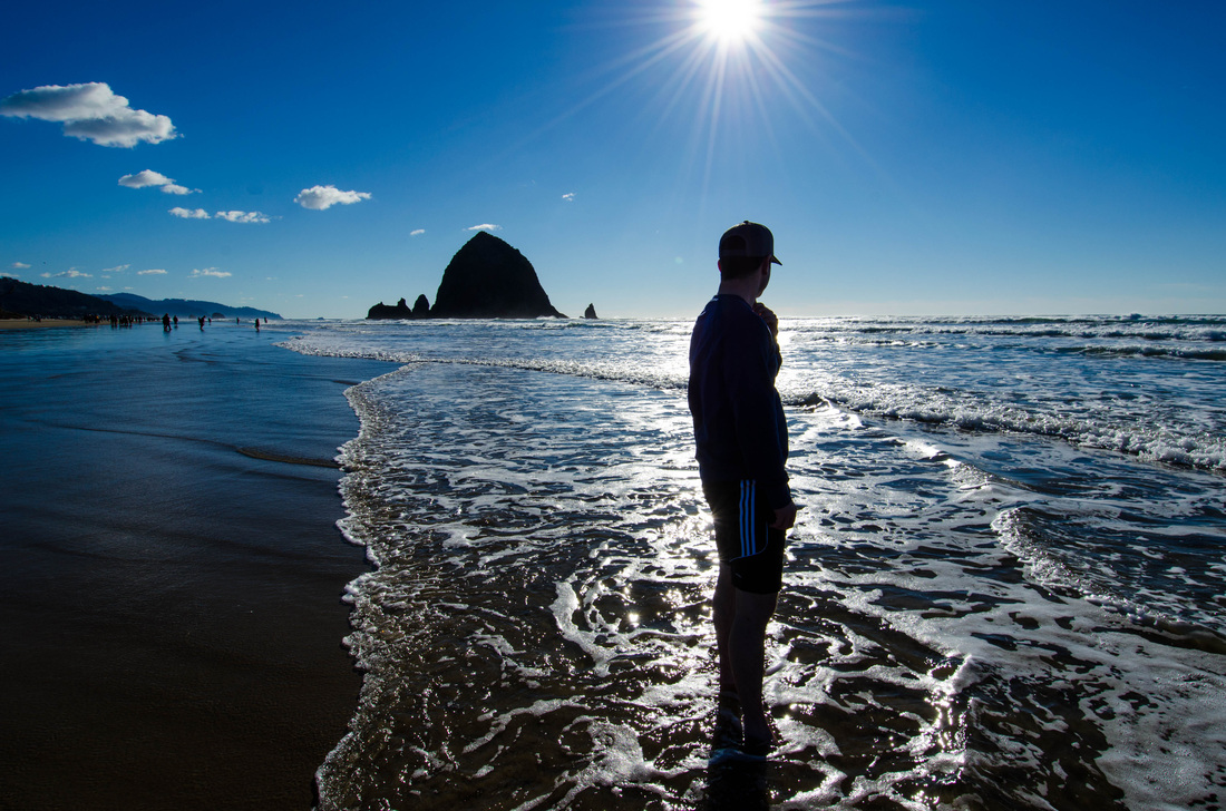
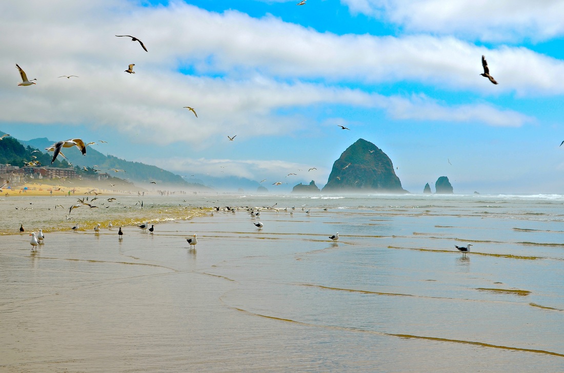
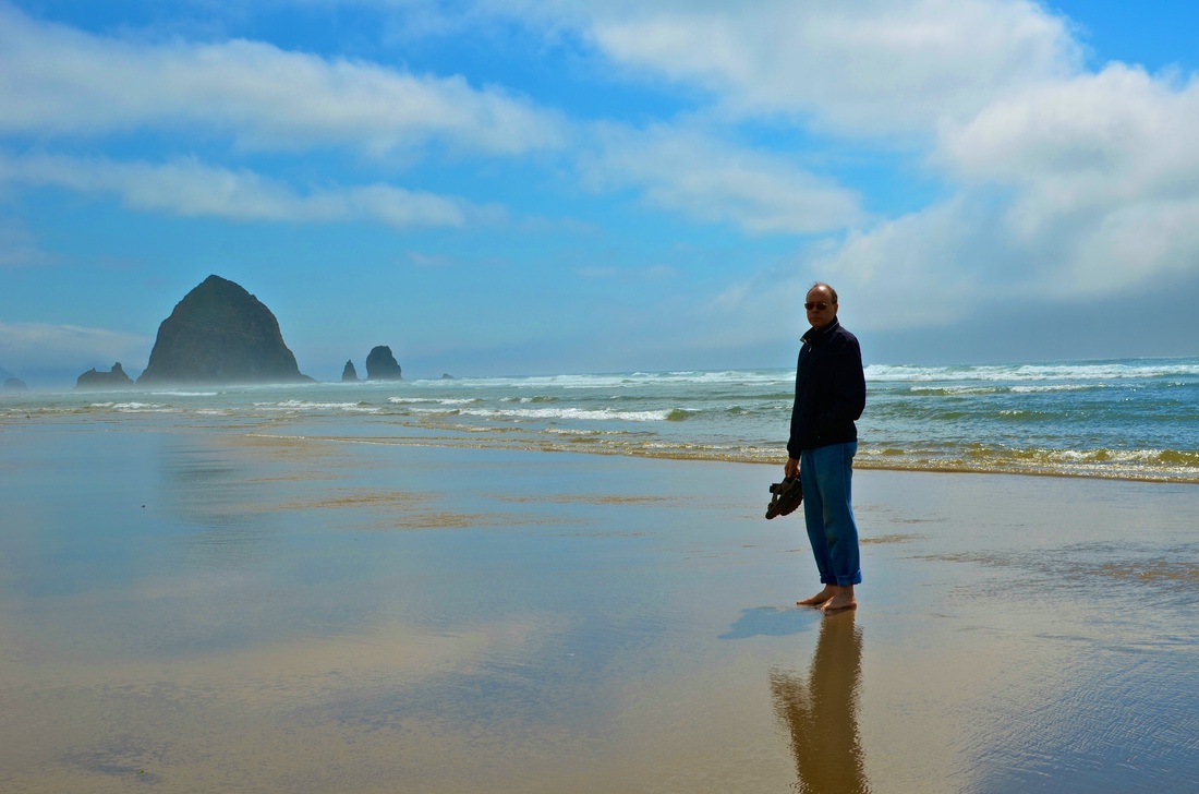
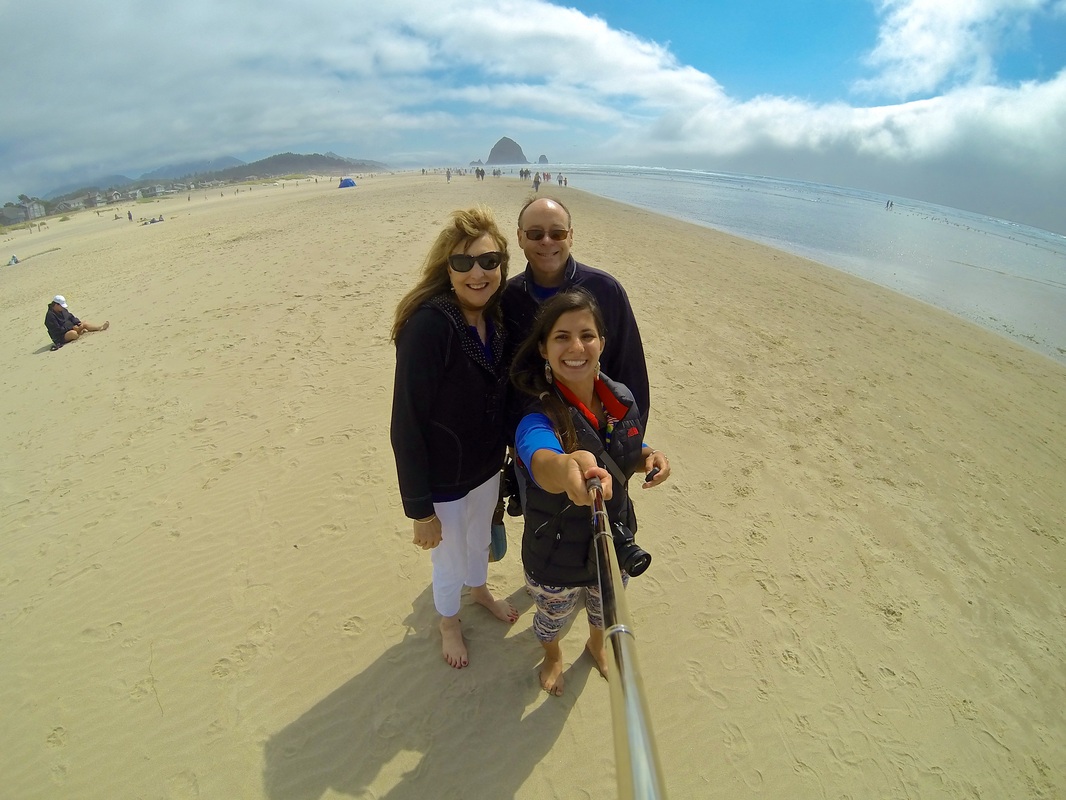
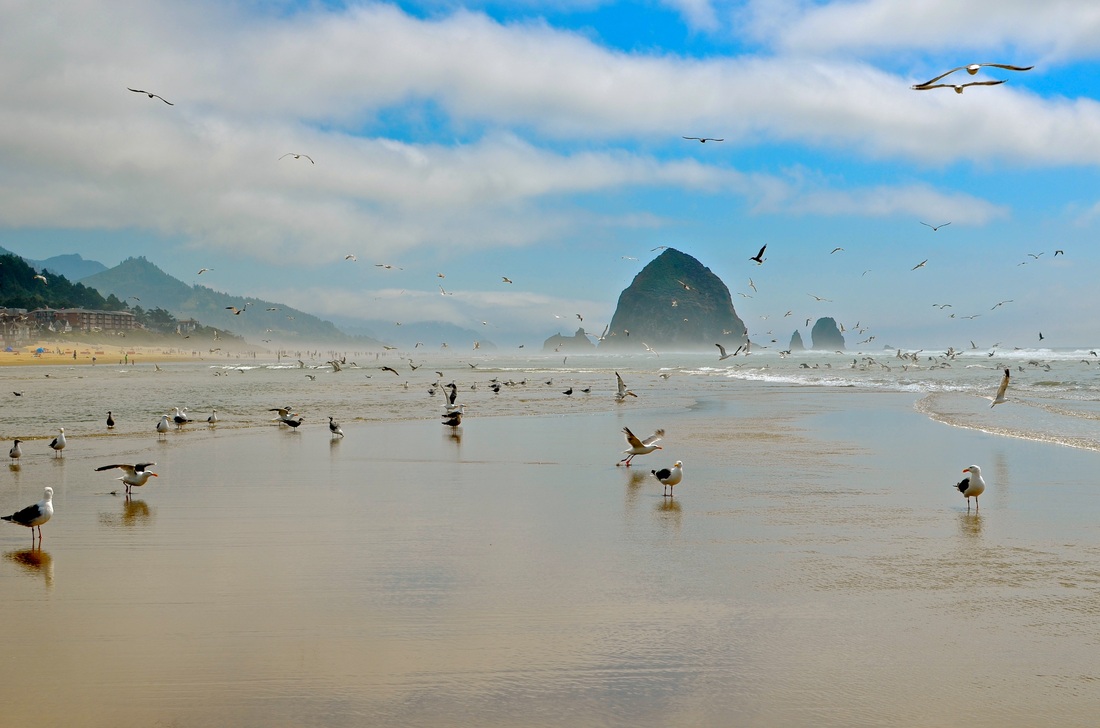
Haystack Rock, 2014
• If you're looking for a fun beach for the family or just some time alone and cute coffee shops, this is the place. We headed out in August from Portland taking US-26 from Portland. It takes about an hour and a half on a good day. Notes: • When we were out at Haystack there were hundreds of people. • If you're bringing your dog during the sunnier seasons and don't like it to be leashed, expect there to be a lot of other unleashed dogs. • Sometimes you need to wear water shoes to get out to the beach because small moats of water are created midway in the sand. • You can kayak out to Haystack Rock. My experience: I love cannon beach for a multitude of reasons. It has a lot to offer as a cute, quaint town. I've been out many times and each time has been a splendid experience. It is the type of beach that allows you to come alone, with friends, with your dog, with your family, and in every situation you'll have a good time. Links: • http://www.mapquest.com/maps?1c=Portland&1s=OR&2c=Cannon%20Beach&2s=OR • http://www.pdxfamilyadventures.com/2008/07/23/cannon-beach |


|
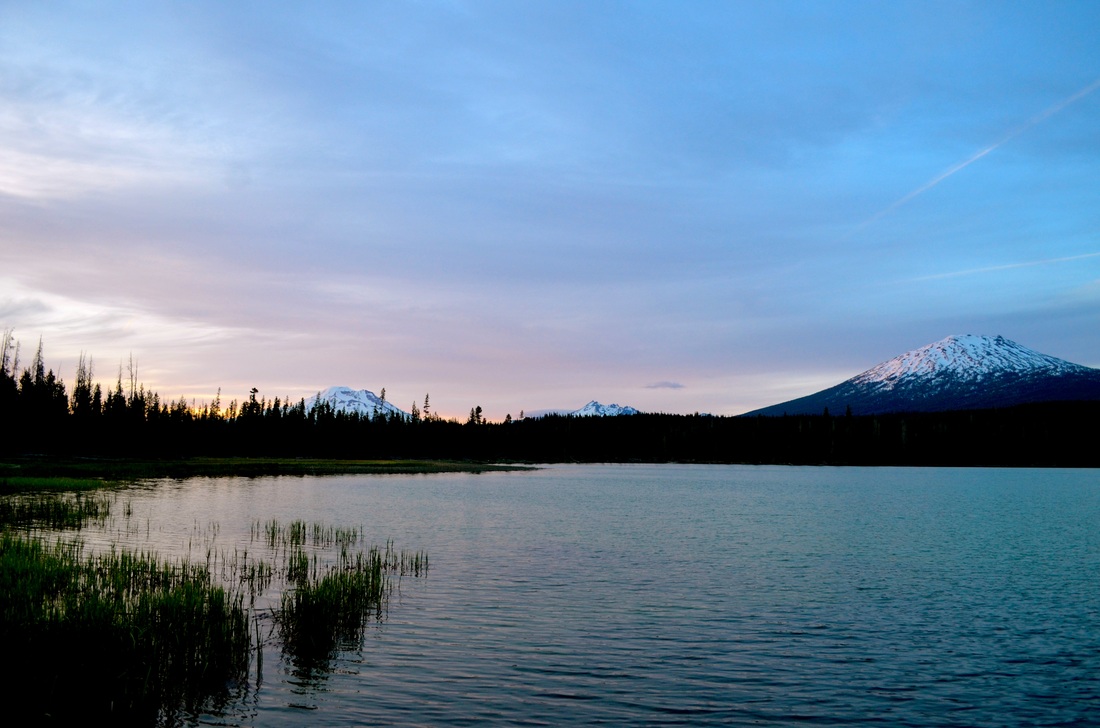
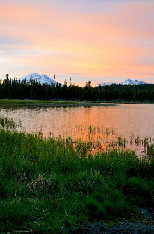
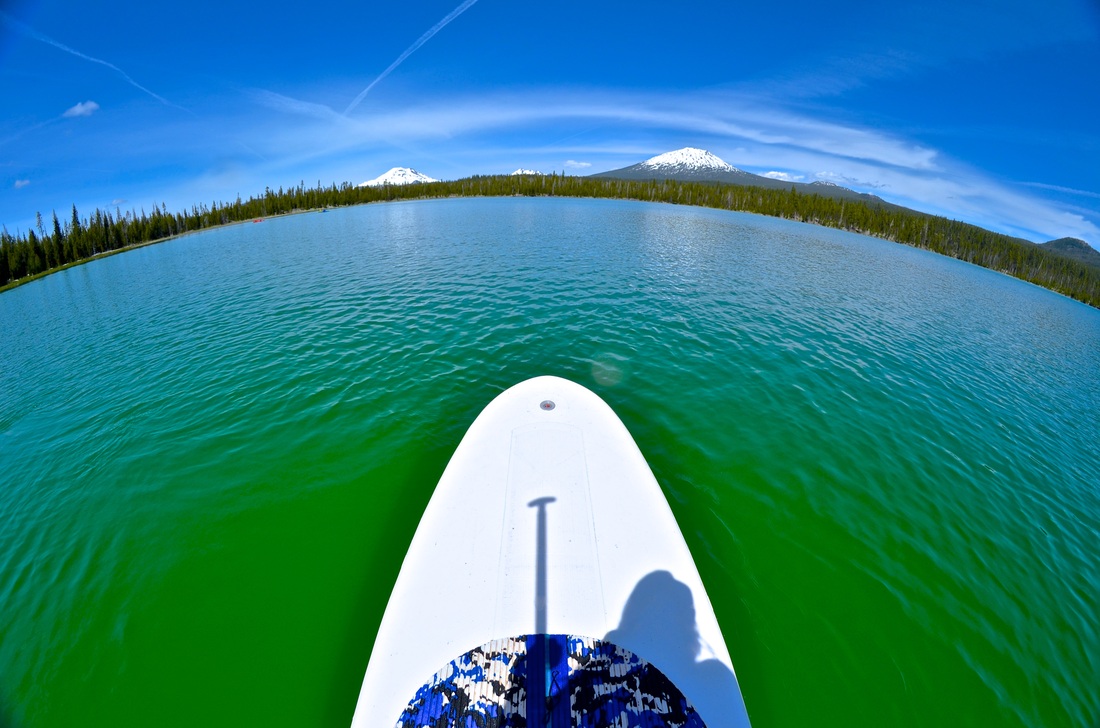
Sparks Lake, 2014
• We ended up at Little Lava Lake and decided to head up the road to check in on Sparks Lake in May. Sparks Lake is near Sunriver, OR and is about a four hour drive from Portland. Notes: • This lake is surreal in it's appearance. My photos don't even do it justice. • During the summer it is an ideal place to camp and do some water-based sports such as SUP or kayaking. • If you're going to head out during Winter take extra precaution if you are going to head out to the center of the lake like we did. My experience: We were in our summer gear because Little Lava Lake was 80 degrees and sunny with no snow. We were incredibly unprepared for this adventure but had an amazing time. Either side of the grass that we walked on was either frozen solid or was water that was easily below freezing. It is an incredibly gorgeous lake and I can't encourage people enough to check this lake out. Especially during sunset during the summer! Links: • http://www.thegreatoutdoorsoregon.com/sparks-lake.php • http://www.fs.usda.gov/wps/portal/fsinternet/!ut/p/c4/04_SB8K8xLLM9MSSzPy8xBz9CP0os3gDfxMDT8MwRydLA1cj72BTJw8jAwjQL8h2VAQAzHJMsQ!!/?ss=110601&t&recid=71876&actid=42&nav&position=BROWSEBYSUBJECT&navid=110190000000000&pnavid=110000000000000&pname=Central+Oregon+-+Sparks+Lake |


|
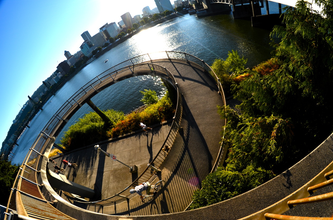
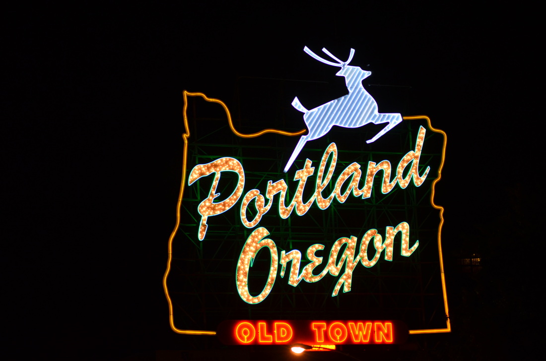
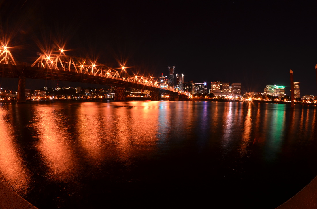
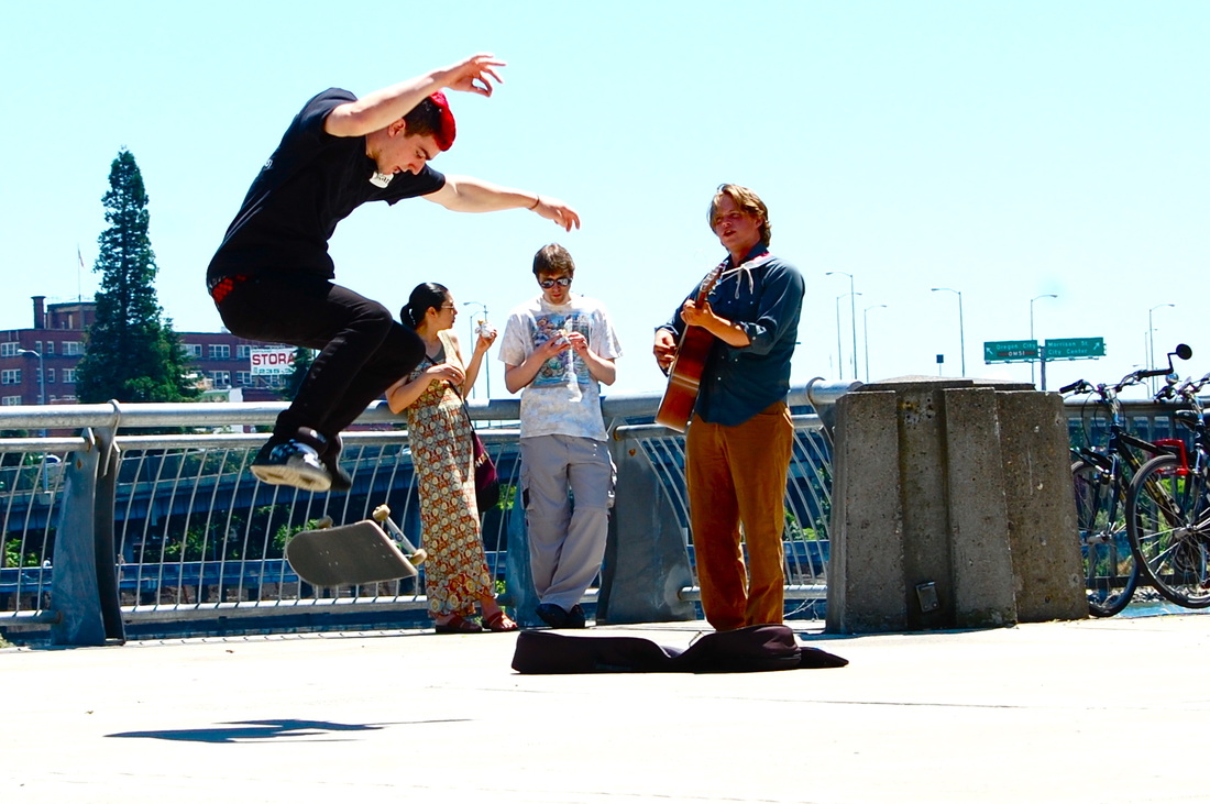
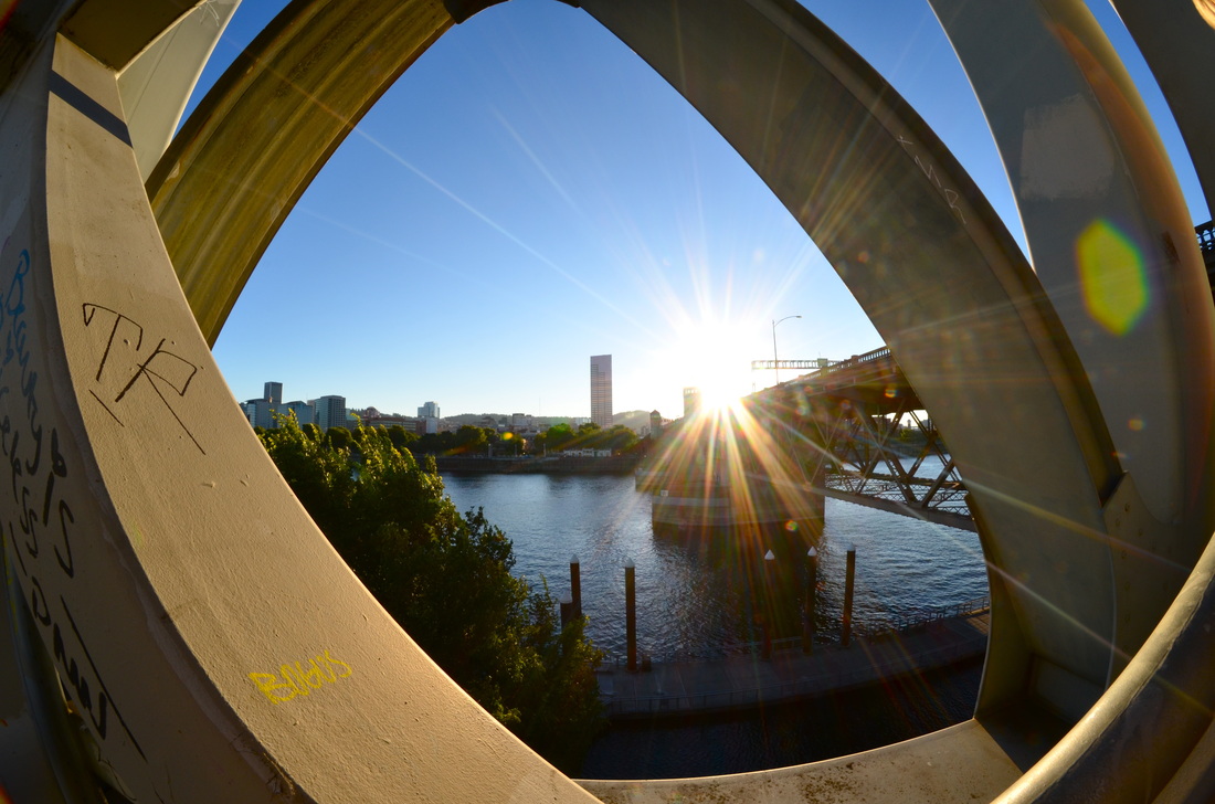
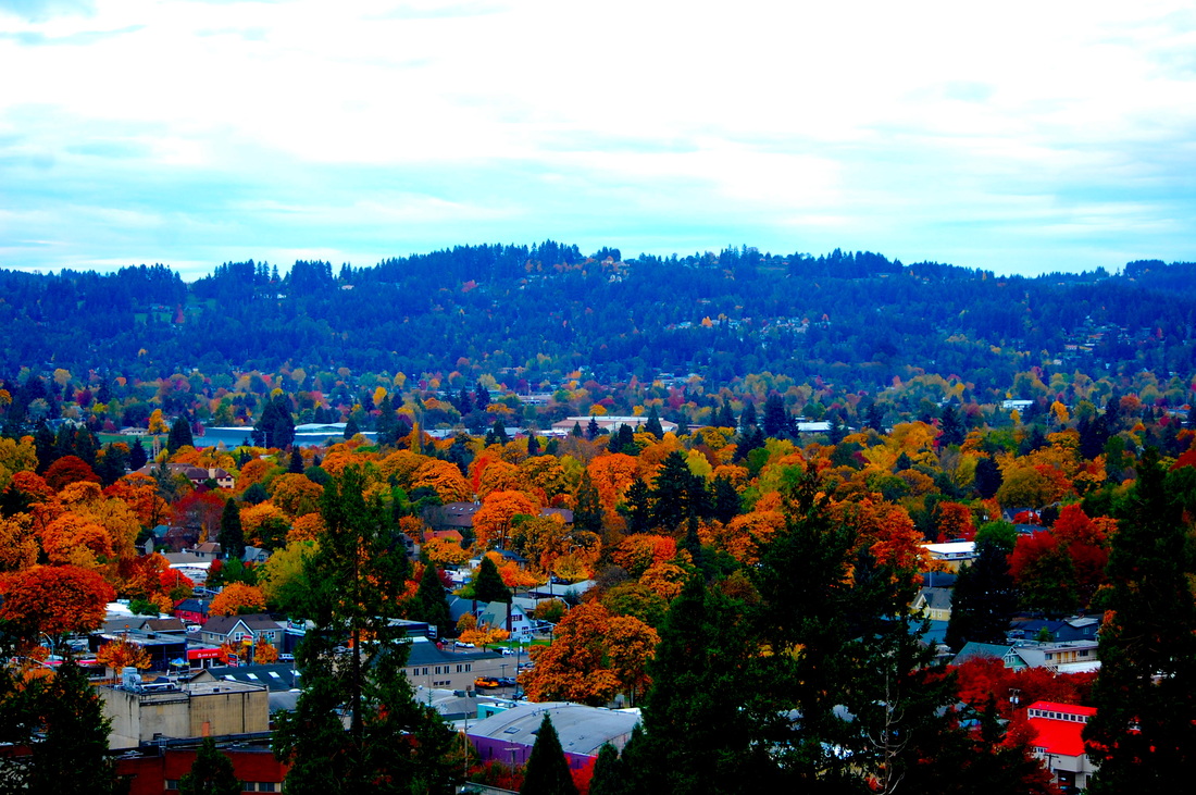
Downtown Portland, 2013
• Most people have been in downtown Portland but there are a few A-list spots to check out. The vast variety of these photos were taken mid-summer. Notes: (Things to check out.) • The Saturday Market • The running and biking paths along the Willamette River • Hood during sunrise while crossing the hawthorne bridge • The incredible street performers all around DT • Powell's Book Store • The Portland Oregon sign at night and during the holiday season (Also at night.) My experience: Portland is a city that is easy to fall in love with. Years ago, as a child, I noted to my mother that there were a lot of people who scared me. She turned to me, being a Portland native, and said "It isn't these people you should fear, for they are only being themselves and are not hiding who they are." It was a profound thing to say and something I feel sums up Oregon. Keep Portland Weird. Keep it authentically unique. It is charismatically interesting with the endless coffee shops during the day and microbrews during the night. Portland is a city well worth your time. Links: • http://www.travelportland.com/things-to-do/ • http://content.time.com/time/travel/cityguide/article/0,31489,1975826_1975753_1975576,00.html |

|
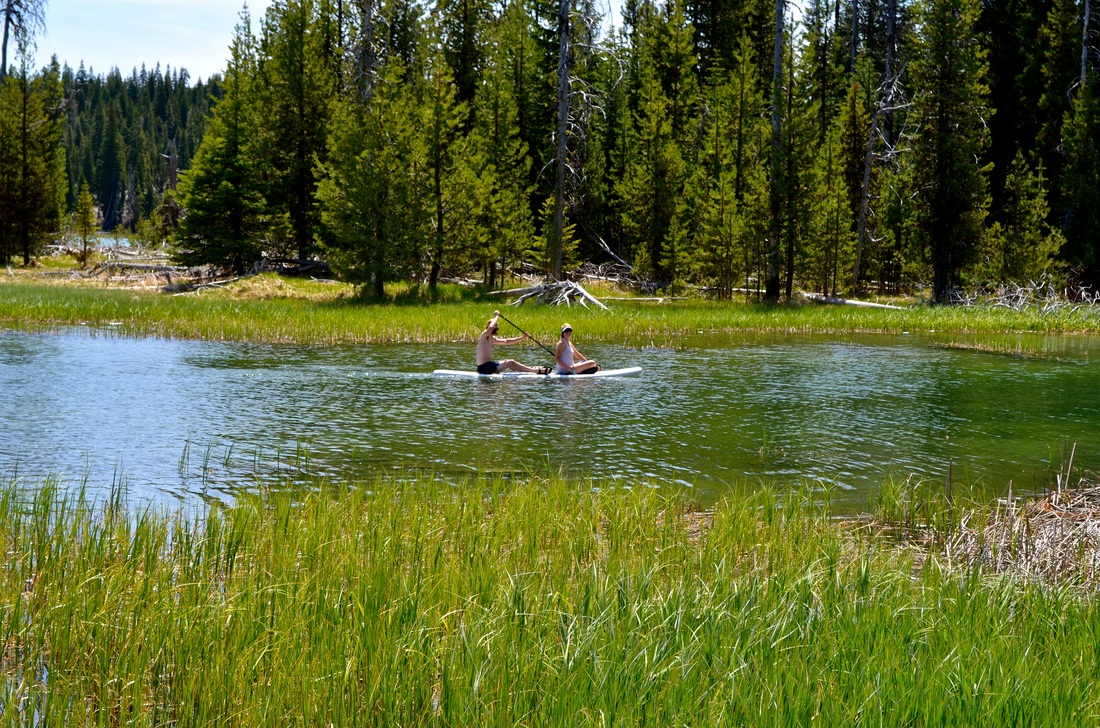
Little Lava Lake, 2014
• We camped out at Little Lava Lake in May. It was 80 degrees and sunny with two feet of snow located only five miles up the road. Notes: • Little Lava Lake is obviously right next to Lava Lake. Both are beautiful and worth your time. • You have a spectacular mountain view and quaint camping spots readily accessible. • Camping, biking, and hiking are all options at this site. My experience: I went on the largest camping adventure of my life time with, I believe it was, twelve people total. It was quite the feat. But a great one at that. We found a site big enough for three tents - one of which was a ten person tent. We were less than a minute walk away from the boat launch. The SUP's did great out on the water. And there were park benches for games and laughter. Additionally, I woke up around 5 or 6 AM one of the mornings to get on the water and it was as serene as it gets. The only catch is the skeeters (mosquitos) were hungry and aggressive. So bring bug spray! Links: • http://www.campsitephotos.com/campground/Little-Lava-Lake • http://www.outdoorproject.com/adventures/campgrounds-campsites/little-lava-lake-campground |

|
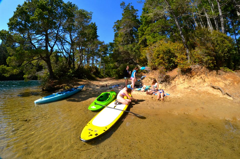
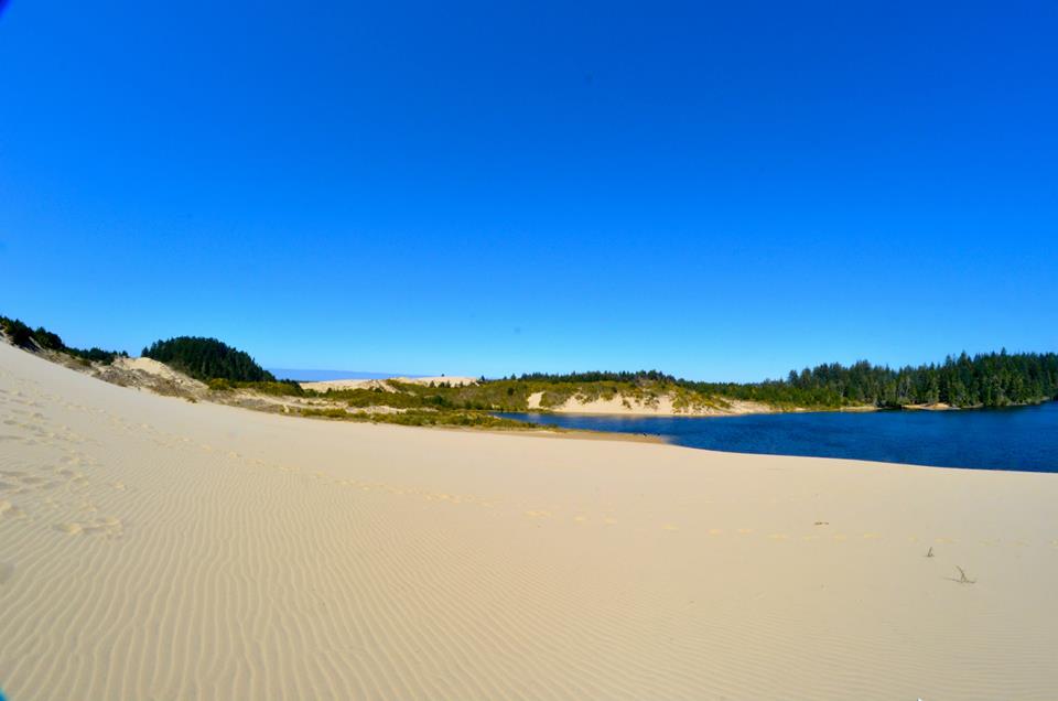
Honeyman Memorial State Park, 2014
• We packed up Red Mamba (My mini van) and headed out to Honeyman Memorial State Park for a couple of days this past April. Notes: • This State Park has everything you could want. Beaches, sand dunes, lakes, hikes, biking areas, camping, diving spots, forest, you name it. • During the warmer seasons you will want to make a reservation in advance or get there very early in the morning. My experience: Honeyman Park was a great place to roll into for the first time. We unloaded the kayak and SUP's from Red Mamba as the second portion of our party hadn't arrived yet and got right in the water without any hassle. We got to paddle around until the sun started to set. Were able to easily set up our camp site, comfortably, and had easy access to hiking trails, sanddunes, and more water access at another point. This is a great family or friend place in my opinion. A little fun fact about this State Park is that it is a memorial park dedicated to Jessie Honeyman who had a deep love and respect for nature. "No work is more important than teaching the children that the God-given beauty of Oregon is their heritage." Jessie Millar Honeyman Links: • http://www.oregonstateparks.org/index.cfm?do=parkPage.dsp_parkPage&parkId=95 • http://www.stateparks.com/jessie_m_honeyman_memorial.html |
|
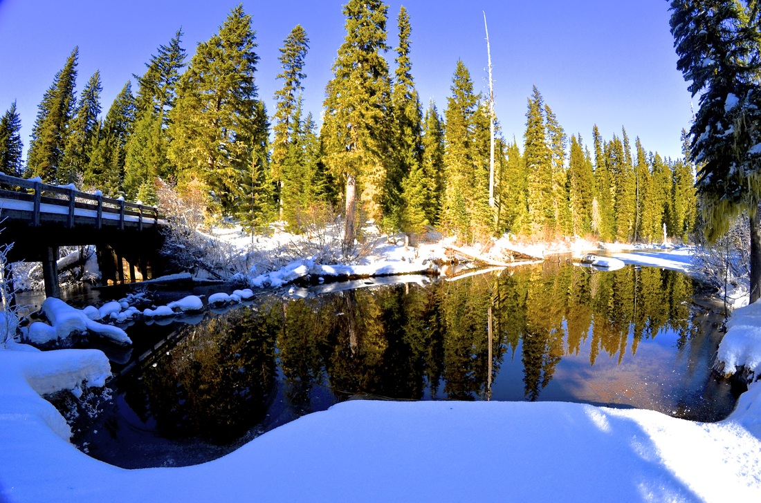
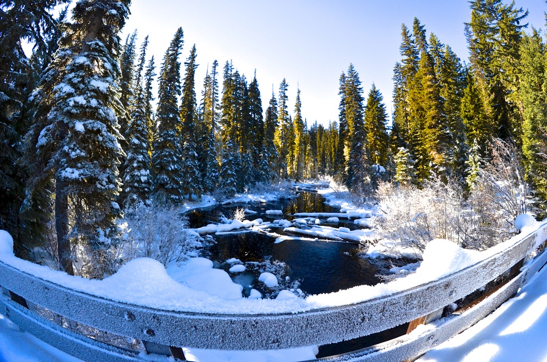
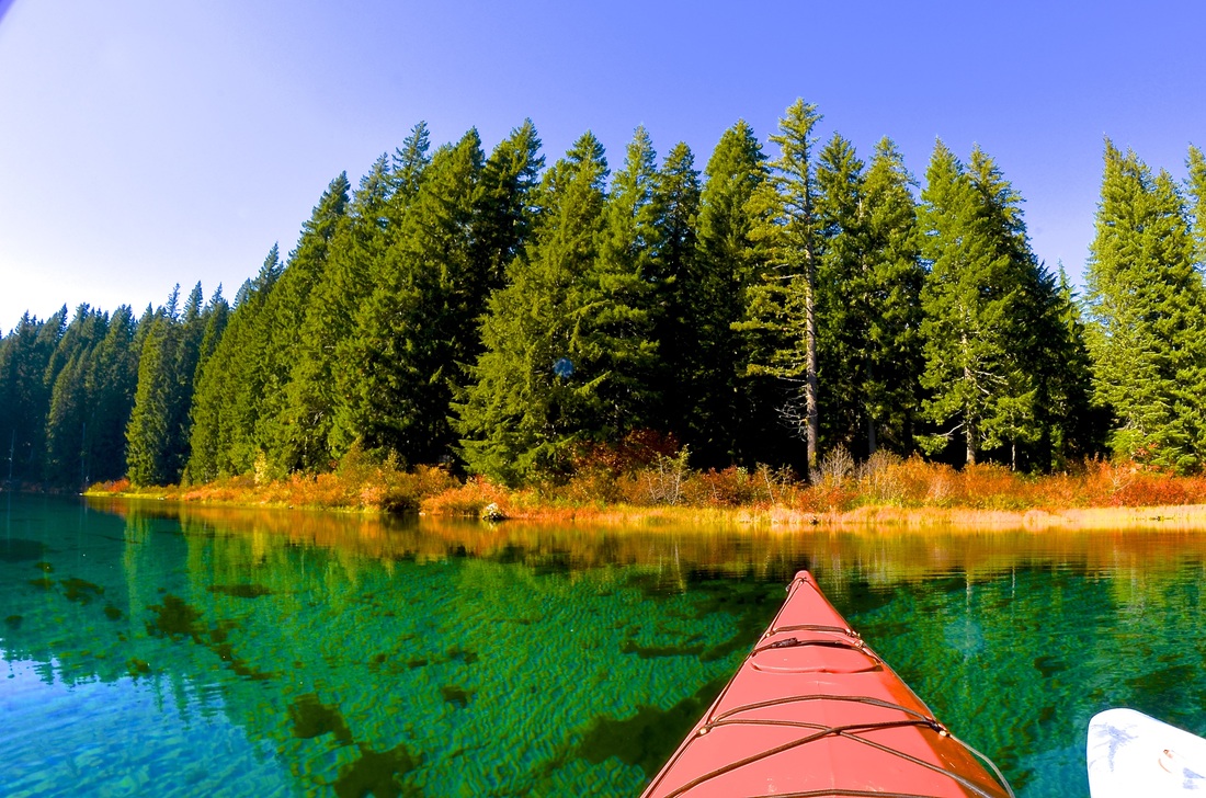
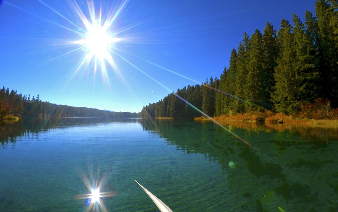
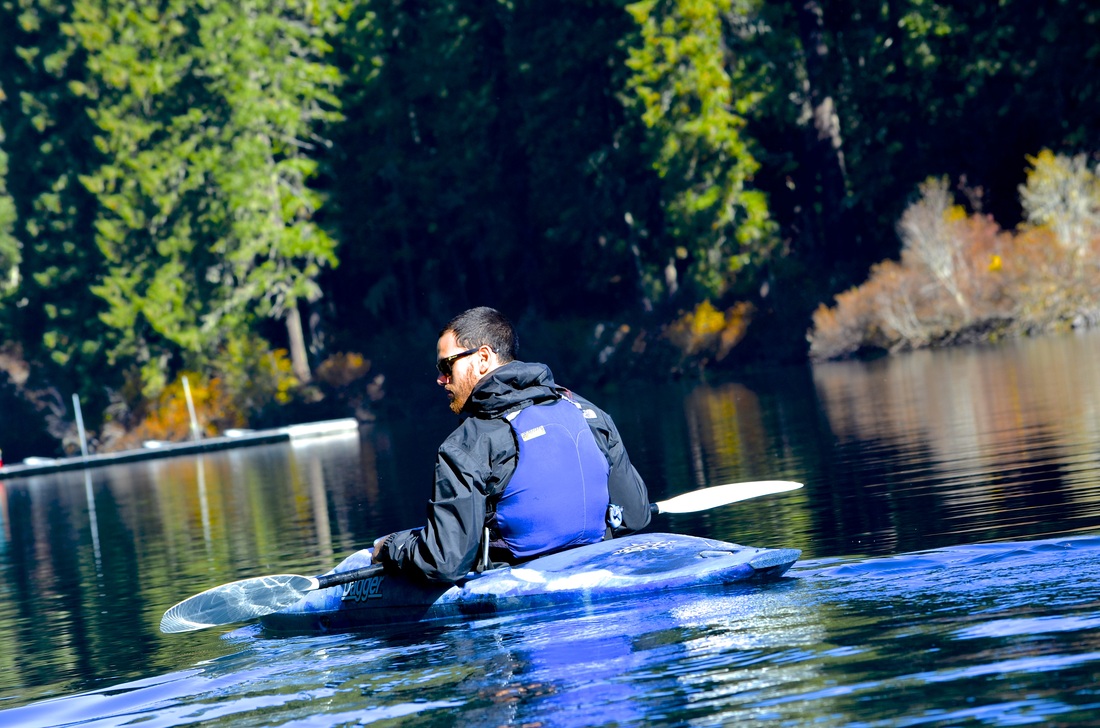
Gold Lake, 2014
• We drove into the Willamette Valley to the Gold Lake snow-park cabin this January. Notes: • The roads should be plowed but ensure that you park close to the road and near the park entrance. • It is wise to stop by the cabin where certified park folk are typically hanging out, drinking coffee, and are there to fetch you if you get lost. • The benefit is if you stop by they know who you are, what you look like (and what your gear looks like as color is important if you're to get lost.) They can also map out where you should go and what you should watch for. • Be careful of the ice. Gold Lake itself was frozen over. But tread cautiously if you end up walking across Gold Lake itself. My experience: Links: • http://www.fs.usda.gov/recarea/willamette/recreation/wintersports/recarea/?recid=4679&actid=91 • http://traveloregon.com/see-do/recreation/camping-recreation/fishing/cycling/hiking/gold-lake-campground/ |


|
Spencer Butte, 2014
• I hiked Spencer more times than I can count over my time at the UO. Notes: • If you live in Eugene this is a MUST DO. It gives you a great overlook over the entire city. • If you are going to do a sunrise or sunset hike - be mindful of the hours the gate are open. These are monitored closely. • If you're going to go hiking during a time that will get dark ensure you have a flashlight other than your phone, such as a headlamp. The trail can get dangerous in the dark, naturally. • If you are going to go hiking alone for a sunrise or sunset hike be extra cautious, have a dog or someone, a flashlight, and let someone know you will be there. (Generally, just go with a friend!) My experience: I hiked to the top of Spencer's four times during sunrise. Two of them were surreal in terms of the sunrise. It is humbling that such beautiful processes are taking place every day and the vast majority of college students are sleeping right through it. I've taken a multitude of groups up Spencer - ability does not matter as long as you can take breaks. So go! Links: • http://www.eugeneoutdoors.com/spencer-butte/ • http://www.spencerbutte.com/hike/ |


|
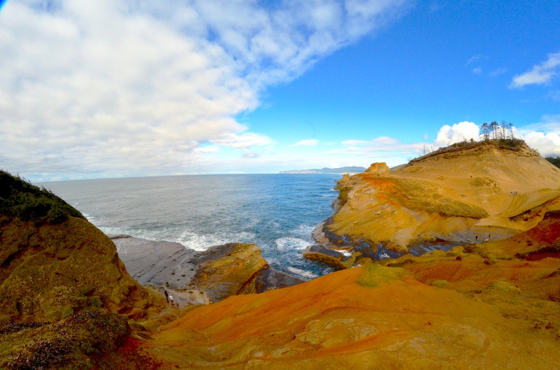
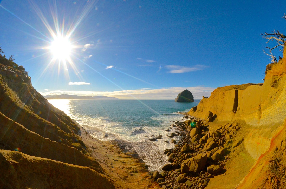
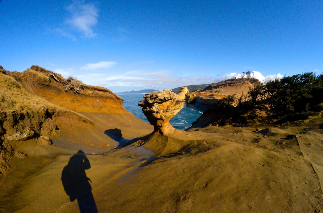
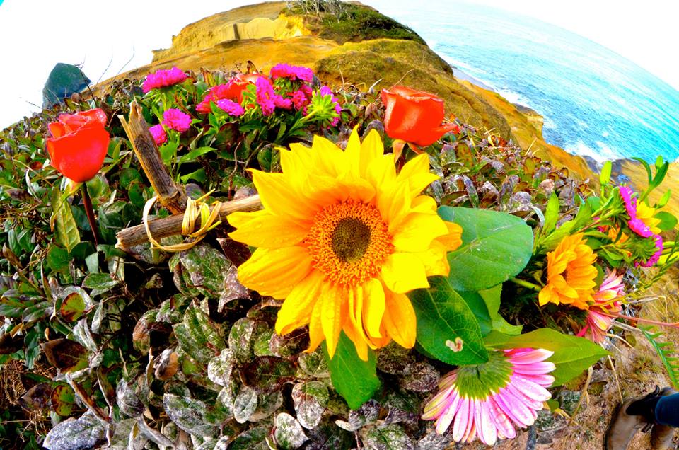
Oregon City - Cape Kiwanda, 2014
• We hiked out to Cape Kiwanda in February. Notes: • It can be a little steep and a tad dangerous the farther out you get. • There are some gates that tell you not to ascend - such as by the sand dune, just take the left path on the other side of the fence. (You shouldn't need to hop a fence!) • When we went up there were beautiful flowers at the top! My experience: I was on a explore-the-oregon-beaches three day trek to see the vast array of Oregon coasts that are offered with my two good friends who are from Texas and Canada. It is truly a scene acknowledging how stunning the Oregon coast is. Links: • http://www.portlandhikersfieldguide.org/wiki/Cape_Kiwanda_Hike • http://pacificcity.org/things-to-do/main.html |


|
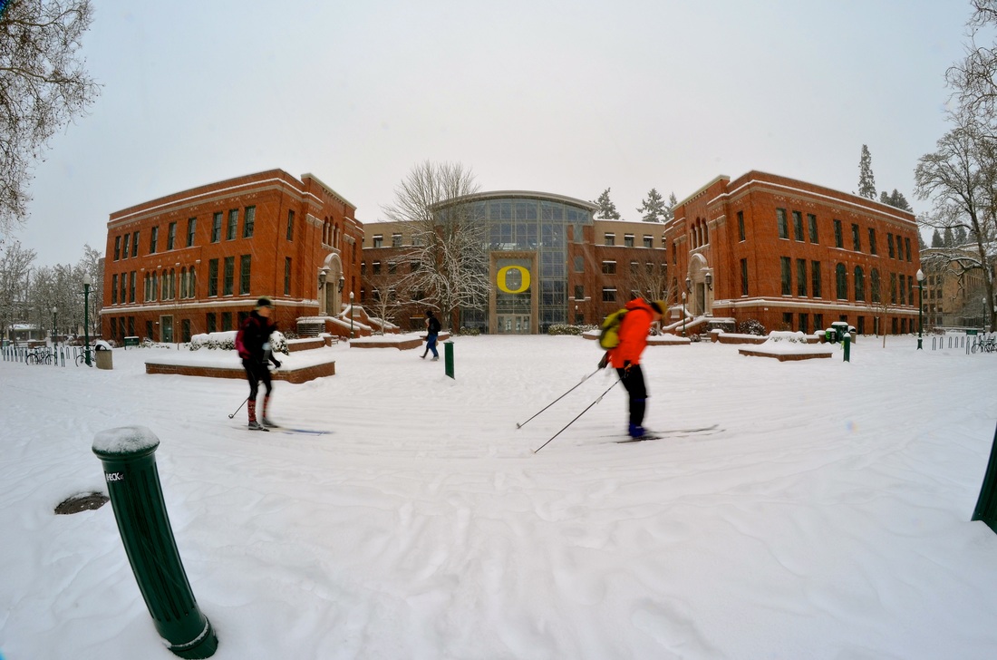
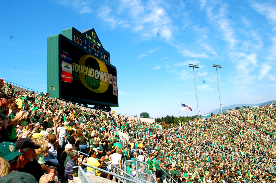
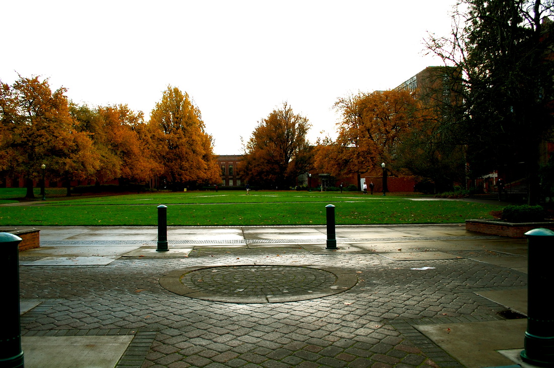
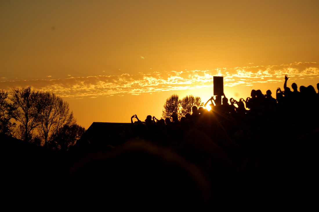
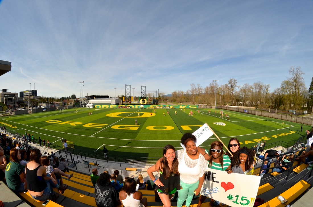
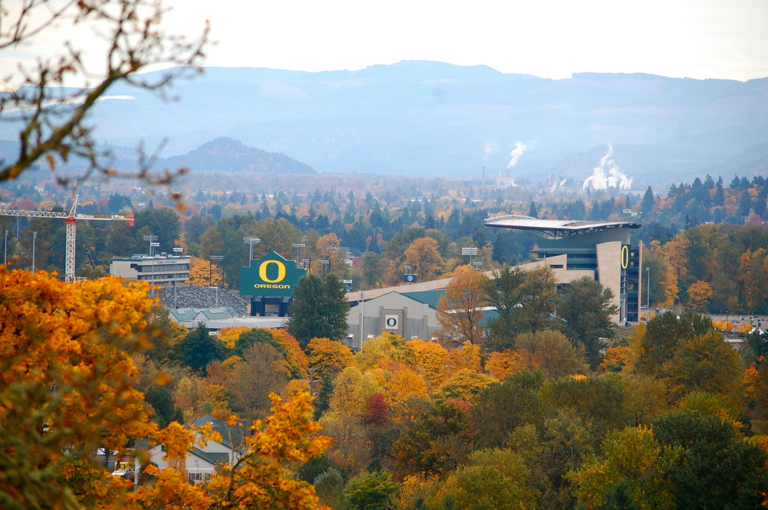
University of Oregon, 2010-2014
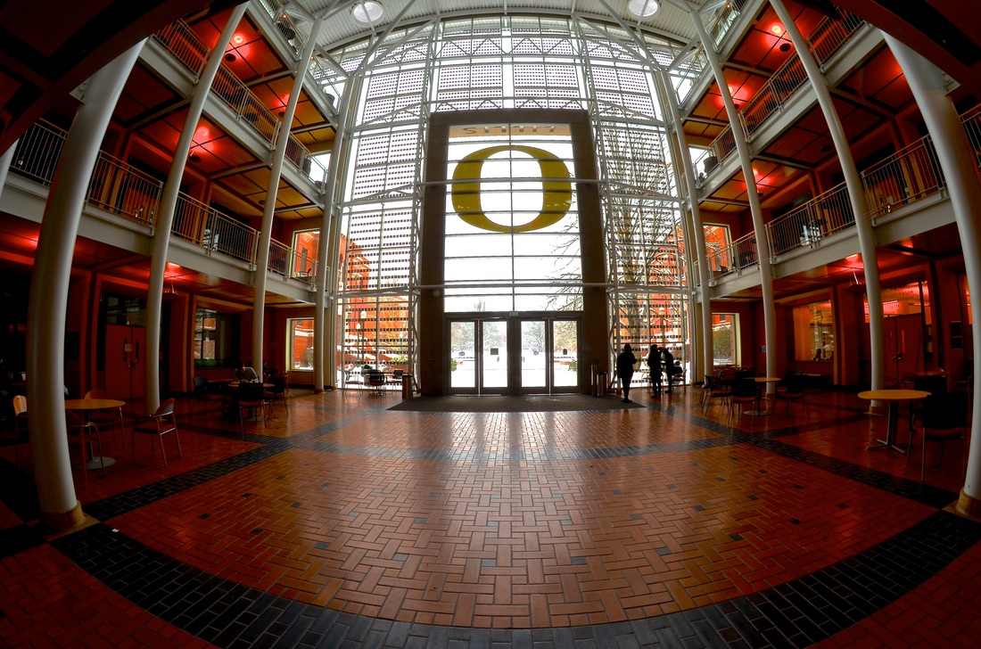
• If you're looking for one of the most idyllic college campuses around - look no further. Notes: • Beyond having a campus that is as green as they come with over 4,000 trees in over 500 species. • You are looking at a school that is in the Association of American Universities which marks it as a competitive, research based, high quality institution. In addition to the not worthy campus and world of academia the culture at the UO is notable in its own. • From events that highlight important statistics that raise the awareness about local to global issues to LARPing or live action role play that you'll see with people geared up with swords and shields it's quite the scene. • Additional you have the staple characters that make campus unique including the LTD man who rides around on his bicycle in a pick tutu only to frog who sells his joke books on 13th right off campus. My experience: Attending the UO for four years was easily one of the greatest experiences in my life. The culture, the people, the architecture, the events, the nature, and the incredibly academia all attribute to a must see campus. Links: • http://uoregon.edu/ • http://uoregon.edu/campus-and-community |

|
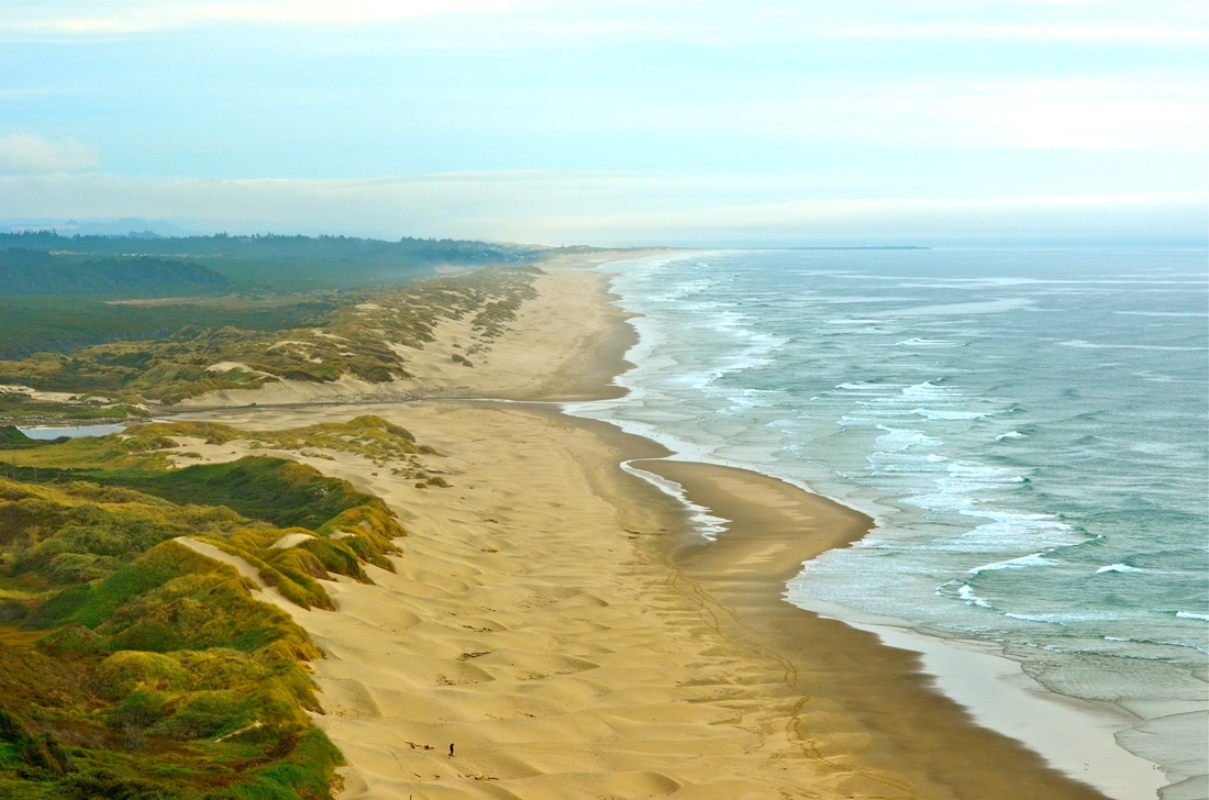
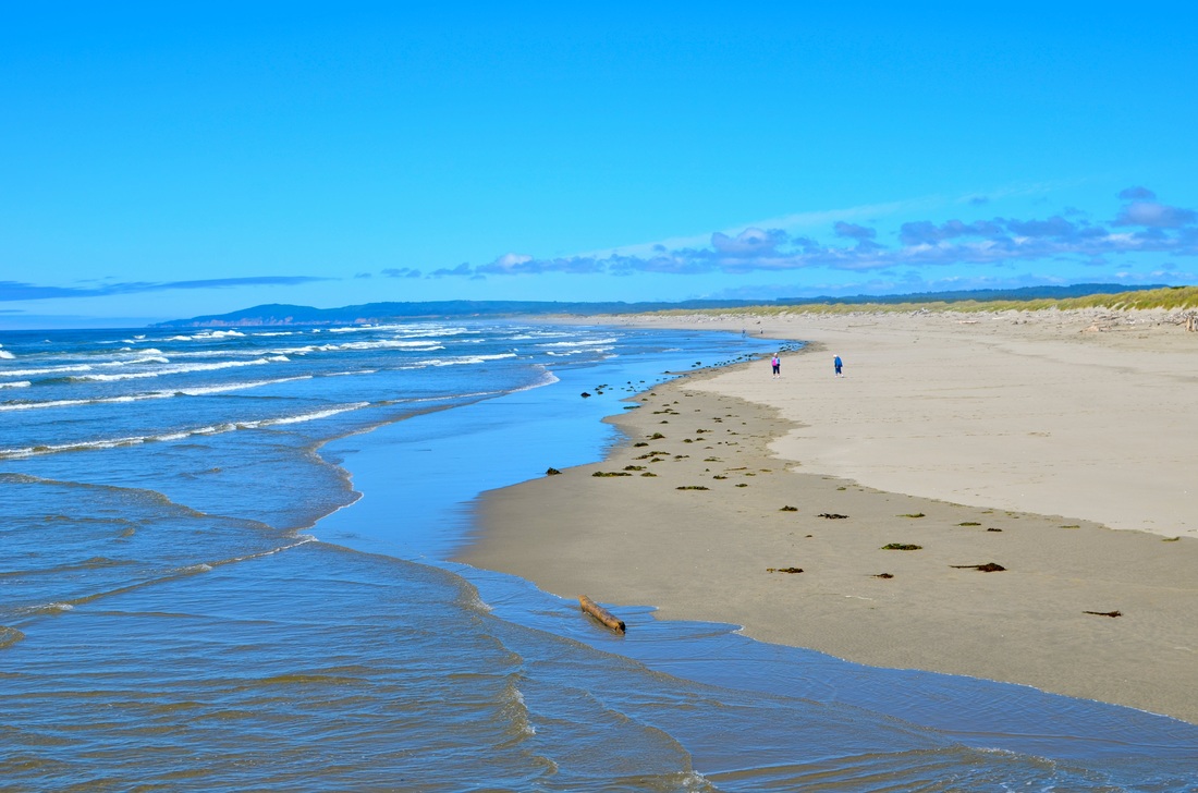
Florence Beach, 2012
• We visited the Florence in January as a nice mid-term break. Notes: • It's worth parking in Florence, grabbing a cup of joe, and heading down to the beach to go for a walk or even pick up some litter. • Heceta Head Lighthouse is visible from several vantage points or you can drive out and take a closer look for a small fee. • Cold, warm, or hot - it's worth heading out to the coast! My experience: Florence beach is a beautiful beach to take a stroll, have a retreat, take your dog, go for a run, or rent out a cabin for the day. It is absolutely beautiful and a exquisite example of what an "Oregon" beach truly is. Links: • http://www.eugenecascadescoast.org/oregon-coast/florence/ • http://www.beachconnection.net/vtour_florence.htm |


|
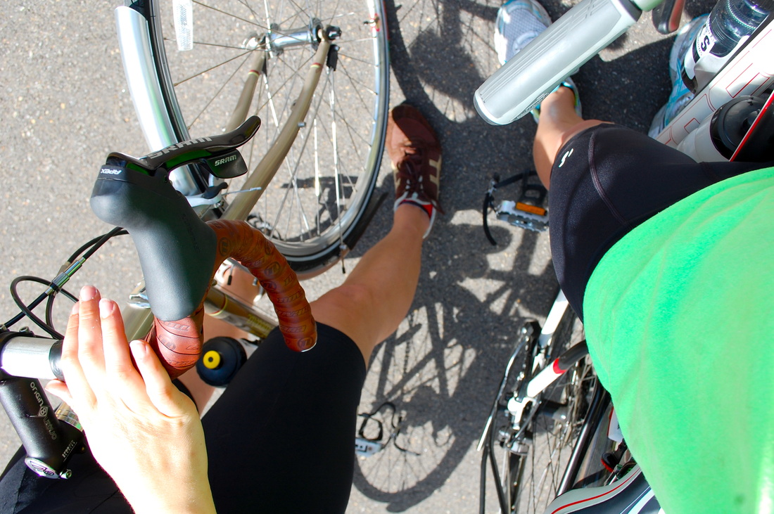
Cycle to Kings Estate Winery, 2013
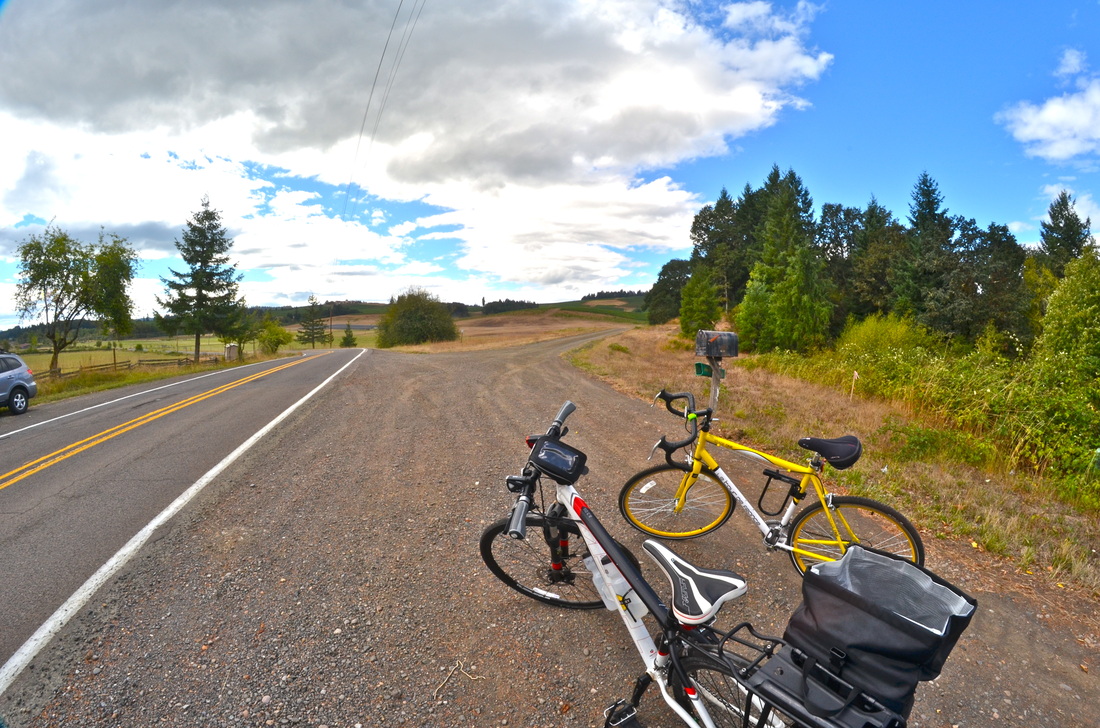
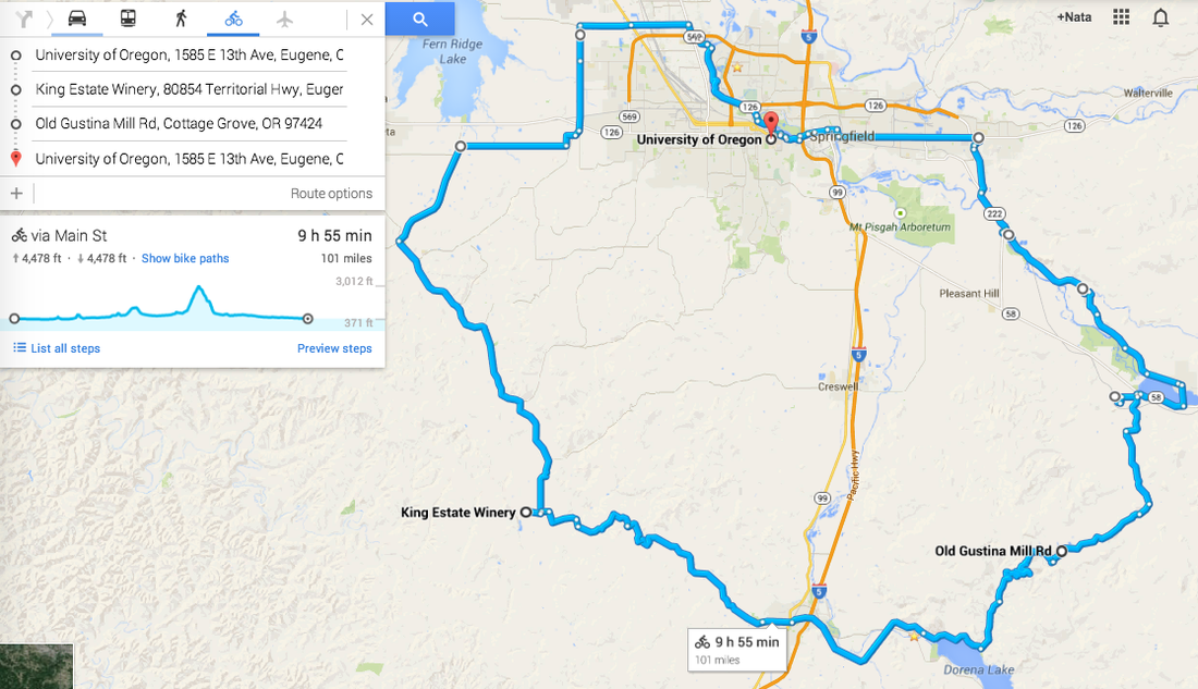
• In September Christopher and I decided the night before to hop on our bikes at 6 AM and ride East from Eugene to do a 100 mile loop cutting around Kings Estate Winery, Cottage Grove, and beyond. Notes: • There are not bike paths along this entire ride - however, most of the road is open and not well traveled by vehicles. • If you are going on a 100 mile bike ride have provisions such as spare tubes, a fix it kit, similar bicycles, water(x2), a printed out map, and a fully charged phone. • Make sure you also have lights for your bike to ensure you are seen if you leave early enough or get back My experience: • We sort of just hopped on our bikes and went for it. We were pretty lost, so the map is a rough sketch of what roads we took. It was an incredible ride however. We stumbled into Kings Estate - which, if you've ever been to Kings Estate - we biked up that steep drive way up the hill to it. The views were incredible. This ride was an intimate look into the lives of rural and urban Oregonians. Chris having a racing bicycle and mine being a touring bike made for a bit more challenging riding at times for me with my panniers loaded up with what provisions we brought. We got back after sundown but it was definitely an incredible ride! Links: • http://ridewithgps.com/routes/1860129 • http://rideoregonride.com/resources/print-materials/cycling-maps/ |
|
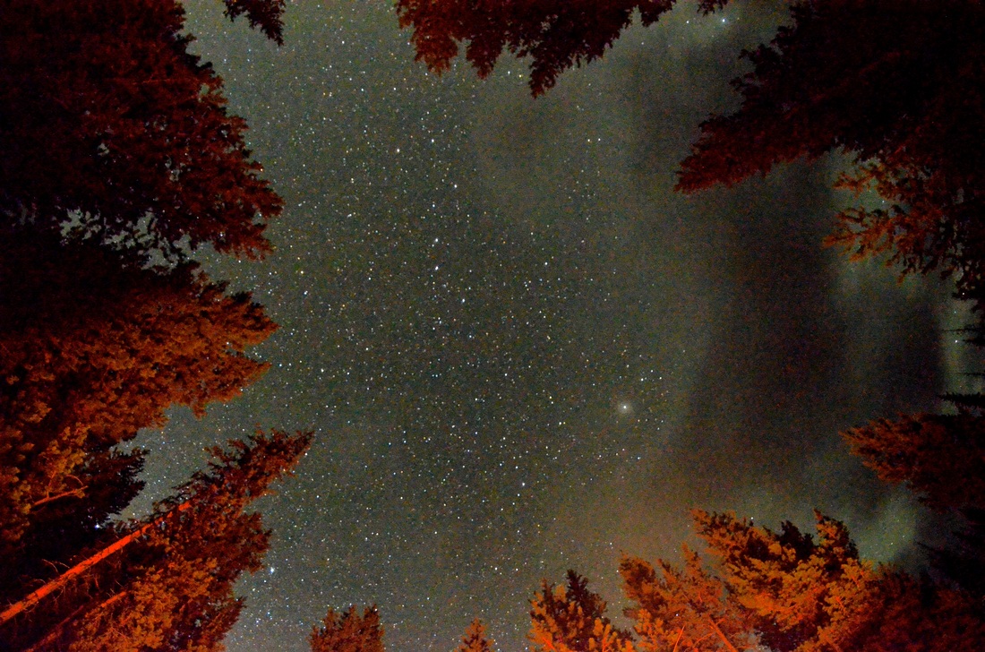
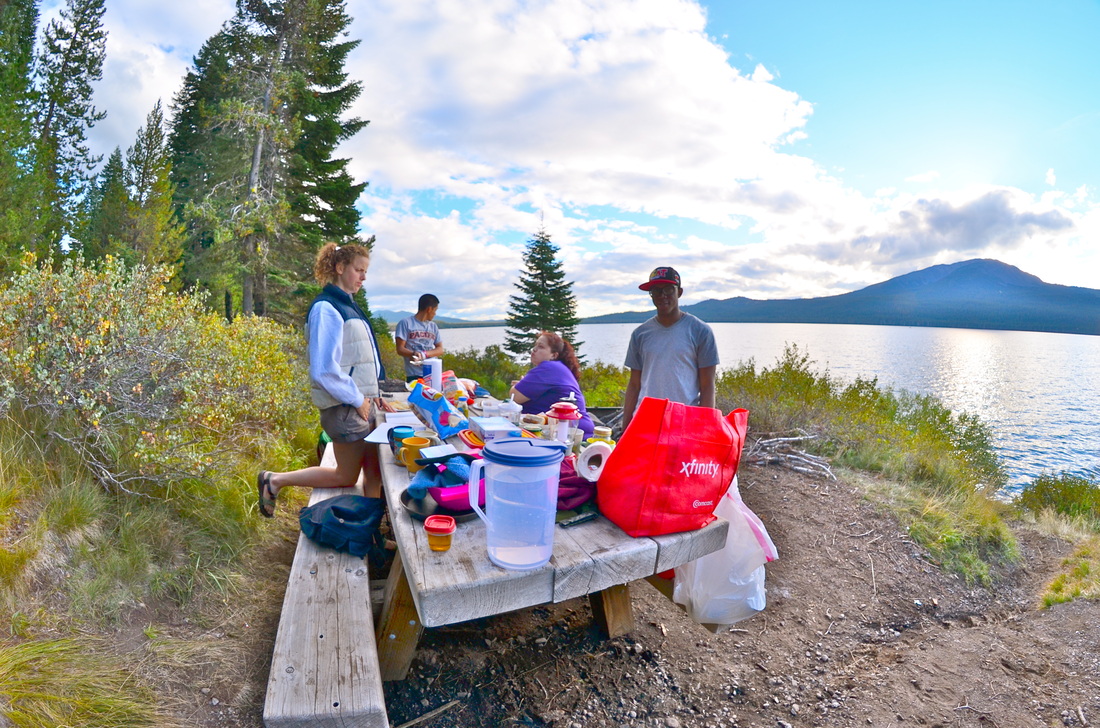
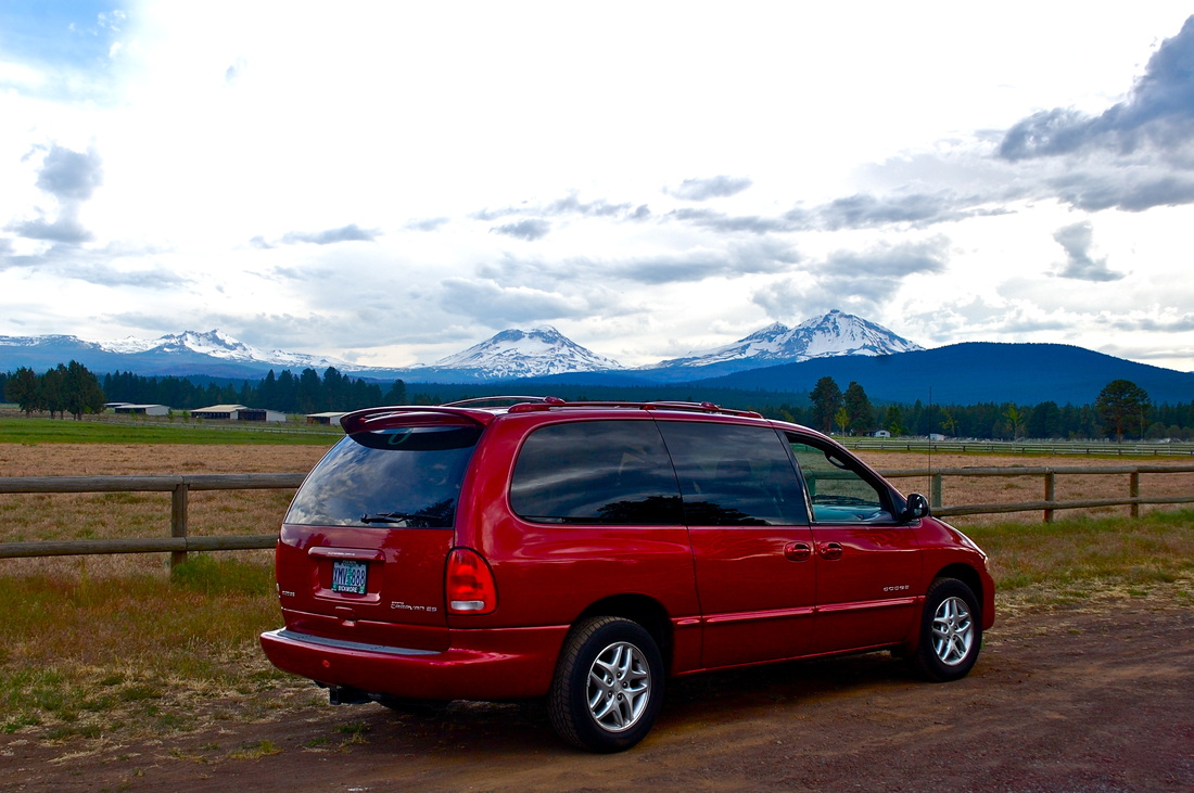
Sunriver, 2012-2013
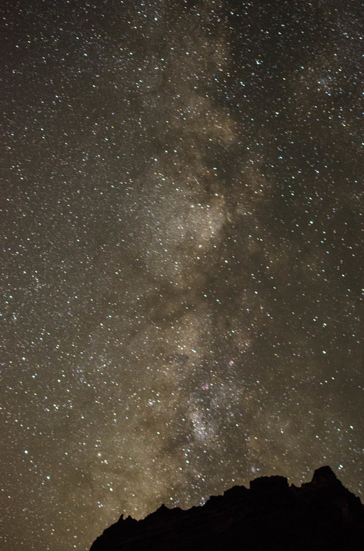
• Daina and I headed out to Sunriver over the summer. Notes: • Sunriver is stunning! It is just outside of Bend and is worth a few day stay. • You will have a hard time finding a more active, outdoor based community. During the summer weather is sunny, water is open and kayak/canoe ready at all times, and the animals are out and about in full swing. • During the winter you are looking at excellent snow shoeing, cross-country skiing, downhill skiing, sledding, and beyond. • Some activities, to name a few, to do if you're debating checking out Sunriver include: Bicycling, hiking, camping, kayaking, canoeing, running, golfing, food, beer, coffee, horseback riding, stargazing, and backpacking. My experience: • I have family and friends that live out in Sunriver and have been visiting it for years. It is a beautiful example of Oregon and the opportunities it provides.I've been kayaking, cycling, fishing, hiking, camping, stargazing, even nursing baby squirrels at one point and time! This is one of the number one places to check out if you're looking for a fun family time or just a relaxing weekend getaway! Links: • http://www.tripadvisor.com/Attractions-g52085-Activities-Sunriver_Central_Oregon_Oregon.html • http://www.sunriverchamber.com/visiting/vacation.aspx |


|
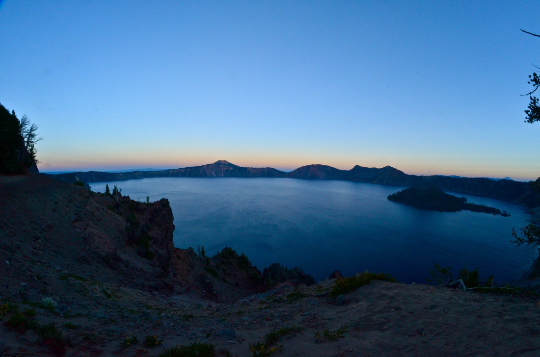
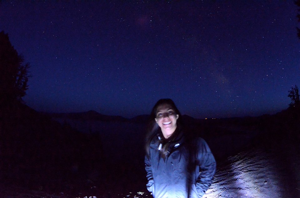
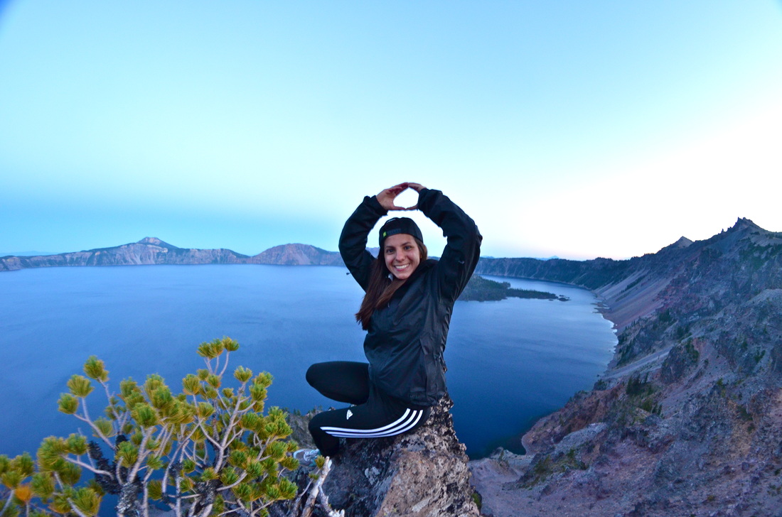
Crater Lake, 2013
• Trekked out to Crater Lake in August with a group of friends. Notes: • Crater Lake tops the list of sites to see in Oregon. • A stunning national park that provides you the opportunity to look in from the vantage point that we stood at during sundown. • You can also hike down and take a boat to Wizard Island and hike to the top of the cone if you're up for it! My experience: • We rushed over to Crater Lake the last night of our trip to catch it during sundown and see what the star gazing was like at night. With Rosie strumming her ukulele, being the only people out in this scenic national park, was a moment that I'd be hard-pressed to forget. Links: • http://www.craterlakelodges.com/ • http://travel.nationalgeographic.com/travel/national-parks/crater-lake-national-park/ |

|
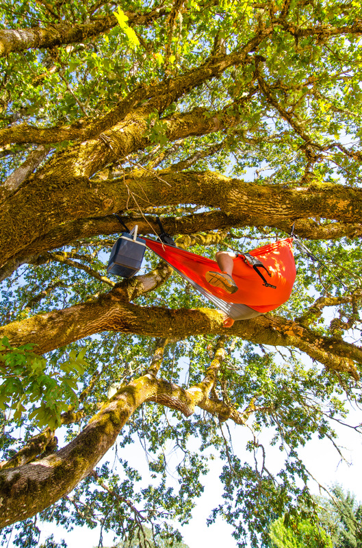
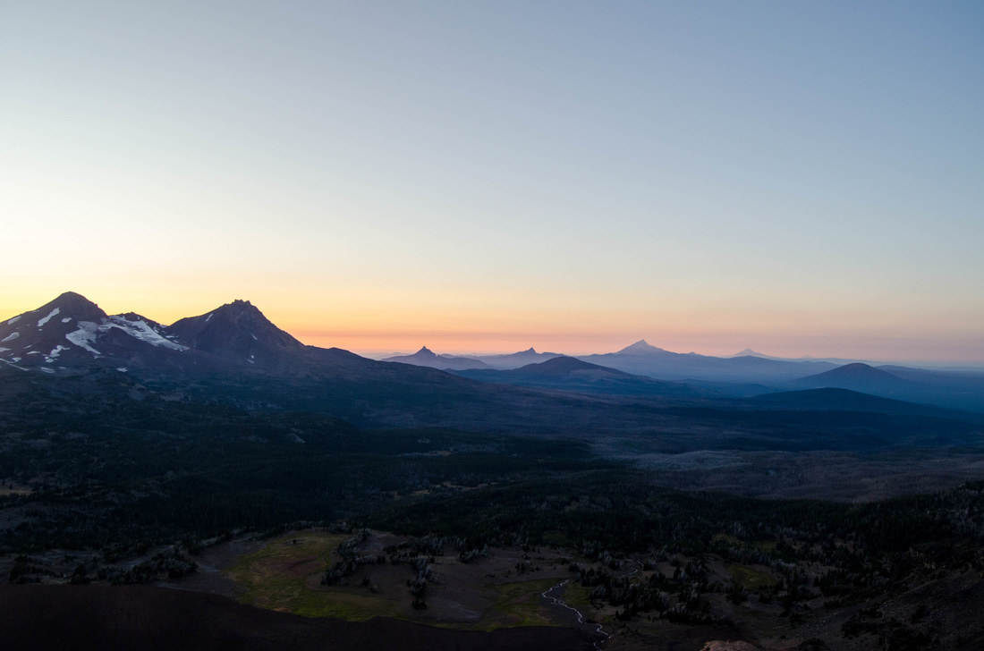
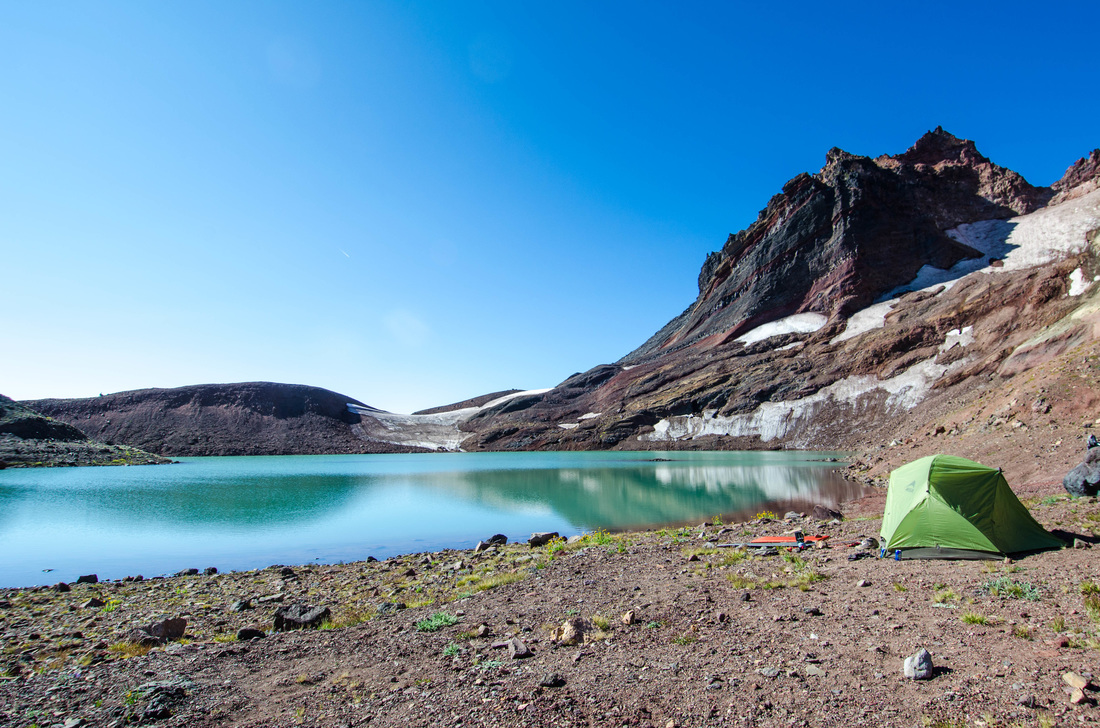
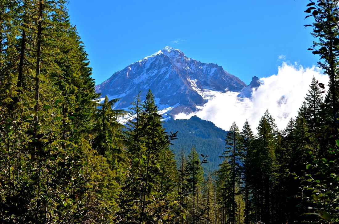
Mt. Thielsen, 2013
• The four of us headed up to check out Mt. Thielsen in August. Notes: • To get there head a mile and a half north of Highway 230/138 to the crossroads for Diamond Lake. The trailhead parking lot is along the side of Highway 138. • Northwest Forest Pass is mandatory. • There are two portions of this hike. Maybe, even technically three. • The first portion of the hike would be what I would call moderate as the elevation gain is noteworthy. • The second portion of this hike is up to the ridge where you can see in the photo to the left where the tree line halts. • The third portion of this hike is advanced/difficult. It is hiking up the ridge. You can look online to see what that might look like, noting it is on all counts - unsafe. • The first portion of this hike still provides stunning views, evidently, and a healthy fun hike for all. My experience: We had heard that Mt. Thielsen was a neat hike and was close to Crater Lake. We drove out, found the trailhead, and ascended to see this magnificent view. This is a great place to pack a couple of hammocks and hike up for a two or three day hike if you're up for it. Links: • http://www.summitpost.org/mount-thielsen/150419 • http://www.oregontrails.com/page.aspx?id=20 |

|
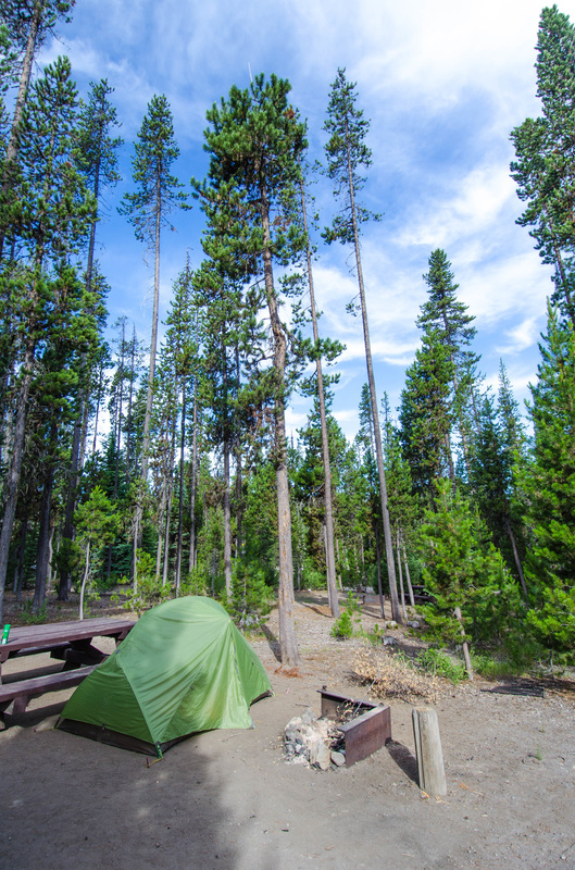
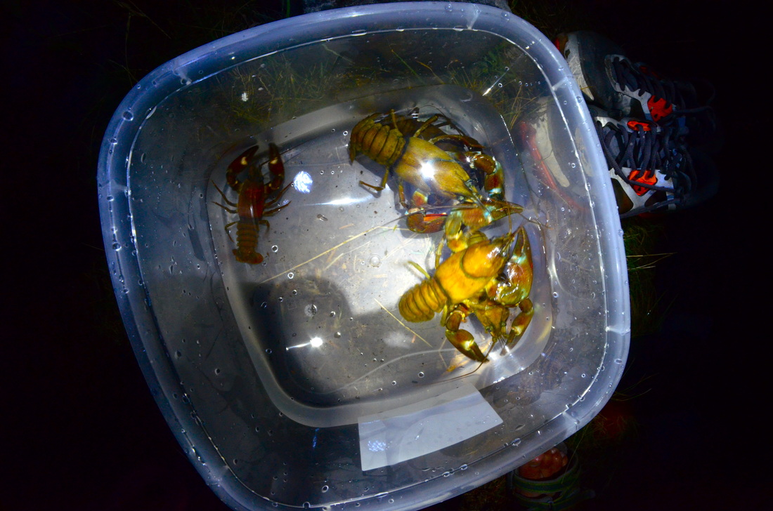
Diamond Lake, 2013
• A group of us headed out in August to Diamond Lake. Notes: • If you're heading out for a nature based weekend but don't think you'll find camping near or at Crater Lake - Diamond Lake is a perfect second best. • There is bundles of camping at Diamond Lake. Most spots give you a view like those pictured. • During the night feel free to take a dip and go crawdad fishing with some tongs. It's a fun experience that leads to a tasty meal for the next day. My experience: • Links: • http://www.oregontrails.com/page.aspx?id=20 • http://www.co.douglas.or.us/countyinfo/dl.html |
|
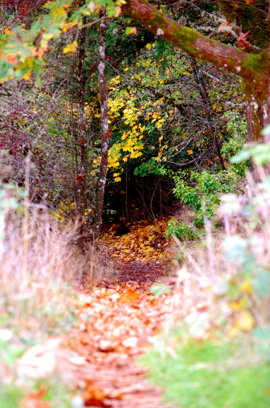
Wildwood Falls, 2012
July • Notes: My experience: Links: • • |
|
Eugene, 2010 - 2014
• Notes: My experience: Links: • • |


|
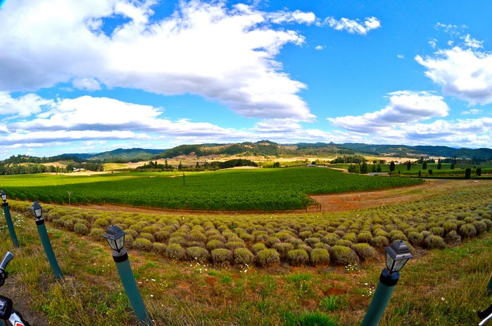
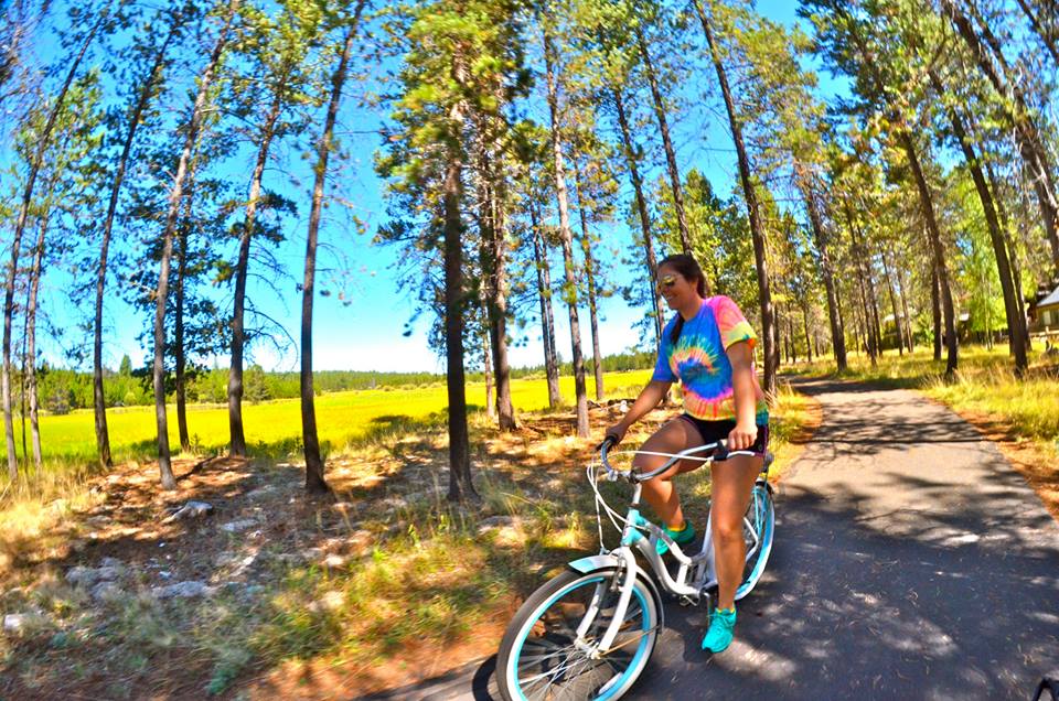
Willamette Valley Scenic Bikeway, 2014
May • Notes: My experience: Links: • • |


|
Mt. June, 2013
August • Notes: My experience: Links: • • |

|
Clear Lake, 2013
October • Notes: My experience: Links: • • |


|
Sisters & Scott's Lake, 2013
June • Notes: My experience: Links: • • |
|
Koosah Falls, 2013
October • Notes: My experience: Links: • • |
|
Mt. Pisgah, 2012
May • Notes: My experience: Links: • • |

The List
KEY: B - Backpacking/Camping, H - Hiking, C - Cycling, & K - Kayaking/SUP)
|
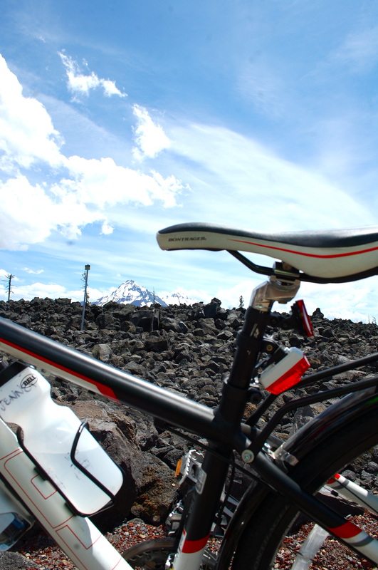
Abiqua Falls (H)
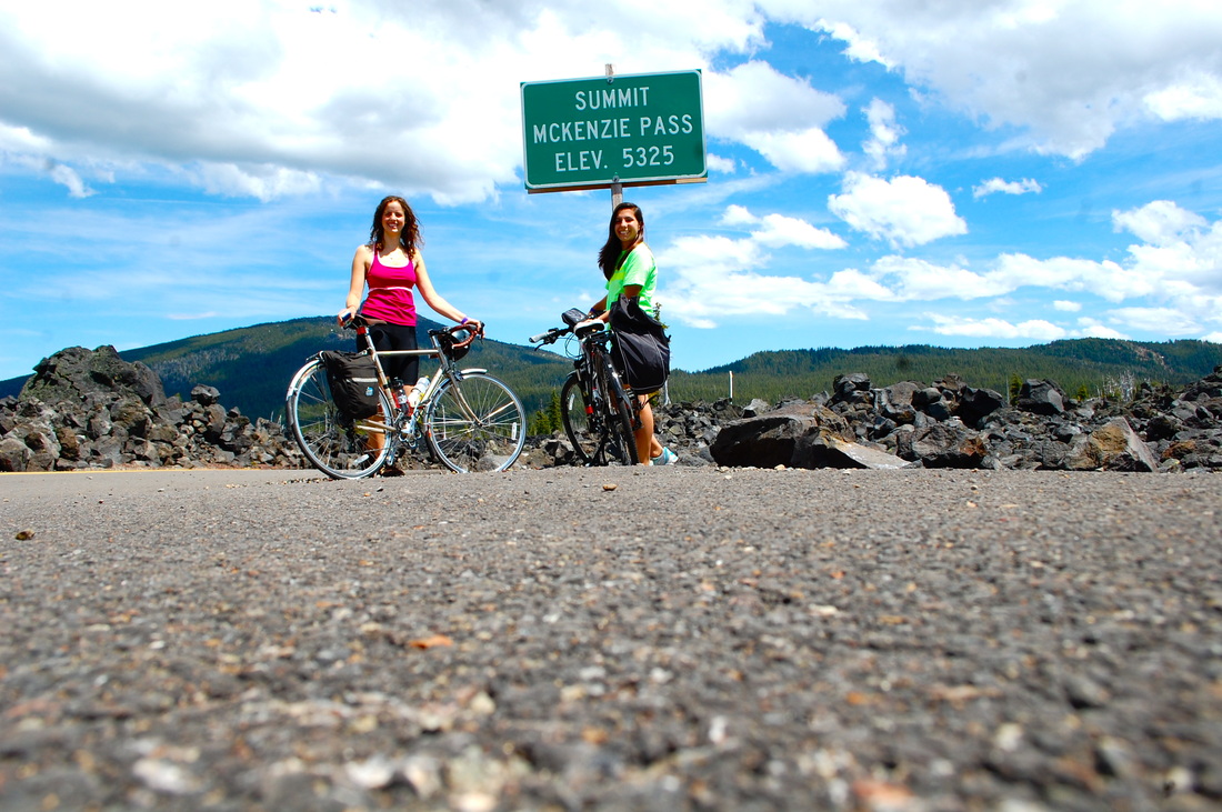
Alvord Desert in Harney Country(The) (H) Banks(The) - Vernonia Trail (C) 21Mi Benham Falls (H, C) Black Butte (H) Blue Lake (K,C, H) Blue Mountain Scenic Byway (C) 145Mi Broken Top (H, B) Butte Creek Falls (H) Calapooia River (H) Cape Kiwanda - Oregon City (C, H, B) ✔ Cascade Lakes Scenic Byway (C) 66Mi Central Oregon Canyon Creek Meadows (H) Charleston to Bandon Tour Route (C) 41Mi Chetco River (K) Clackamas River (H) Clatsop Look (H, K) - Ecola State Park Clear Lake (H, K) ✔ Coast River Seaside Oregon (K) Cottage Grove Covered Bridge Tour Route (C) 20Mi Council Crest (H) ✔ Cow Creek Tour Route (C) 45Mi Crater Lake National Park Cleetwood Cove Trail – Ferry ride to Summit Cone (H, B) Crater Lake (H) ✔ Crown Point (Vista House) – (C, H) Cycle Oregon (C) 74Mi – Yamhil Soujourn Dalles to Glenwood(The) (C) 65Mi Deschutes River – Middle (K) Devils Lake (H, K) – Can summit Sisters from Devils Trailhead Diamond Lake (H, K) ✔ Diamond Loop Tour Route (C) 69Mi Dog Mountain (H) Dry Creek Falls (H) ✔ Eagle Cap Wilderness (B) East Steens Tour Route (C) 143Mi Eastern Oregon’s Elkhorn Crest (H, B) • To Dutch Flat Lake (8.6) • To Lost Lake (12.8) • To Summit Lake (20) • To Marble Pass (46) Elk Lake (K) Elkhorn Drive Scenic Byway (C) 106Mi Elowah Falls (H) ✔ Emigrant Lake (K) Eugene(City) (C) ✔ Eugene to Kings Estate Winery (C) 100Mi ✔ Florence Beach (H, B) ✔ Flying M Ranch(The) - (Horseback Riding) Forest Park (H) ✔ Foster Reservoir (K) Gold Lake (H, B) ✔ Grande Tour (C) 80Mi Green Lakes (H) Haystack Rock - Cannon Beach (C, K, B) ✔ Hells Canyon Scenic Byway (C) 208Mi High Desert Discovery Scenic Byway (C) 127Mi Historic Columbia River Highway Scenic Byway (C) 70Mi Honeyman Memorial State Park (H, B, C, K) ✔ Horsetail Falls (H) Ice Lake (B, H) Indian Point (H) ✔ Jewell Meadows Wildlife Area (C, Walking) John Day River(The) (K) Jons Rud Viewpoint (H) (Overlook Journey Through Time Scenic Byway (C) 286Mi Klamath Lake (K) - Upper Koosah Falls (H) ✔ Lakeview City (C, B) Latourell Falls (H) Larch Mountain (H) Lava Lake (C, B, H, & K) Lewis River Falls (H) Linton Falls (H) Little Lava Lake (C, B, H, K) ✔ Little Luckiamute Falls (H) Lost Creek Lake (C, B, H, K) Lost Lake (H, K) McKenzie Pass - Santiam Pass Scenic Byway (C) 82Mi McKenzie River and Foothills (K) McNeil Point (H, B) |
Milo McIver State Park (H, B, K)
Mt. Jefferson (H, B) Mt. Hood Scenic Byway (B) 105 Mt. Hood – Summit (B) Mt. June - (H) ✔ Mt. Pisgah (H) ✔ Mt. Thielsen (H) ✔ Mt. Thielsen Summit (B) Multnomah Falls (H, B, C) ✔ Myrtle Creek – Canyonville Tour Route (C) 68Mi Nehalem Bay State Park (C, B, H, & K) No Name Lake (H, B) North & South Twin Lakes (K) North Santiam River (K) North Umpqua River (K) • Gravel in to Bogus Creek and/or Bogus Creek to Susan Creek Olallie Lake (K, H, B) Oneonta Falls (H) ✔ Oregon coasts Cascade Head (H, B) Oregon Outback Scenic Byway (C) 171Mi Oswald West State Park’s Hidden Cove (K) Over the River and Through the Woods Scenic Byway (C) 66Mi Owyhee Canonlands (H, B, & K) Owyhee River – Lower (K) Pacific Coast Scenic Byway (C) 363Mi Painted Hills - John Day Fossil Beds National Monument (B, H) Paulina Lake (K) Portland - Downtown (C) ✔ Portland to Multnomah Falls (C) 65Mi ✔ Portland Women's Forum (C, H) ✔ Powell Butte Nature Park (C) Proxy Falls (H) Punchbowl Falls (H) ✔ Ramona Falls (H) ✔ River Kayak Discovery Trail – Seaside Oregon (K) Rocky Butte (H, C) ✔ Rogue – Umqua Scenic Byway (C) 172Mi Rogue River(The) (K) • Go via Merlin and Grants Pass/Nugget/Day Stretch Sahalie Falls (H) Saddleback Mountain (H) Scott's Lake (H, C) ✔ Seal Rock (H, K) Silver Falls State Park (H) Silver Falls Tour Route (C) 55Mi Siouxon Peak, WA (H) ✔ Sisters Ride for Two Rivers (C) 55Mi ✔ Smith Rock State Park (H, B) South Sister (H, B) Sparks Lake (K, H) ✔ Spencer Butte (H) ✔ Steens Loop Tour Route (C) 59Mi Sunriver (H, B, C) ✔ Susan Creek Falls (H) Sweet Creek Falls (H) Tamolitch Pool (AKA Blue Pool) (H) The Vineyard and Valley (C) 50Mi Thors Well (K) Three Sisters Wilderness (H, B) Toketee Falls (H) Triangle Lake (K) Trillium Lake (K, H) ✔ Tripple Falls & Beyond (H) Tumalo Falls (H) Umqua River Scenic Byway (C) 66Mi University of Oregon (C) ✔ Volcanic Legacy Scenic Byway (C) 140Mi Wahclella Falls (H) Wahkeena Loop (H) Waldo Lake (K) ✔ West Cascades Scenic Byway (C) 215Mi White River Falls (H) Wildwood Falls (H) ✔ Willamette River - Downtown Portland (K) Willamette Valley Scenic Byway (C) - 30Mi ✔ |
